

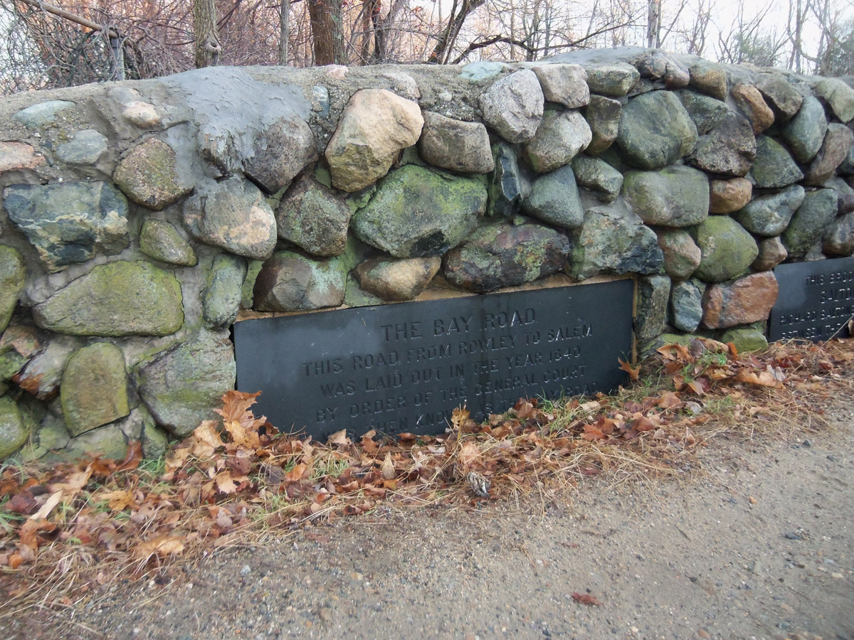
In November 1639, the General Court in Boston ordered that a road be laid out from Boston to Portsmouth. Bay Road was to be constructed by each town along the way, and milestones carved in stone were installed to indicate distances.
Some (but not all) of the road is also known now as Historic Route 1A. The route went through Ipswich, making it an important stagecoach stop along the way in the 18th and early 19th century. Several inns flourished on High Street and North Main Street. It was ordered that every town must choose two or three men who shall join with two or three of the next town & they shall have power to lay out ways where most convenient, “not withstanding any man’s propriety so that it not occasion the pulling down of any man’s house or laying open any garden or orchard.”
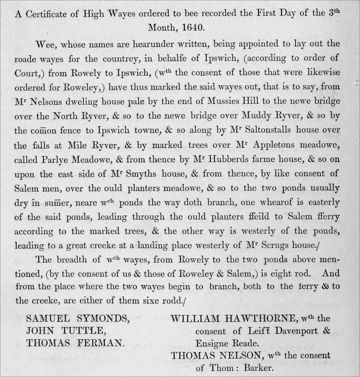
In 1640, surveyors reported that they had laid out the Highway from Rowley to Salem as follows:
- “from Mr. Nelson’s dwelling house pale by the end of Hussies Rill to the new bridge over the North River,
- & to the new bridge over Muddy River,
- & so by the common fence to Ipswich towne,
- & so along by Mr. Saltonstall’s house over the falls at Mile River,
- & by marked trees over Mr. Appleton’s meadow called Parlye Meadow,
- & from thence by Mr. Hubbard’s farm house,
- & so upon the east side of Mr. Smiths house,
- then over the ould planters meadow,
- & so to the two ponds usually dry in summer near which ponds the way doth branch:
- one whereof is easterly of the said ponds leading through the old planters field to the Salem ferry according to the marked trees
- and the other way is westerly of the ponds leading to a great creek at a landing place westerly of Mr. Scrugs house.”
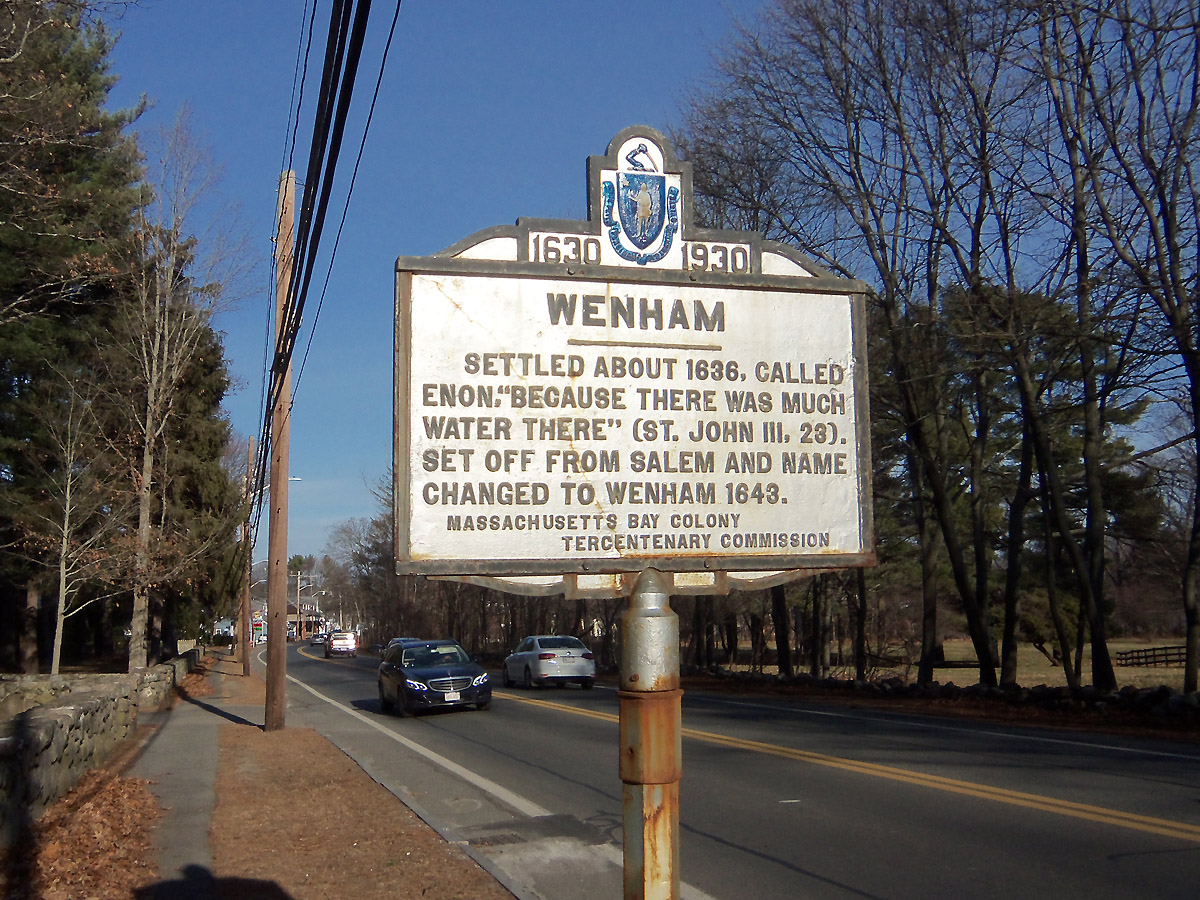
During the early 1700s, the entire Bay Road was marked with milestones. The markers from Boston to the Wenham town line have either been lost or removed. Nine stones remain today, four of which are in Newbury and the remaining five between Wenham and Ipswich. After 1804, the Newburyport Turnpike (today’s Rt. 1) was built “over every hill and missing every town”, providing a more direct route from Boston to Newburyport. Information about the stone markers is from
- Stone Structures
- Ancient Milestones of Essex County by James B. Stone
- Milestones and Guideposts by Mary and James Gage
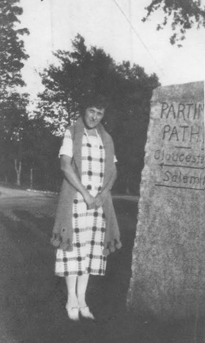
Photos of mileage markers and other historic imagery on the Old Bay Road from Wenham to Newburyport
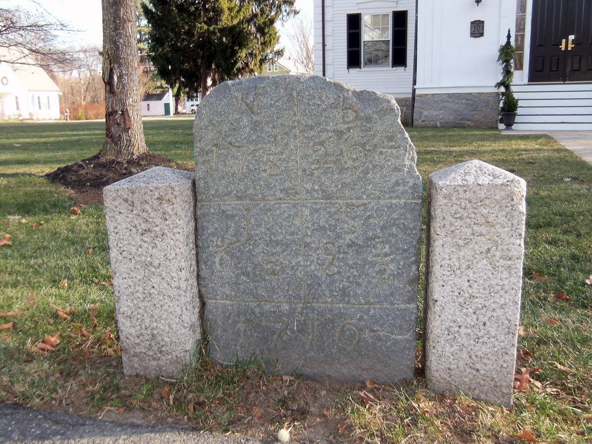
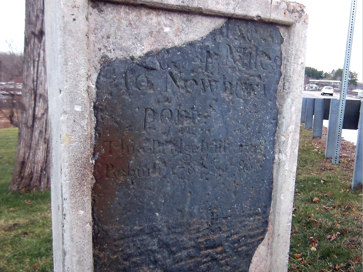
Milestone 17 1/2 on Route 1A, Wenham, MA Milestone 17 1/2 on Route 1A, Wenham, MA This milestone is in the middle of town. It reads, “N 17 ½” Newbury seventeen and a half miles, “B 20 ½” Boston twenty and a half miles, “S 9 ½” Salem nine and a half miles, “I 6 ½” Ipswich six and a half miles. It is dated 1710.

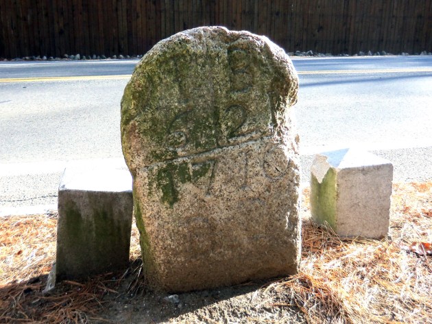
Milestone 20 on Route 1A, Wenham, Massachusetts. It reads “I 7” Ipswich seven miles, “B 20” Boston twenty miles. It is dated 1710. The saying reads, “Job the 30 23 I know that thou wilt bring me to death and to the house appointed for all living.” This milestone was erected in front of the meeting house and burying ground.
Mile 24, Rt. 1A in Ipswich, date 1709: “B25” (25 miles to Boston). This small milestone is on the west side of Route 1A near the entrance to Appleton Farm. The old Bay Road stone sign was moved to the edge of the woods near the entrance to Appleton Farms when the road was widened.


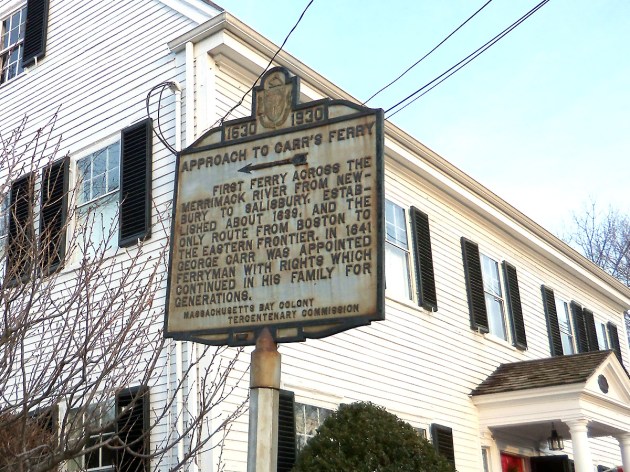
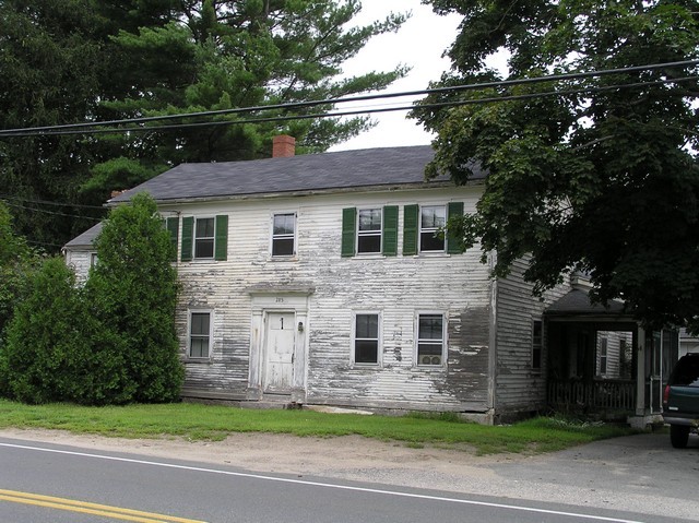
The Jewett family book in its history of Rowley refers to a milestone in the cellar wall of a 1809 house in the Ipswich village, inscribed with “B 29 / N 9”. This may be the Daniel Norse house at 285 High St. Our eminent historian Thomas Franklin Waters wrote about this man and more interesting history related to his house:
“Some rods back from the highway at the Village, on the farm of John W. Nourse, a few years ago, the ploughshare disclosed a cache of finely fashioned stone spearheads, some forty or more, the buried treasure, perchance, of an Indian brave, or some armorer of the centuries past. A series of diagrams has been prepared by our townsman, Mr. John W. Nourse, a skilful surveyor and an enthusiastic antiquarian student.”
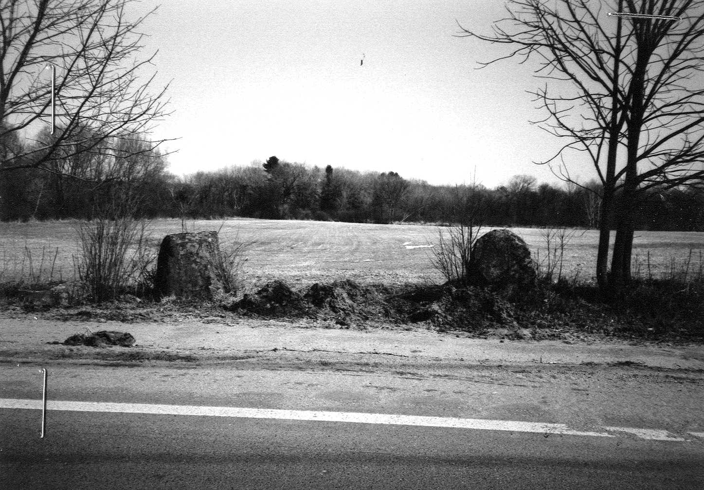
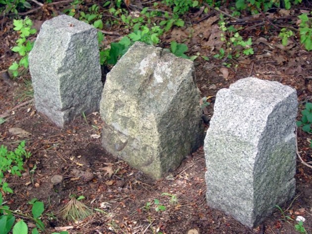
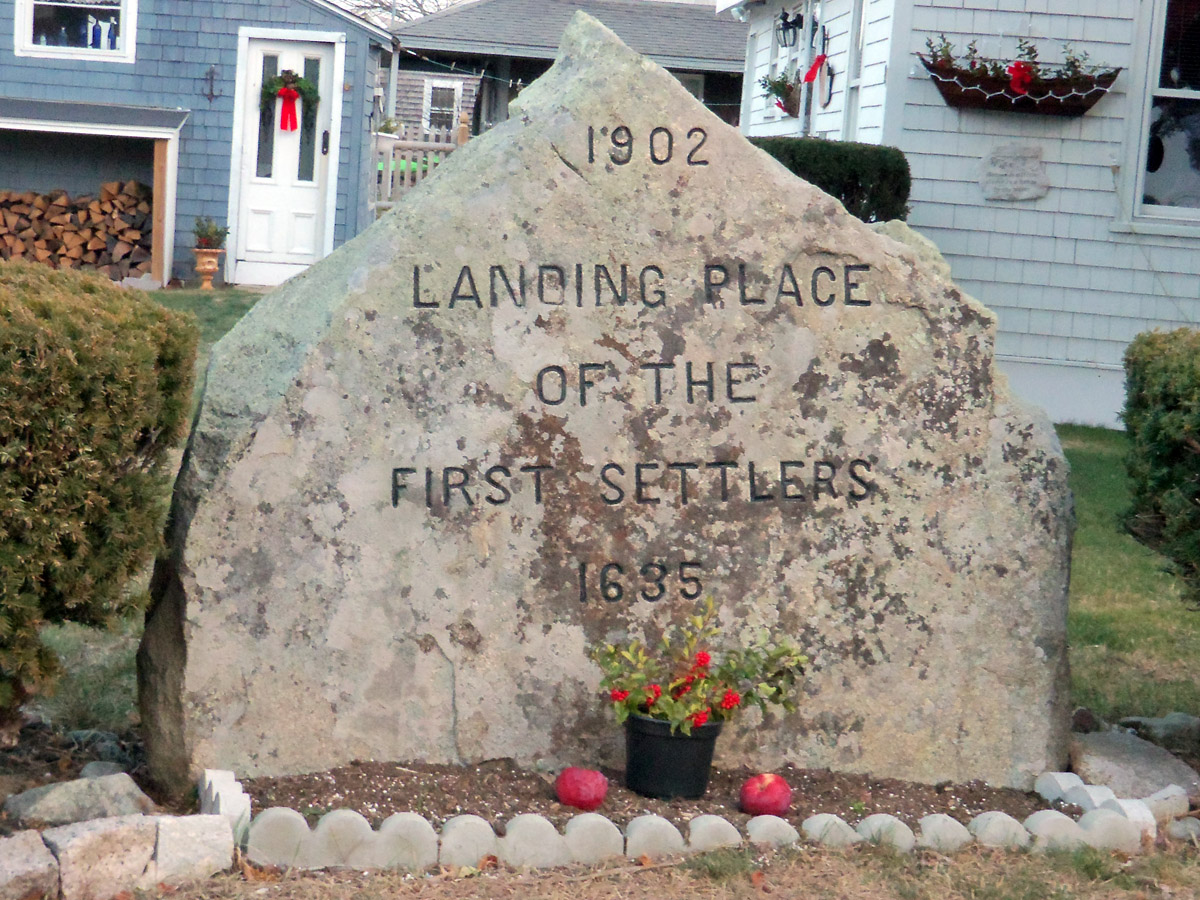
These two large stones on the side of Central Street in Rowley, just before Townsend Brook, are said to have been placed in 1639 at the entrance of the Common Land of the First Settlers of the town when it was set apart from Ipswich. The brook is so named because it was the “town’s end.” Documented with the Massachusetts Historical Commission, the author wrote,
“This point was designated as the northernmost boundary of the settlement of the town on what was then known as Holmes Street, now Central Street. Settlers were ordered not to build beyond this point, about one-half mile from the First Parish, where the colonists were to gather behind the tall fence that surrounded the meetinghouse in case of Indian attack.”

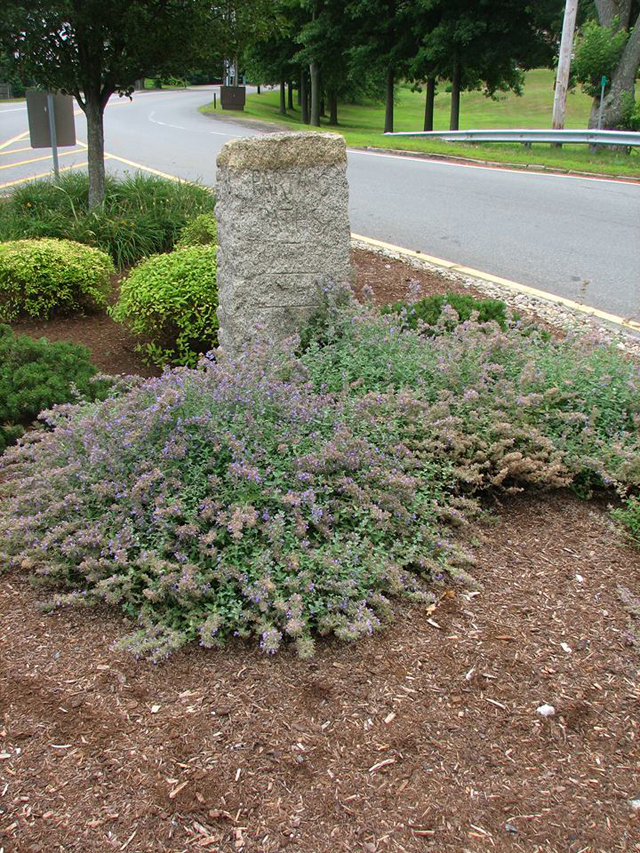
You’ll find this marker on Coleman St. in Rowley, about half a mile from the Governor’s Academy. The Old Bay Rd. here is now just a path heading south parallel to Rt. 1.

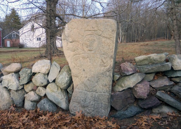
Milestone 33 is at the Governor’s Academy in Byfield. The stone was carved by gravestone carver John Hartshorn. It reads “N 5”, five miles to the center of Newbury, “B 33”, thirty-three miles to the center of Boston. Beneath the mileage is the date 1708,
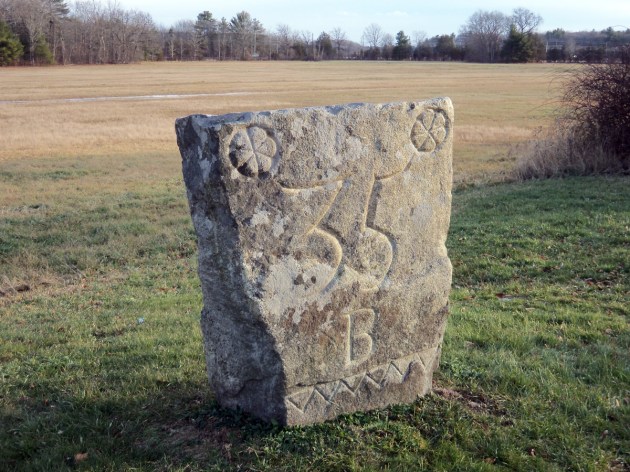
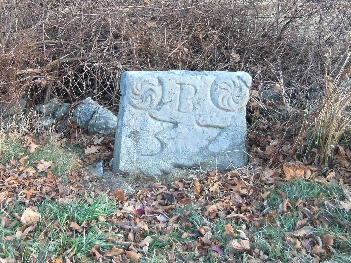
Milestone 35 is on Middle Rd. in Newbury near the intersection with Boston Street. The stone was carved by gravestone carver, John Mullicken of Bradford, MA, circa 1735. It reads “B 35” Boston thirty-five miles. This milestone has two sets of geometric designs. Note the line of triangles across the bottom edge.
Milestone 36 is on Boston Street in Newbury. The stone was carved by gravestone carver, Robert Mullicken, Sr. of Bradford, MA, circa 1735. It reads “B36” Boston thirty-six miles.
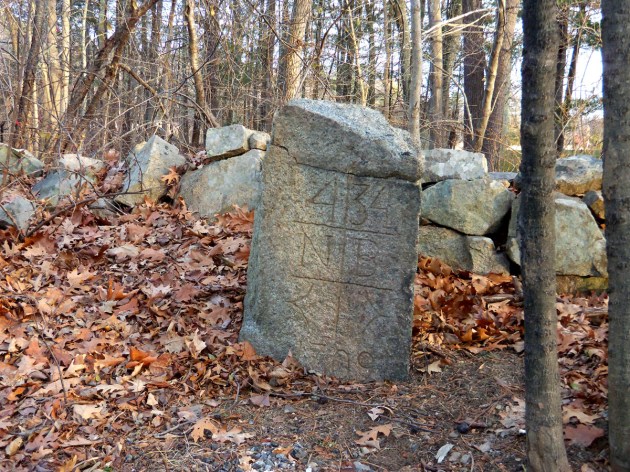
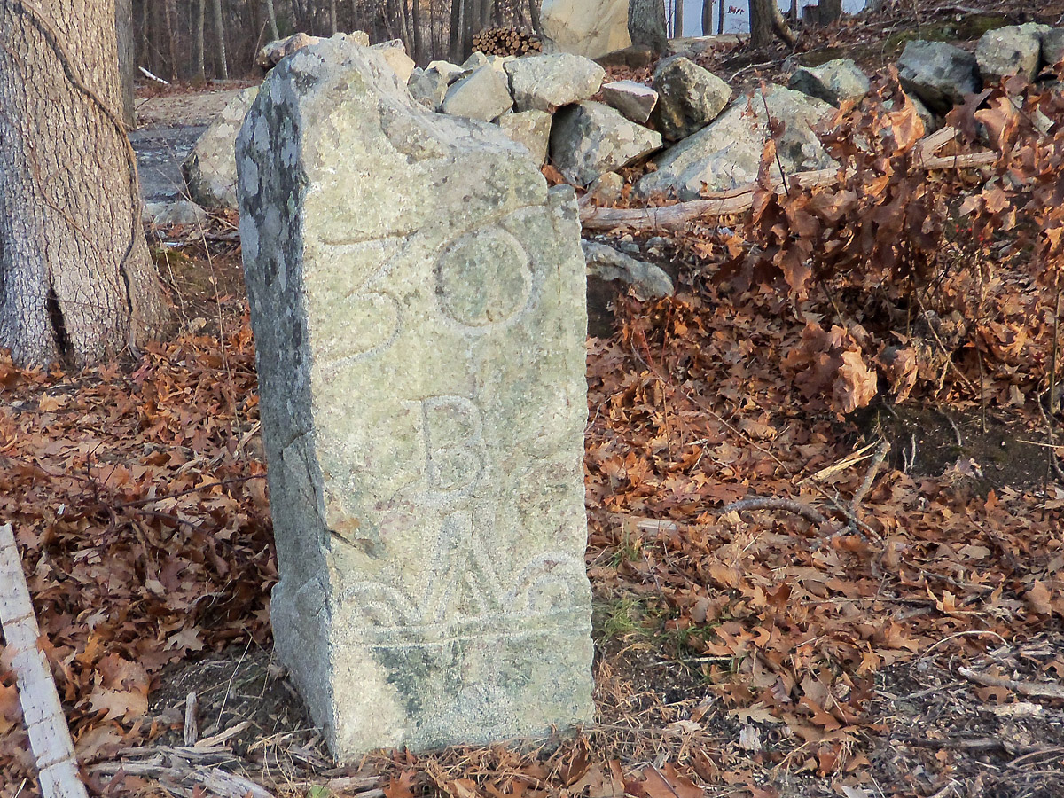
Milestone 37 is on Green St. in Newbury. The stone was carved by four gravestone carvers: Robert Mullicken, Sr., Robert Mullicken, Jr., John Mullicken, and Joseph Mullicken of Bradford, MA, circa 1735. This milestone has sunken into the ground so that the bottom edge design is no longer visible
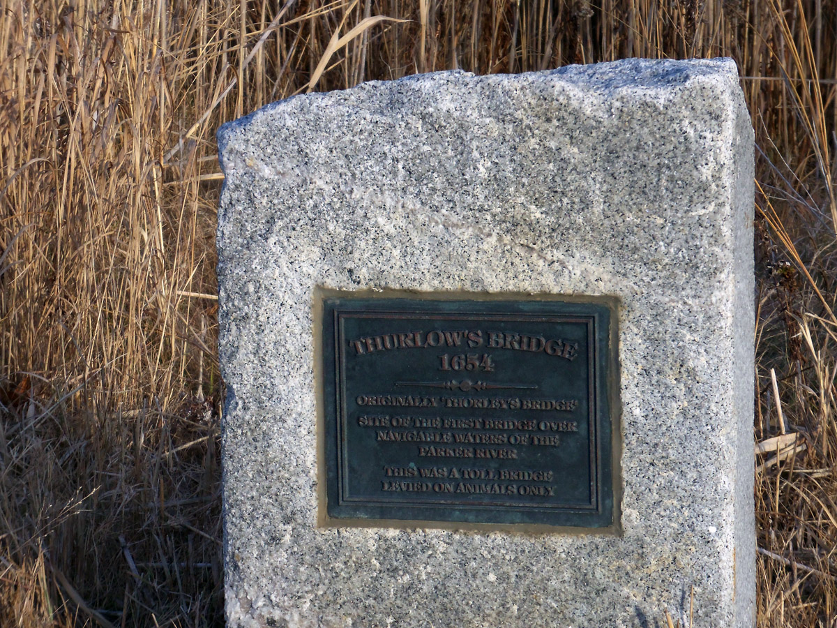
This marker is on Rt. 1A at the Parker River, about half a mile from the Old Bay Rd.
Further Reading:

Thank you for this article on Bay Road / Route 1A. I had been wondering about the history of this road after a recent visit to Hamilton, and the article answered many of my questions. I especially appreciated the photographs of mile markers and historical signage.