
Into the 19th Century, Town Hill was used for grazing and was almost bare of trees. Springs flowed out of the hillside and were tapped to provide water for the houses below them on High Street. In 1873, the town voted to begin construction of reservoirs to fight fires, and in 1878, a reservoir for fire purposes was rebuilt at the corner of Mineral and High streets, which may still exist. The term “reservoir” refers to the underground cisterns that were constructed throughout the downtown area for the hand-pumped fire engines. The 1880 Town Report included payments for the construction of wells on High Street and at the head of Mineral Street. A large cistern may still exist underground near the intersection of Mineral and High Streets. Old underground cisterns in front of the Ipswich Public Library and beside the Ipswich Inn were demolished a few years ago.
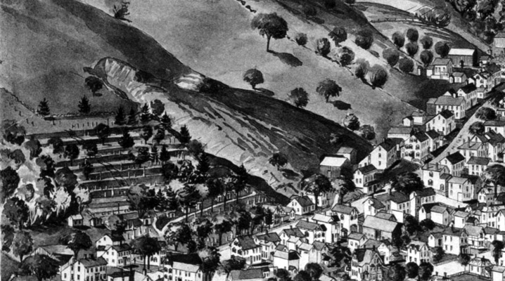
The 1893 Birdseye map shows a serious washout just to the east of the Old North Burying Ground, forming a deep gully. Whether this was erosion created over time or caused by a storm is not recorded. It could have been a stream that became a waterfall during storms, such as the one Arthur Wesley Dow photographed in Ipswich. The Great September Gale of 1815 was the first hurricane to strike New England since the Great Colonial Hurricane 180 years earlier, but was followed by the Norfolk and Long Island hurricanes in 1821. This was the beginning of a series of tropical storms and hurricanes that affected New England for the next 100 years.
A short road now being used by the Cemetery Department was apparently constructed over part of the gulley. During heavy rains, water would have rushed down the hillside and crossed High Street onto Dirty Lane, which is now Mineral Street, emptying into muddy Farley Brook.
A late 19th-century photo taken by Arthur Wesley Dow shows a barn and sheds that once stood at 53-55 High Street at the foot of the gully. The structures are in the approximate location of a lane that runs up the hill beside the cemetery. In this photo, the barn rests on an elevated rubble foundation, which would have diverted the flow of water. The barns and sheds are long gone, but the roof of the Lummus house at 45 High Street is shown with staging around the chimney.
Susanna Homan
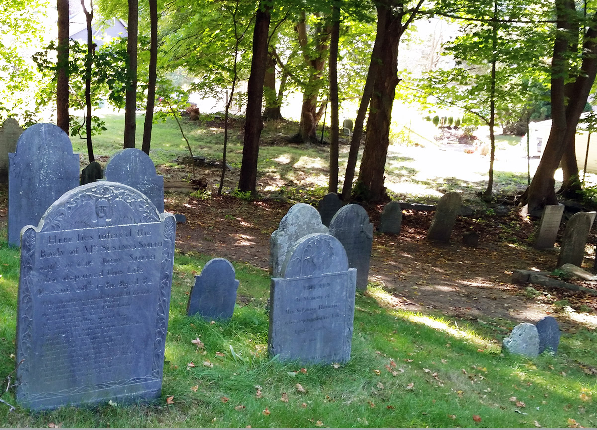
The large stone on the left marks the grave of Susanna Homan. In 1725, Increase How purchased “a good mansion house” at the corner of County Street and Poplar Street from John Whipple, and kept an inn in the house. After he died in 1754 at the age of 74, his daughter Susanna (who had married Captain Richard Homan) ran the inn. In 1756, she received and took in three Catholic families from French-speaking Nova Scotia whose arrival had been anticipated and debated by the Ipswich people for several months.
In the fall of 1789, just four months after he took the oath of office, President George Washington visited Ipswich and dined at Susanna Homan’s Inn. Crowds awaited him at the South Green, where he was welcomed by the Selectmen and a regiment of the militia. At the Inn, he partook of a meal and proceeded on to Newburyport. Susanna Homan, whose gravestone describes her as “fair and good” died three years later at age 66. The building’s Federal-era hip roof was replaced by a Mansard roof in the late 1800s to give the inn a third floor. It is now known as Swasey’s Tavern, after the owner, General Swasey,who was the town moderator, famously fell dead at a Town Meeting in 1816.

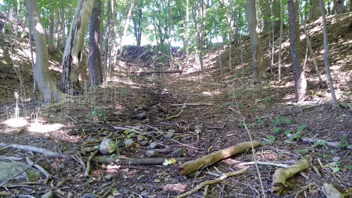
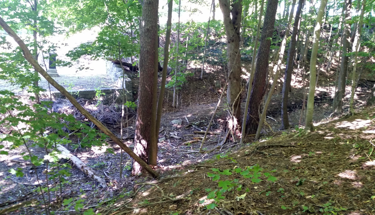
I wonder could the Chasm have been a road to the reservoir. It points directly to the site and would have given easy access to work on the reservoir, or transport water to the town below. It appears that the top of the “road”, where the Chasm ends, has been backfilled for more graveyard acreage. Could the grade have continued to the water?
The Fire Dept. would need a collection of water. FIRE CISTERNS are reliable year round dedicated water sources for fire fighting, often required when there is no central piped water supply in the area.. I would wonder if this chasm was built for this.
I love seeing the changes that have been made to places and even how they’ve stayed the same! It’s fascinating to me!