

View more rides at:

Willowdale Mountain Biking
Willowdale has 40 miles of trails for all levels and great fire roads to learn on. The Forest exists as two separate parcels divided by Route 1. The eastern block of the Forest abuts Bradley Palmer State Park and the Ipswich River; the western section includes 100-acre Hood Pond. Access the trails from Topsfield Rd. between Topsfield and Ipswich MA, or from Linebrook Rd. in Ipswich. Willowdale Trail Map
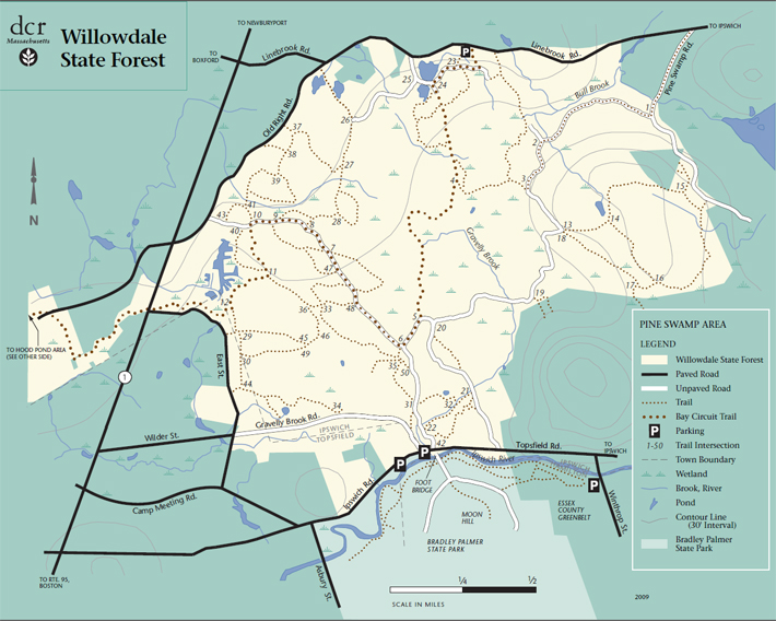
Start: Linebrook Road in Ipswich MA, across from the Marini farm field on the right-hand side parking lot. Coming from Rt. 1, this is on the right, well before Doyon school. map to start

Directions: From the South: Take I-95 to Exit 50 to Route 1. Take Route 1 North heading towards Topsfield. Travel 4 miles to Ipswich Road. Take a right onto Ipswich Rd. Follow Ipswich Rd for approximately 2 miles. Ipswich Road will turn into Topsfield Rd once you are in Ipswich. There will be two turnouts on the right-hand side for parking.
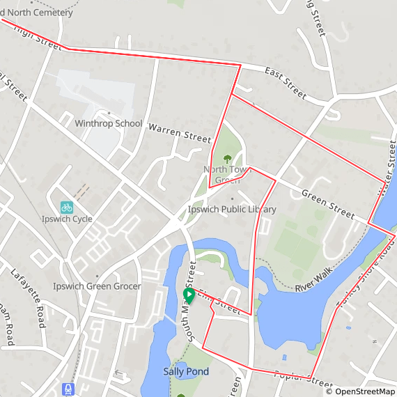
Ipswich Around Town 2.5 miles
From the Ipswich Visitor Center on South Main Street, this ride takes you through much of the town’s historic district.
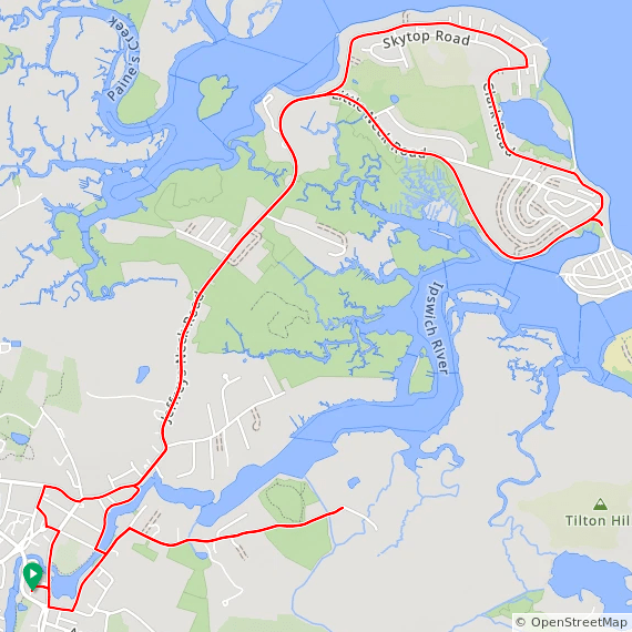
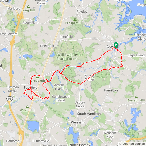
Ocean views: Labor in Vain and Jeffreys Neck (11 miles)
From the Ipswich Visitor Center on South Main Street, this bicycle ride takes you along the Ipswich River and out and back to Great Neck and Labor in Vain Creek. Scenic views with a few climbs.
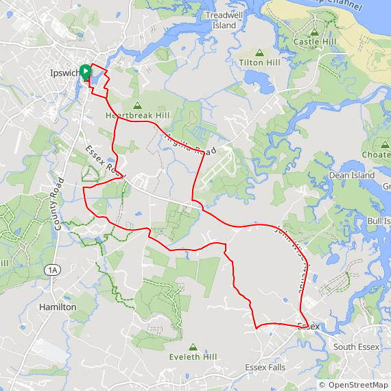
Ipswich to Essex from the Ipswich Visitor Center (12 miles)
From the Ipswich Visitor Center at 36 S. Main Street, this ride takes country roads to neighboring Essex. Gently rolling hills with a couple of moderate climbs.
The Ipswich River Sanctuary and Topsfield
This Ride starts at the Ipswich Visitor Center and takes nice roads to neighboring Topsfield. Along the way you can stop for a visit or a hike at Mass Audubon’s Ipswich River Sanctuary.
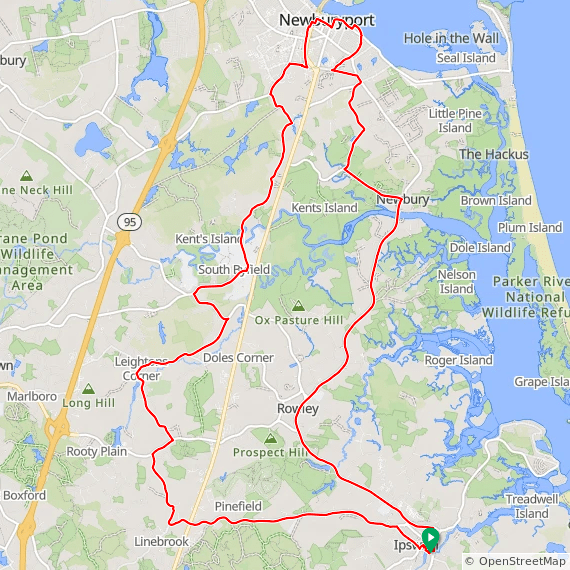
Ipswich to Newburyport out and back
Start Location: Ipswich Visitor Center, 36 S. Main St., Ipswich MA. This ride takes historic Rt. 1A from Ipswich through Rowley to Newbury and Newburyport for a 31-mile round trip. You can add on a ride out to the Parker River Wildlife Refuge on Plum Island for an extra 10 miles.
Ipswich to Salem
This ride departs from downtown Ipswich MA, taking local roads to Beverly where we cross the bridge to Salem. After riding through the historic neighborhoods in this well-known city, we return to Ipswich through historic downtown Beverly and Hamilton.

Ipswich-Salem ride
Ipswich-Merrimack River Ride 35 miles
Start Location: Ipswich Middle and Senior High School, 130 High St., Ipswich MA. (we start from the parking lot behind the school). (Map to Start) This ride takes Rt. 1A from Ipswich to Rowley then continues on pleasant roads past two reservoirs to the Merrimack River in West Newbury. The ride is not arrowed.

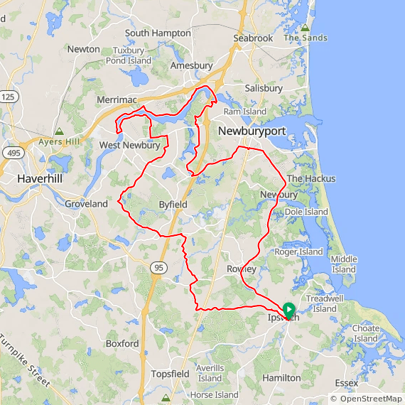
Merrimack River Ride from Ipswich, 50 miles
A ride from Ipswich Massachusetts through the state forest area to West Newbury MA, along the Merrimack River, returning through Newburyport and the Great Salt Marsh. (map to start)
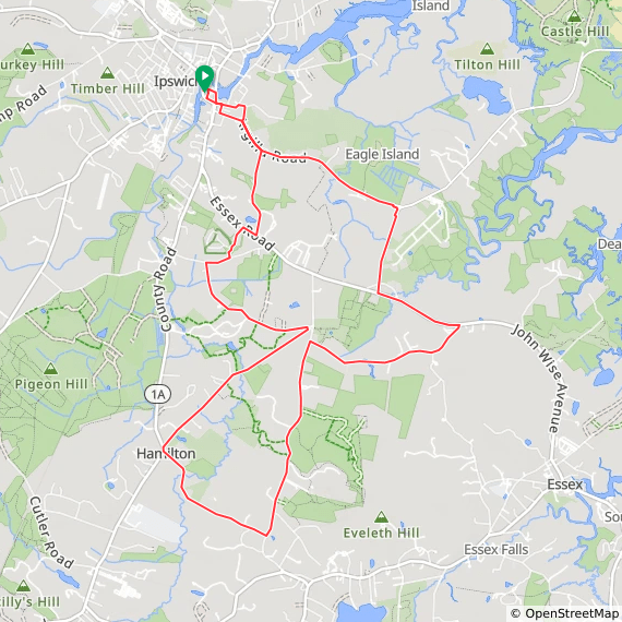
Ipswich 12-mile countryside ride from the Ipswich Visitor Center
Start: Ipswich Visitor Center, 36 South Main Street, Ipswich MA. View map to start
What to expect: Ride along the quiet roads between Ipswich, Essex, and Hamilton. A few short easy climbs.
Ipswich River Watershed ride

