

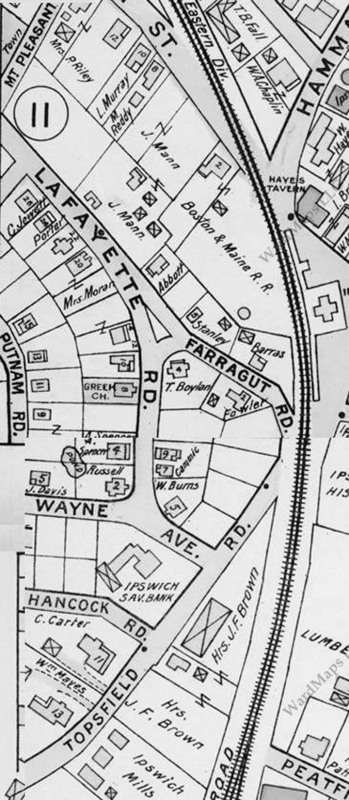
The Lafayette Road neighborhood, including Farragut Rd, Prescott Rd, Putnam Rd. and Lafayette Rd. was built in the first decade of the 20th Century on farm land previously belonging to J. C. Underhill and other families along Topsfield Rd. The names of the neighborhood and streets seem to have been assigned by the developers of “Agawam Heights.”


These photos of the earlier Underhill house, no longer standing, and new houses in Agawam Heights under construction are from glass plate negatives in the collection of William J. Barton, taken by Edward L. Darling circa 1910.


My family (Spencer) eventually owned both 4 and 6 Lafayette Rd. Very interesting to learn the history of Agawam Heights. My Cousin, Ann Spencer was the last of the family to own 4 Lafayette. She passed away around 2003, and the house was sold. Email me if you would like an early photo of the Spencer family at 6 Lafayette. On the map, a pond is depicted behind the house. You can see the pond in the photograpy.