

In November, 1634, it was agreed that “the length of Ipswich should extend westward unto the buryinge place (Old North Burying Ground), and eastward unto a cove of the river, unto the planting ground of John Pirkings the Elder.” The cove mentioned here was where the Ipswich River lapped East street before Agawam Ave. In the 19th Century, wharves and coal barns lined the Ipswich River, but the Town Landing as we know it today did not exist until 1916.

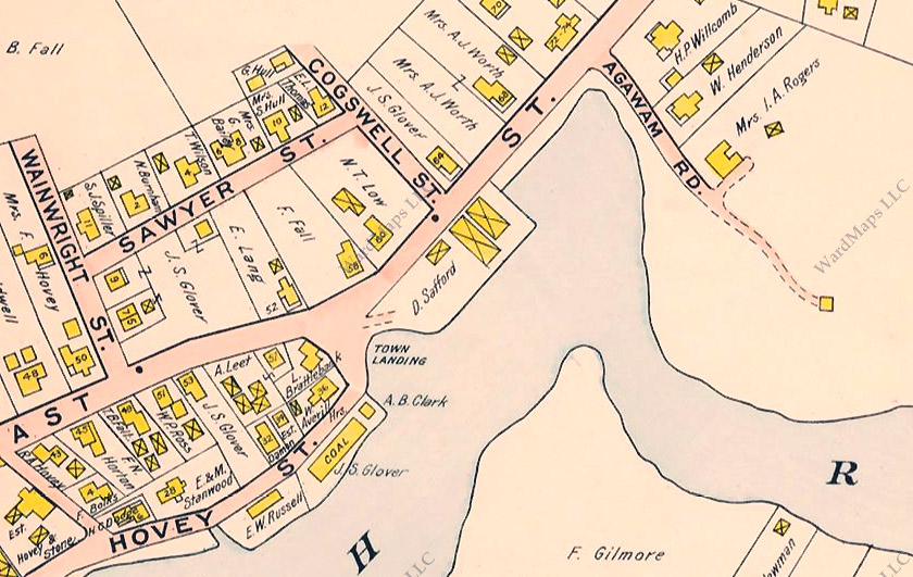


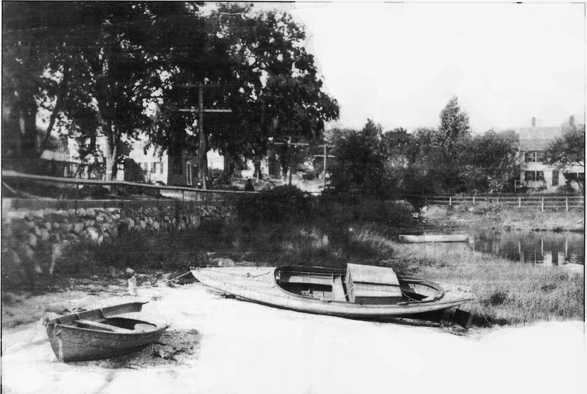
Shown below are several old photos showing the former cove and the stone wall that once separated the Ipswich River and East Street. Utility poles along the street indicate that the next two photos were taken after 1903, the year that the electric power company was created but before 1916 when the cove was filled to create the present-day wharf (aka Town Landing), definitely before 1927, the year Dexter died.
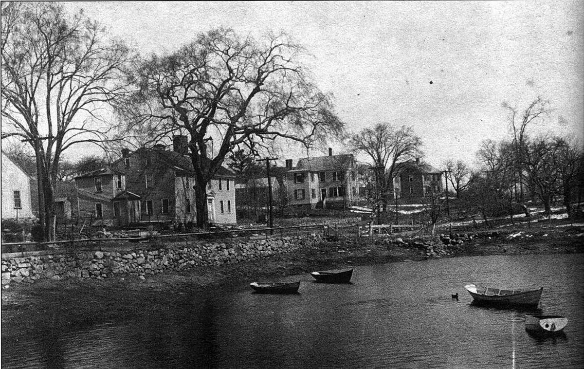
The three middle houses along East Street in the upper view and the house on Agawam Avenue in the middle photo all still exist today. The house farthest to the left in the upper photo no longer stands.
The 1914 Ipswich Town Report includes an announcement from the Selectmen:
“A few years ago the matter of “filling in” the cove between the lower wharf on East Street and Agawam Avenue was brought before the Town. A committee was appointed and a report was made, but no further action was taken. The matter has again come before the board and will be presented to the citizens for their consideration at the annual meeting. Permission for this work can be obtained from the Harbor and Land Commission. If a retaining wall were built and the space gradually filled in with waste material, a piece of land suitable for a park and other purposes would develop.”

The 1916 Town Report includes payment for improvements at the Wharf. For several years following, the current town wharf was referred to as the Averoff Wharf. “WATER FRONT IMPROVEMENT: Paid to James Averoff and Soteros Canelos, wharf property, $3250 00.”
From the 1939 Town Report:
“An inspection of the Town Wharf has been made by the Board. The Board desires to report that in the very near future it will be necessary to ask for an appropriation for improvements and repairs.”

“An Article will appear in the Warrant requesting an appropriation for the reconstruction of the retaining wall at the Town Wharf. The wall at the present time is in very poor condition and should be rebuilt.”
“The Board felt that the completion of the Town Wharf was something of an accomplishment, not only because the transfer of the State funds was so long delayed, but because the members feel that it is of the utmost importance to do everything they can to stimulate the clamming and fishing industries and to increase the recreational facilities located in the Town.”
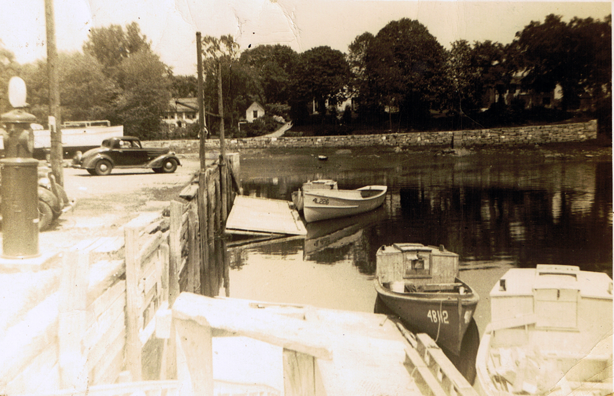
The Riverview Cash Market

Fred Cronin graduated from the Manning High School class of 1914. He operated the South Side store for a few years, and later owned the River View Cash Market at the Town landing, formerly Alonzo’s Restaurant, and later known as Alice’s before it was torn down. These photos were given me by his son, Robert Cronin, now 91.


Robert Cronin wrote his memories of his father’s store on the Town Wharf:
“Looking at the space where it stood, you can’t believe that it fit in that area. And yet, we dispensed all kinds of groceries, meats, etc. Fried Clams were sold on weekends. We dug and shucked our clams. Also, the farther end of the building was a workshop run by Vernal Smith. There are a couple of reasons I wax nostalgic looking at these photos: I spent most of my high school years working in the store up until I went into the Navy. Both of my brothers were smart–they played football. So, I was elected to work in the store.
The one thing that kept my morale up while in the navy was the thought of returning to the store and taking up where I left off. Murphy’s Law took over. The building needed too many repairs, and staple goods were hard to get, thus the dream disappeared, but many memories linger on, and these forgotten photos bring them back.”

“I find myself dropping off in my red leather chair, bored with the long winter and inactivity of being retired. As far as this winter goes–I won’t go back in time and bring up the historical winters we grew up in. Those two-mile walks through snow and sleet to get to school, and to make it worse, it was up hill coming and going! I do believe we enjoyed our growing up, and had a better chance of arriving to adulthood in better shape in mind and body. I have talked to quite a few old timers, and all have the same recall of those bygone years.”


Ipswich in Transition by Alice Keenan
The following story is from a weekly newspaper column written by Alice Keenan in 1991. Her sons published her compiled columns in the books, “Ipswich Yesterday“, volumes I and II.

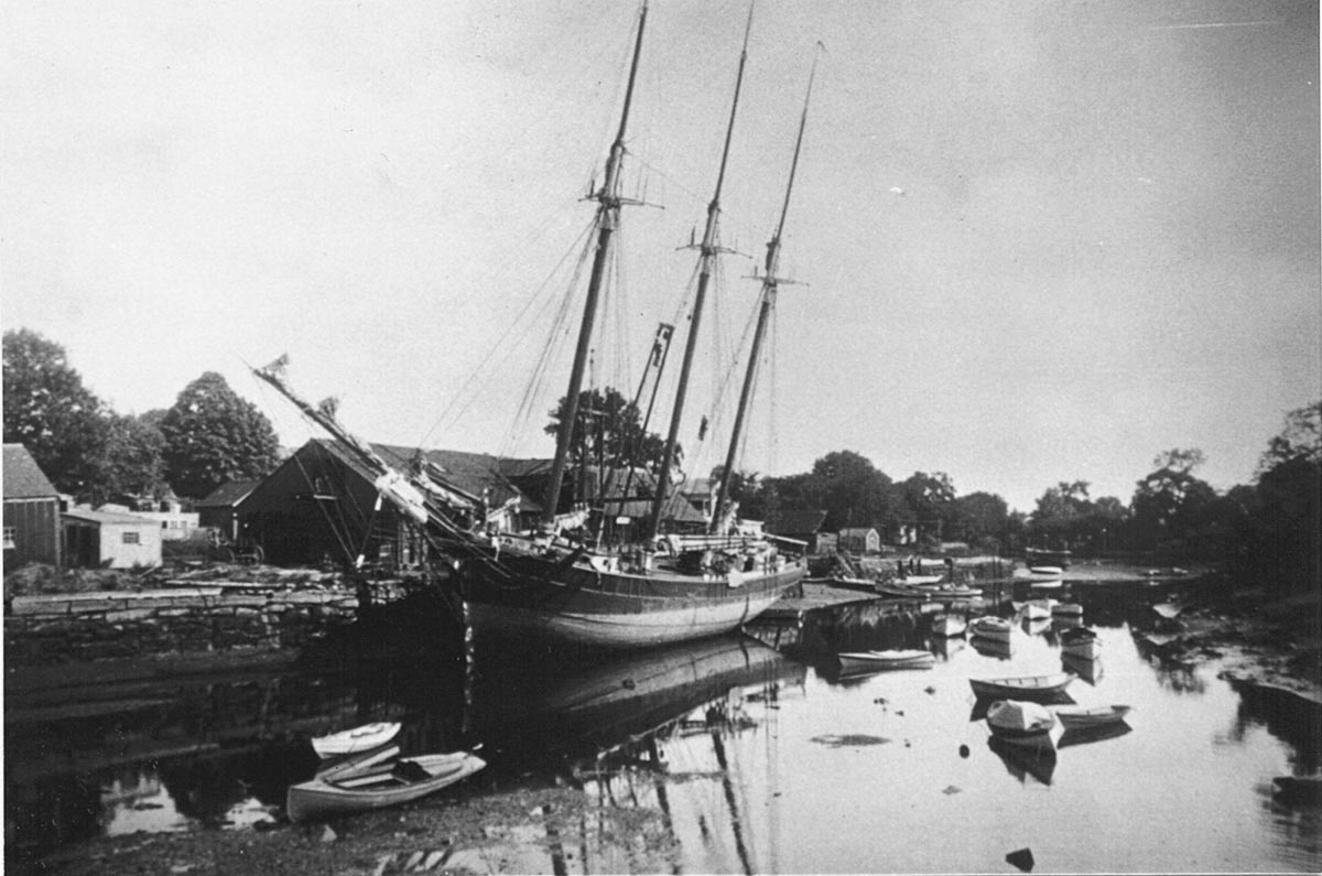
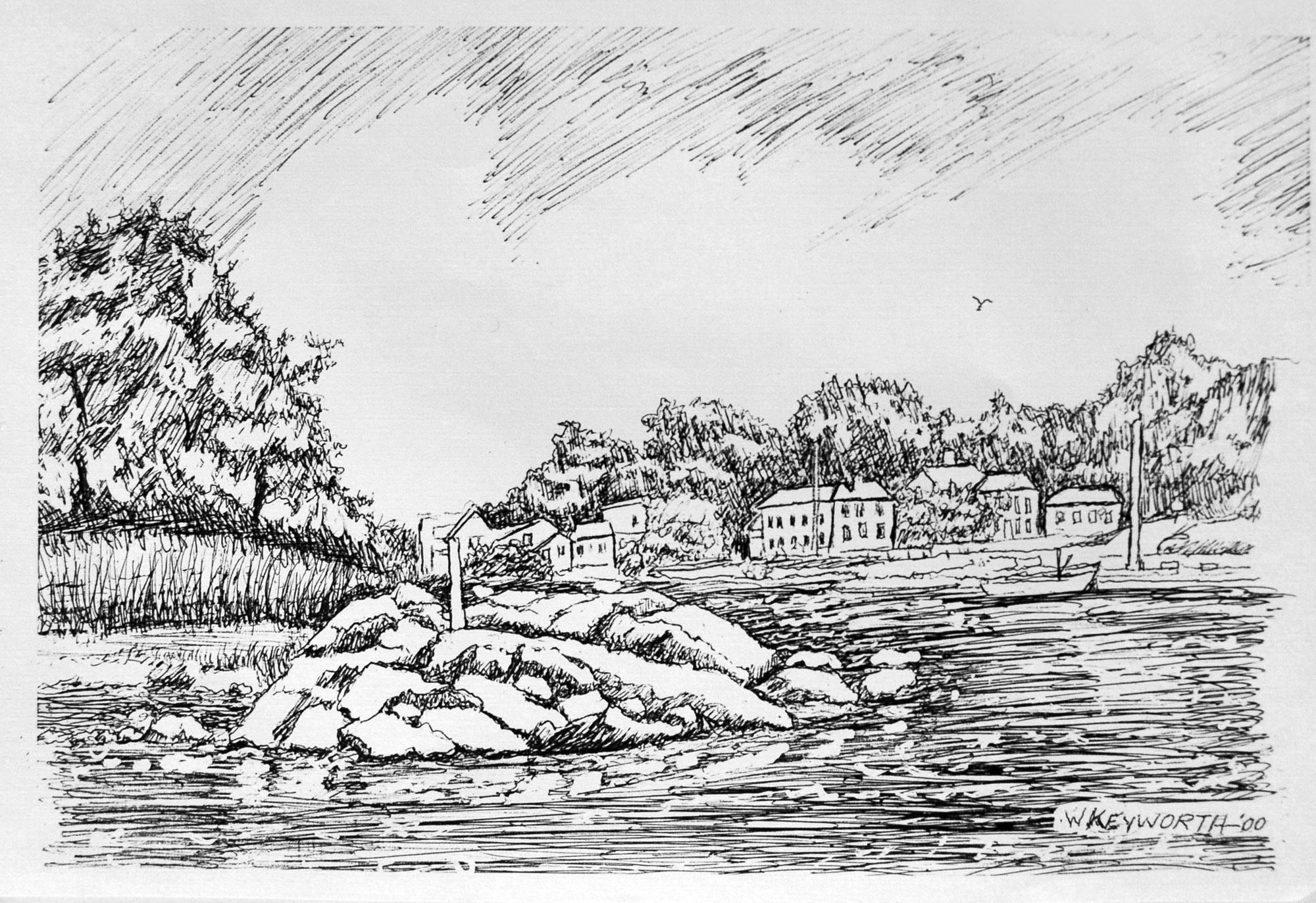
Ipswich in transition could very well be the title of these two pictures of East Street and the Town Wharf taken before and after the turn of the century. The picture above shows the Town Wharf circa 1890, and the masts of a coal schooner unloading in front of Brown’s wharf and warehouse. In the background standing well beyond Agawam Avenue is the Edward Choate shipbuilding yards. Here he built among others: “The Lucy Cogswell” in 1868; “The Fred Gray” in 1869; “The Mattie F” in 1875 and what has to be the most photographed excursion boat of them all, “The Carlotta” in 1878. The boats were launched down a tiny little railway that ran into the river and whose rails could still be seen a dozen or more years ago before they silted over. In the background is the tiny cottage that later served as the summer home of Miss Claretta Rogers whose family then owned the old Newmarch house on Agawam Avenue and the entire sweep of acreage from the river bank back onto Newmarch Street.
The small building in the foreground could be the old Ipswich Custom House. That office was discontinued in the 1870s when the records were moved to Newburyport and subsequently lost. By the time the picture was taken, it could either be an office or a snug one-room home complete with roses climbing up a tiny trellis and sporting some rather fancy Victorian trim. Later the small building would be moved down to Brown’s Square, where it still stands as part of an office for a commercial enterprise. In the center of the picture is the ever-present “Ringbolt Rock.” This ancient guardian of the tiny harbor was so named because of the giant iron rings that somehow or other were fastened to its slippery surface and helped pull the boats around the point when the going got sticky. Similar iron rings dotted Nabby’s Point and other spots along the river and remained in place until gathered up in the great scrap metal drives of World War II.

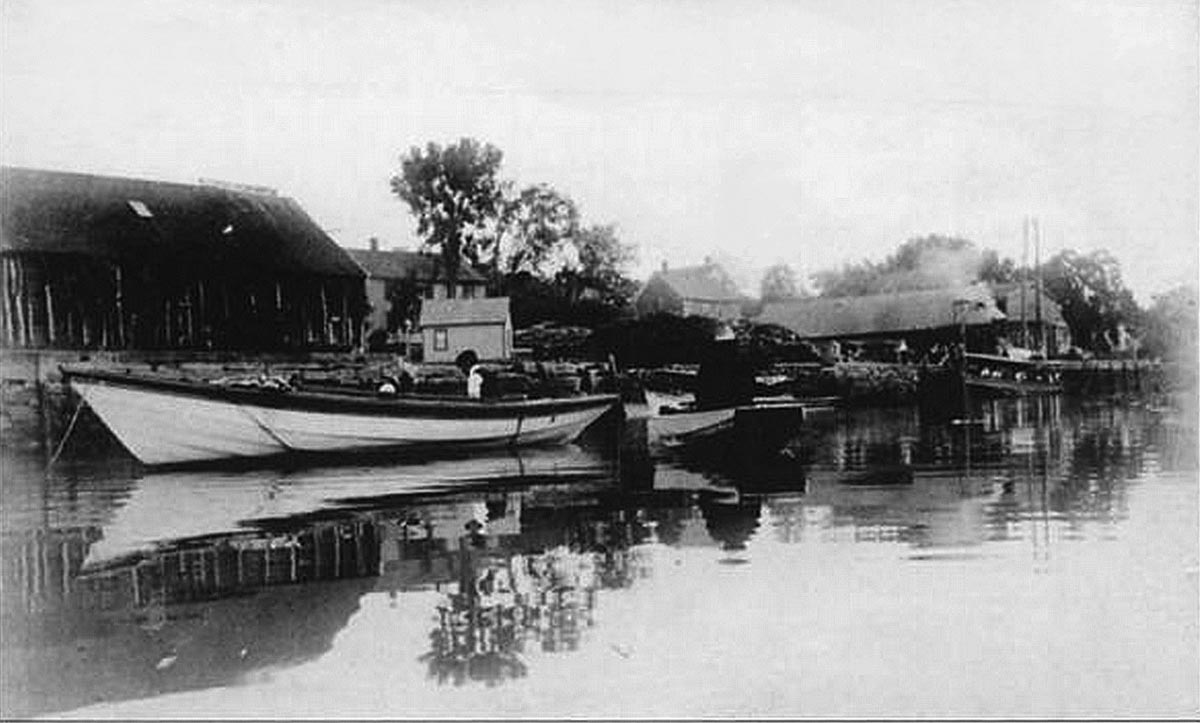
The next picture was taken some years later. Brown’s Warehouse and Choate’s Boatyard have disappeared. The great sweep of Rogers’ meadow is revealed and has now become Spiller’s Lane. Ringbolt Rock still stands guardian – as it does today— and the old Customs House is now the office of, or simply advertising, “P. R Eames, Wood, Coal, Lime, and Cement,” and the small attached shed spouts the wares of “Glover’s Coal and Lime.”
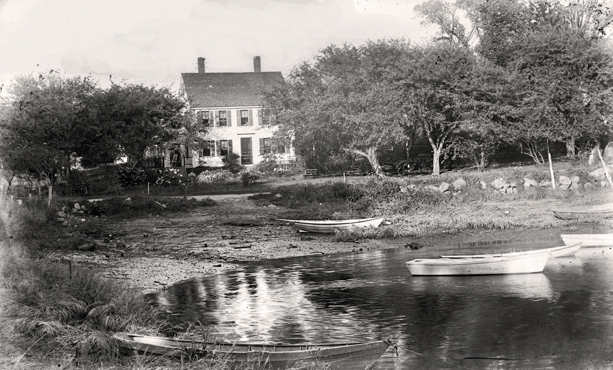
Hiking up the country-like dirt road that was East Street, we view the rear of the old “Morris House;’ built in 1723 and then owned by the Holland family. We thank their granddaughter, Rena Pardekas, for the many sweet memories she shared with us and for the many happy hours she spent as a child. She told us of the great, brick arches in the ancient cellar, the iron doors that enclosed the brick bake ovens, the upstairs and downstairs borning rooms, the supposedly haunted front bedroom, and the quaint old attic where she would climb with Grandma Holland to gather up the rug cleaners for the annual spring attack on winter’s grime — and nobody enjoyed a cleaning spree more than a proper Yankee grandma. Her grandfather removed one of the small buildings adjoining the house and outfitted it as a small variety store on the further end of his property line, facing East Street, and there it still remains as the front end of the present Alyce’s Variety store. Ironically, in the spring of 1959, this delightful antiquity would be pulled down to enlarge the parking area for the store that Grandpa Holland began more than a half-century before. Progress? — we suppose so — but we rather liked it just the way it was, way back at the turn of the century.
Related posts:
- The Steamship Carlotta
- A Photographic History of the Ipswich Mills Dam
- Along the Ipswich River: Historic photos of the Ipswich River from original glass negatives taken by early Ipswich photographers Arthur Wesley Dow, George Dexter, and Edward L. Darling.
- The Ipswich River: The 35-mile Ipswich River flows into the Atlantic Ocean at Ipswich Bay. The Ipswich River Water Association works to protect the river and its watershed. Foote Brothers Canoes on Topsfield Rd provides rentals and shuttle service from April to October.
- The Industrial History of the Ipswich River: The Industrial History of the Ipswich River was produced for the Ipswich 375th Anniversary by John Stump, a volunteer for the Ipswich Museum, and Alan Pearsall, who produced the Ipswich Mural with funding from EBSCO.
- The Choate Bridge: The American Society of Civil Engineers cites the Choate Bridge in Ipswich as the oldest documented two-span masonry arch bridge in the U.S., and the oldest extant bridge in Massachusetts.
- The Old Town Landings and Wharfs: Many a pleasant sail down the river are in the memories of William J. Barton. “These were the names of the places and flats along the Ipswich River before my time, and familiar to me during my time. They were used by the fishermen and clammers. I know. I was one of them. It was the happiest time of my life.”
- When Herring Were Caught by Torchlight: In the late 19th Century, most of the men around the river would look forward to “herringing” when fall arrived. The foot of Summer Street was the best landing. One year so many herring were caught, they were dumped in the Parker River, and Herring did not return for many years.
- County Street, Sawmill Point, and bare hills: The town voted in 1861 to build County Street and its stone arch bridge, connecting Cross and Mill Streets. A Woolen mill, sawmill, blacksmith shop, and veneer mill operated near the bridge.
- Diamond Stage: In 1673, two fishermen from the Isles of Shoals, Andrew Diamond and Harry Maine, arrived together in Ipswich. Mr. Diamond built a platform for salting and shipping fish and became quite successful. The location is still known today as Diamond Stage.
- Water Street: In the book, Ipswich in the Massachusetts Bay Colony, Volume I, Thomas Franklin Waters recorded the history of Water Street, which is part of an early public right-of-way that extended from the wharf to the Green Street Bridge, then continued along the Sidney Shurcliff Riverwalk to County St.
- Visit the Ipswich River Watershed Association site

Love the pictures of the old wharf! I had lived across the street in the 70s so it brings back memories. Thank you!
I love your posts!