
The headwaters of the Miles River begin in Beaver Pond in Beverly and flows into Longham Reservoir, where a former outlet of Wenham Lake joins in. From there for most of its course the River is a lush flowing wetland, crossing into Ipswich behind New England Biolabs and feeding into the Ipswich River behind the Presbyterian Church on County Rd. Melting of the Laurentide ice sheet about 14,000 years ago is believed to have carved out Wenham Lake and created the valley extending through the Longham and Miles River basins.

Known in Colonial times as Mile Brook or occasionally as Sawmill Brook, the Miles River is a major tributary of the Ipswich River but has been degraded by upstream use as a water supply and by damming of Wenham Lake. An elevation drop in the Miles River between Beverly and Wenham contributed to the settlement of that area. Over a million alewives swam upstream to Wenham Lake as late as the 1890s, before the water superintendent petitioned the legislature to close the lake, which eliminated the anadromous population.
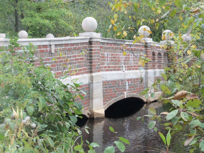
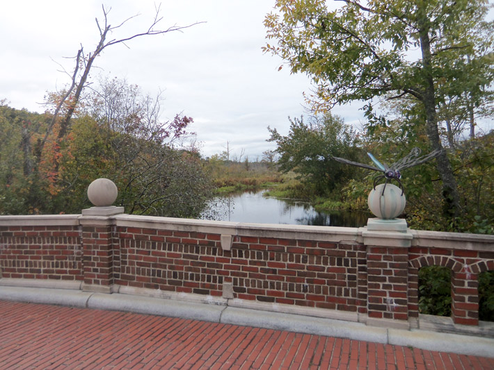
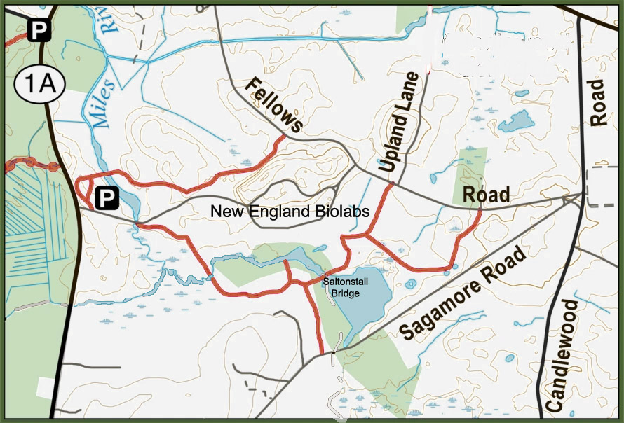
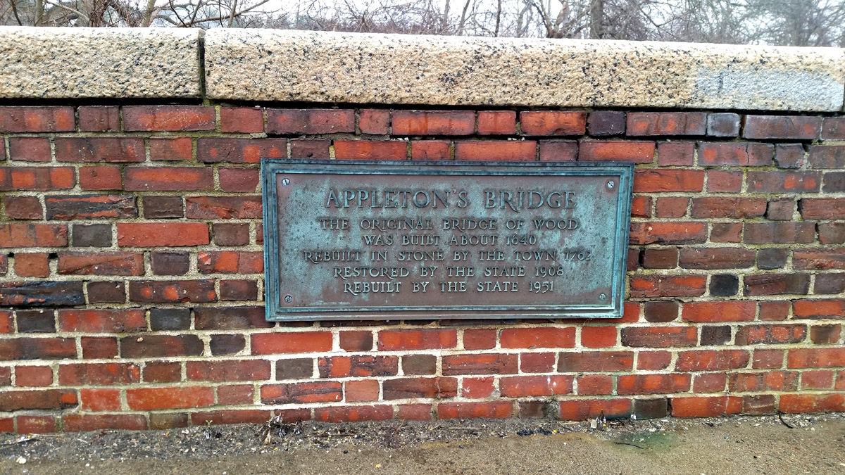
In 1638, Richard Jacobs of Ipswich received a grant of 40 acres on the southeast side of Mile Brook, bounded by the 40-acre farm of Richard Saltonstall on the northwest. The most direct way to Town lay over the Mile River and through the pastures to the way now known as Fellows’s Road. He built a bridge over the Mile Brook in about 1650. On Dec. 6, 1658, the town ordered that a highway be laid out through Mr. Saltonstall’s 40 acres and part of John Andrews’ farm, continuing across Richard Jacob’s bridge over the River. In the early 20th Century Mr. Proctor built the beautiful brick arch bridge at the same point and named it “Saltonstall’s Bridge” which is now the terminus of the trail system at New England Biolabs.

Appleton and Potter mills
Entered into the Town Book, December 16, 1638: “Granted Mr. Samuel Appleton by the company of freemen …. a farm containing four hundred and sixty acres more or less meadow and upland as it lyeth bounded by the River commonly called the Mile Brook on the Northeast and by the great River on the Northwest in part..and by a swamp on the Southeast, to enjoy all the said Lands to him his heirs and assigns forever.”
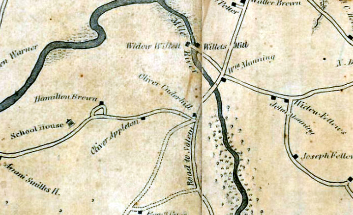
On March 24, 1696, Edmund Potter and Abraham Tilton petitioned to set up a dam and grist mill on Mile Brook near the house of John Potter, “not to damnify Col. Appleton’s saw-mill,” which was a bit east, near the County Road bridge over Miles River. The rapid descent of the stream from that location and the volume of water at that time made possible a second dam.

A story from the Potter farm
The Potter farm passed through several generations. Lydia Symmes who married Richard Potter in 1762. In her old age, she recalled an exciting story told during her childhood at the old farm near the river. In her childhood, a heavy growth of oaks and hickories remained on the river bank, and from the neighboring swamp, the cries of wolves and other wild animals were plainly heard at night. The ancestral home had served as a garrison house for the neighborhood and was surrounded by a stockade. The Indians were friendly and came frequently to the house for food and tobacco, but the owners had a cellar with a concealed entrance in case of trouble. One day, when the men were at work in the fields, and the mother of the household was cooking dinner, her little girl discovered Indians landing from their canoes in warpaint and fully armed. The mother hurried with the children into the cellar. The Indians entered, helped themselves to the dinner, smoked at their leisure, and having done no damage to the house or furniture, the whole band returned to their canoes.
The great tract of pasture, meadow, and swamp bounded by County Road, Essex Road, Candlewood Road, Fellows Road, and Lakeman’s Road, was a part of the common land of the Town, and when the common lands were divided into Eighths in 1709, it became part of the division known as the South Eighth. The natural boundary of the Inner Common of the South Eighth was Mile Brook.
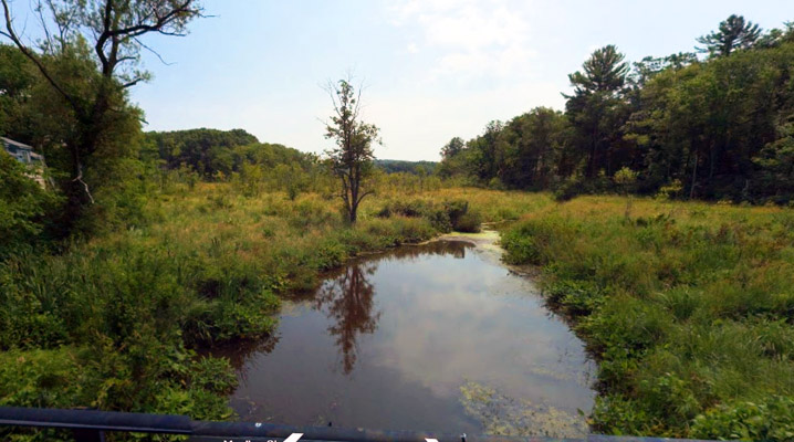
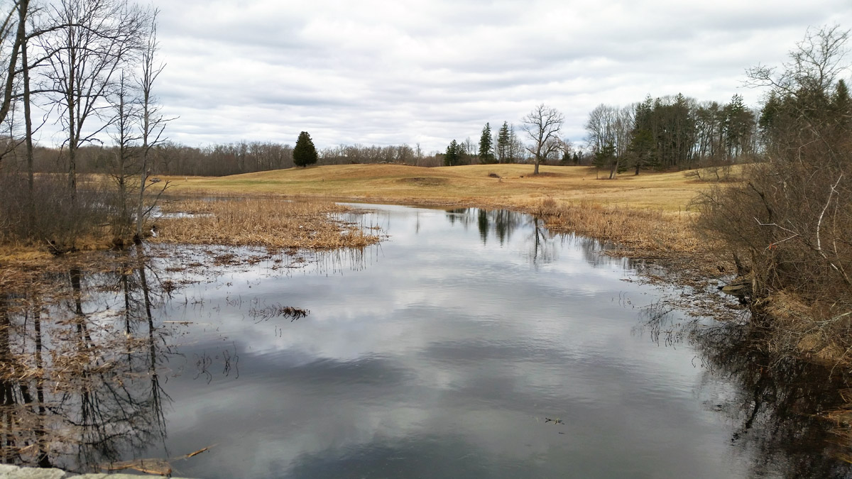
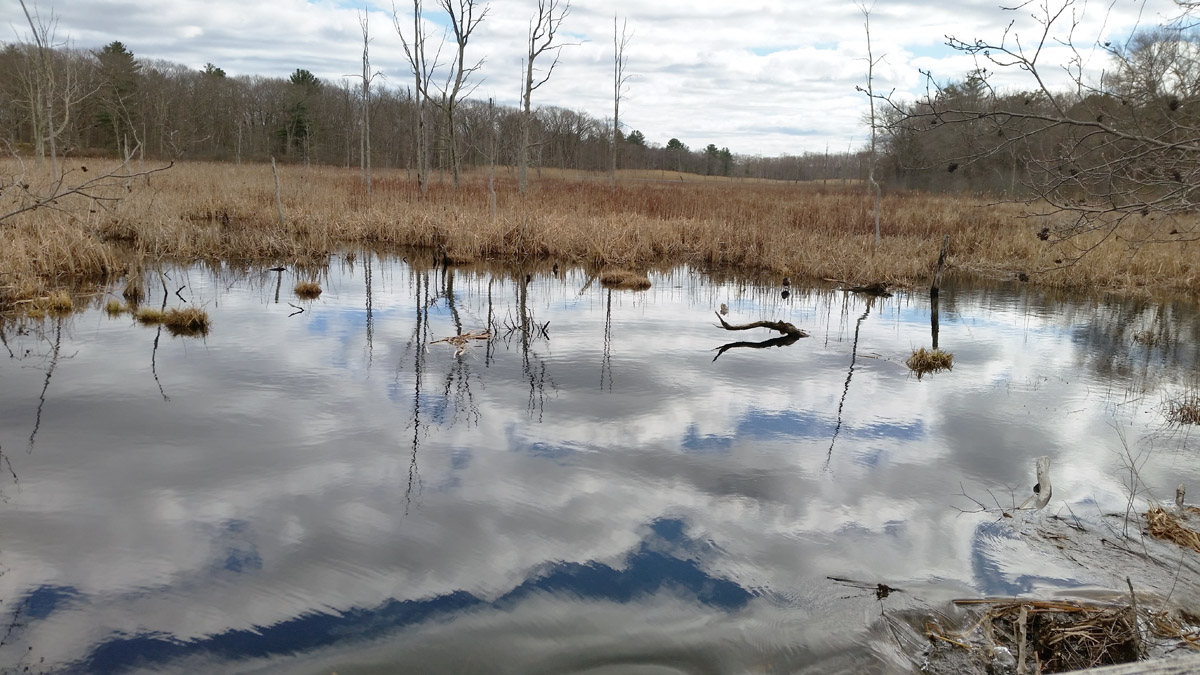
The Miles River today
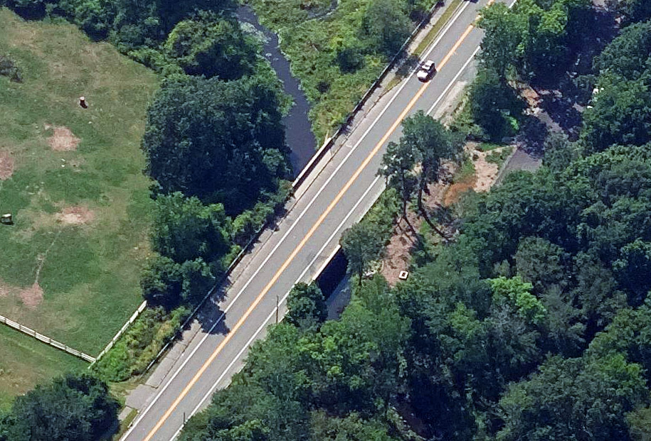
Probable remnants of the old Potter and Willet mill can be seen from the Rt. 1A County/Bay Road bridge over the river, the stones repurposed as bridge abutments. The 1872 Ipswich map identifies a grist mill nearer to the confluence with the Ipswich River. The site of the Appleton Mill is identified today by a tail race pond near the corner formed by County and Waldingfield Roads, which was fed by a ditch from the Miles River that crossed through the Greenbelt property on the east side of the road. Today the river is marginally navigable by kayak, with considerable obstructions and downed trees.
The Miles River today provides excellent riparian and wetlands habitat, but because of the two upstream water supply reservoirs, the river suffers from low flow velocity. Wayne Castonguay of the Ipswich River Watershed Association observed, “The deficit in the overall water balance, especially during high flows, contributes to filling in and relatively poor water quality. These little rivers in particular need natural pulses to keep the channels open and the waters healthy.”
Around 2005, the four watershed communities of Hamilton, Beverly, Ipswich, and Wenham formed the Miles River Collaborative to work together to solve these problems, but progress has been slow. Section 206 of the 1996 Water Resources Development Act authorizes limited funding for the restoration of aquatic ecosystems. Appropriateness is determined by the Army Corps of Engineers, which would prepare a detailed feasibility study and then carry out the design and implementation. To date, applictions specifically for funding restoration of the Miles River have not been successful.
Thanks to Wayne Castonguay and Kerry Mackin for the information provided in this article.
Sources:
- Ipswich River Watershed Association
- Ipswich in the Massachusetts Bay Colony, Vol. 2
- Publications of the Ipswich Historical Society, Issues 10-15
- The Old Bay Road from Saltonstall’s Brook and Samuel Appleton’s Farm
- Candlewood, an Ancient Neighborhood in Ipswich
- The Physical Geography, Geology, Mineralogy and Paleontology of Essex County By John Henry Sears, Essex Institute
- Manning House and Potter Farm
- Final Massachusetts Integrated List of Waters for the Clean Water Act 2022 Reporting Cycle Page 136

Nice story!