

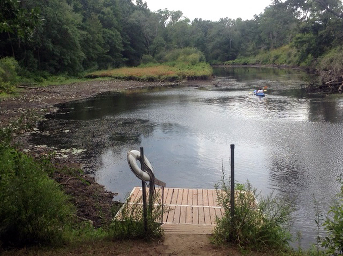
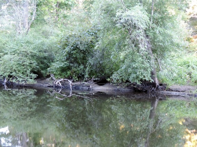
During the 2016 summer drought, the water level behind the Ipswich Mills Dam was intentionally lowered by about 3 feet to ascertain the geology of the river at that location, to examine the foundation of one of the mill buildings, and to help determine what the river upstream of the dam will look like when the dam is removed.
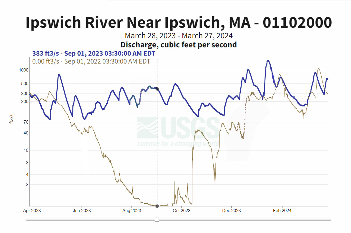
The USGS gage during August of 2016 – for most of the month the river was flowing less than 1 cubic foot per second (cfs), an absolute extreme scenario. By comparison, in March, 2024 when this article was written, the gages were measuring an average of about 600 cfs. When and if the dam is removed, the water level immediately behind the dam location will be perhaps a foot lower than during the drawdown during extreme summer drought conditions. Measurements from the 2016 drawdown and the following images indicate that the effect of removing the dam will taper off upstream until it has no impact at approximately 1.3 miles upstream where the river flows under the commuter rail bridge.
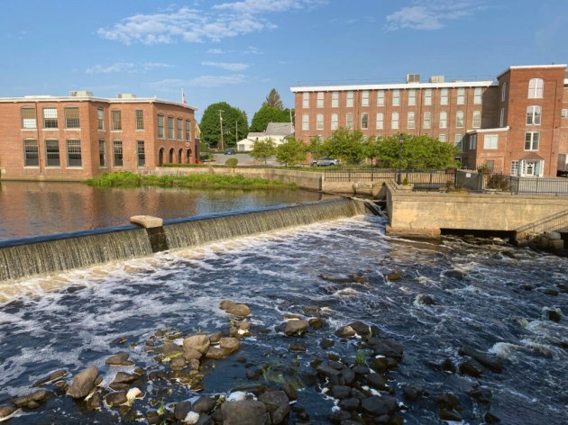
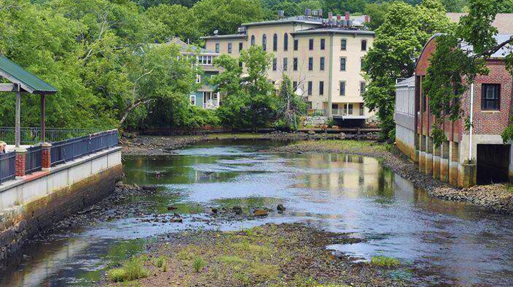
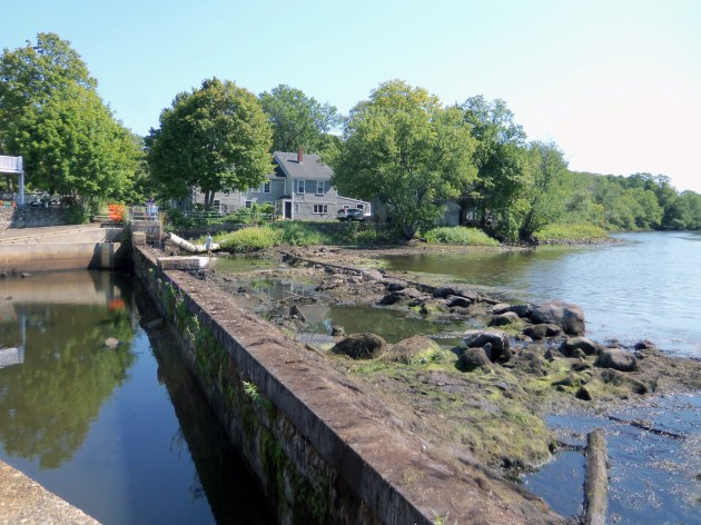
The following pictures taken during the 2016 drawdown help visualize the river’s appearance after the removal of the Ipswich Mills Dam.


More about the Ipswich River
 No “Bait and Switch” - Photo by David “Stoney” Stone Letter: The headline “Bait and Switch” in the November 25 article about the Ipswich Mills Dam was eye-catching but very misleading. Read this article at the Ipswich Local News.
 Historic Survey of the Ipswich Mills Dam - Inventory No: IPS.9009: Ipswich Mills Hosiery Manufacturing Company Dam. Survey Form F (structure) submitted to the Massachusetts Historical Commission, Recorded by: Ted Dattilo for the Public Archaeology Laboratory, Inc., May 2024. Received by the Mass. Historical Commission on Nov. 12, 2024 Historical Narrative: The history of the dam and how it relates to the development… Continue reading Historic Survey of the Ipswich Mills Dam
  Ipswich Receives $1.2M Grant For Dam Removal - Ipswich Mills Dam Removal Project Nationally Recognized Among 43 Projects to Receive U.S. Fish and Wildlife Service Funding On April 23, 2024, the U.S. Fish and Wildlife Service announced that 29 states will receive just over $70 million to support 43 projects that will address outdated or obsolete dams, culverts, levees, and other barriers fragmenting… Continue reading Ipswich Receives $1.2M Grant For Dam Removal
  Ipswich Mills Dam Feasibility Study - In 2010, the Ipswich Board of Selectmen voted to begin exploring removal of the Ipswich Mills Dam. The feasibility study was completed in March, 2019 and will set the stage for the Town's decision regarding the dam.… Continue reading Ipswich Mills Dam Feasibility Study
 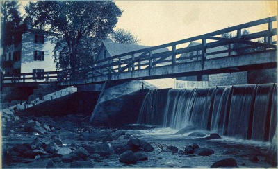 The History of the Ipswich Mill Dam, and a Natural History of the Ipswich River - We measure history by time, but for the Ipswich River and its alewives, time could be running out. We can help preserve the human and natural history of the Ipswich River by freeing it from its man-made encumbrances.… Continue reading The History of the Ipswich Mill Dam, and a Natural History of the Ipswich River
  Regarding the Removal of the Ipswich Mills Dam - By Ipswich resident Roger Wheeler On May 21, a yes vote to remove the head of tide Ipswich Mills Dam and free the river will provide Ipswich, Essex County, and New England with a rare fish-accessible river. This could be an extraordinarily uncommon river and watershed if all fish have accessibility at the head of… Continue reading Regarding the Removal of the Ipswich Mills Dam
 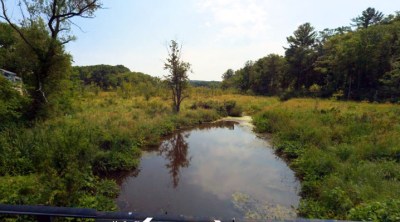 The Miles River - Known in Colonial times as Mile Brook, the Miles River is a major tributary of the Ipswich River but has been diminished in volume by upstream use as a water supply. Evidence of the old Potter and Appleton mills can still be found near County Rd.… Continue reading The Miles River
  The Choate Bridge - The American Society of Civil Engineers cites the Choate Bridge in Ipswich as the oldest documented two-span masonry arch bridge in the U.S., and the oldest extant bridge in Massachusetts. … Continue reading The Choate Bridge
 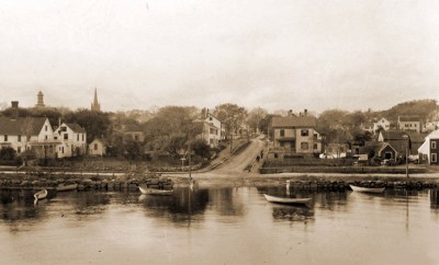 When Herring Were Caught by Torchlight - In the late 19th Century, most of the men around the river would look forward to "herringing" when fall arrived. The foot of Summer Street was the best landing. One year so many herring were caught, they were dumped in the Parker River, and Herring did not return for many years.… Continue reading When Herring Were Caught by Torchlight
  Massachusetts Provincial Law: “An Act to Prevent the Destruction of Alewives on the Ipswich River” - Concerns about the environmental toll that dams have on the Ipswich River date to before 1773. … Continue reading Massachusetts Provincial Law: “An Act to Prevent the Destruction of Alewives on the Ipswich River”
 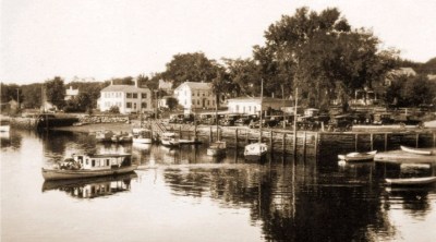 Industrial History of the Ipswich River - The Industrial History of the Ipswich River was produced for the Ipswich 375th Anniversary by John Stump, , and Alan Pearsall.Historic photos are by Ipswich photographer George Dexter. … Continue reading Industrial History of the Ipswich River
 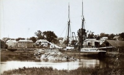 The Town Wharf - The Ipswich Town Landing is one of several locations along the River where wharves were located over the centuries. … Continue reading The Town Wharf Along the Ipswich River - Historic photos of the Ipswich River from original glass negatives taken by early Ipswich photographers Arthur Wesley Dow, George Dexter and Edward L. Darling. … Continue reading Along the Ipswich River
 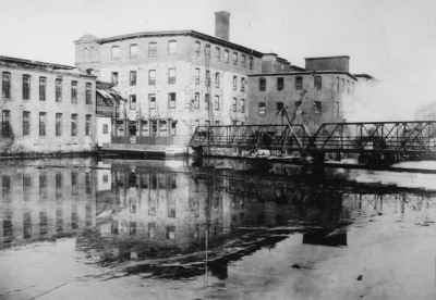 A Photographic History of the Ipswich Mills Dam - Geologically, the Ipswich River is quite young. The Laurentide ice sheet during the most recent ice age receded to the northern border of Massachusetts around 14,000 years ago. As the ice sheet melted, the sea level rose about 100 ft. higher than current levels, putting much of the North Shore area temporarily under water until… Continue reading A Photographic History of the Ipswich Mills Dam
Do you know if samples of the riverbed around Sylvania were ever taken? I often wonder how much, if any, toxic waste was dumped into the river, and perhaps still remains. Mercury, radioactivity etc. I’m sure if their was, most of it was washed to the sea.