
Marblehead's Elbridge Gerry served as governor of Massachusetts and vice-president of the United States, but his historic legacy will forever be tied to a political monster dubbed the "Gerrymander."

On the Massachusetts North Shore
Marblehead's Elbridge Gerry served as governor of Massachusetts and vice-president of the United States, but his historic legacy will forever be tied to a political monster dubbed the "Gerrymander."
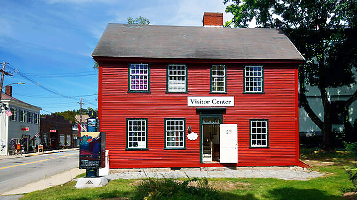
The Ipswich Visitor Center is staffed by a wonderful crew of twenty-one knowledgeable volunteers, each filling a two-hour shift once a week. We have two openings for next summer, and to sign up, please email Gordon Harris at historicipswich@gmail.com

Colonial liquor licenses were granted to Ipswich men of highest esteem. They were bound “not to sell by retail to any but men of family, and of good repute, nor sell any after sunset; and that they shall be ready to give account of what liquors they sell by retail, the quantity, time and to whom.”
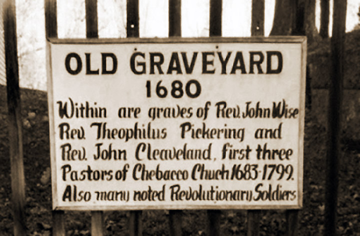
In 1819 the inhabitants of Chebacco Parish began noticing lights moving about at night in the graveyard. It was discovered that at least eight graves had been dug up and their coffins were empty.
The story of Sarah Dillingham, wife of John Caldwell is of a loving and most thoughtful life.One of the first children born in Ipswich, and then orphaned, she became a "woman of qualities" that caused her name to never be forgotten. The years entrusted them with eight children and countless Ipswich descendants. Their home on High Street still stands.

On Aug 6th 1795, Pomp an African-American slave was hung for chopping off the head of his master. He was confined in Ipswich jail, and a sentence of death was passed. He was held there until the day of his execution, which was attended by a "cheering crowd of thousands" after a sermon by Rev. Dana.
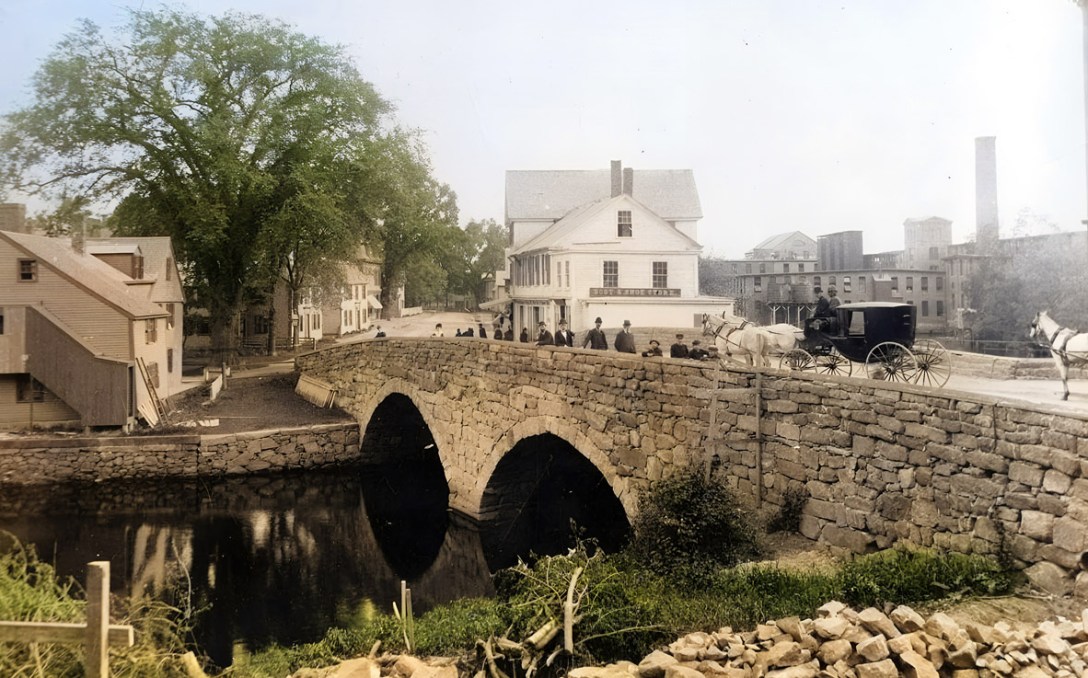
The American Society of Civil Engineers cites the Choate Bridge in Ipswich as the oldest documented two-span masonry arch bridge in the U.S., and the oldest extant bridge in Massachusetts.
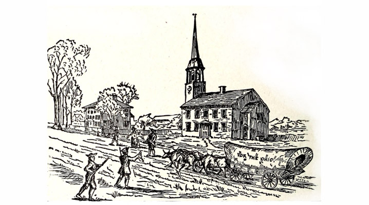
In December 1787, a group of Revolutionary War veterans and adventurers set out from Ipswich on an 800-mile journey through the wilderness by horseback and rafts to establish the first settlement in the Ohio Territory.

This remote area was originally known as Ipswich Farms. After the residents began pressing for their own church, the Massachusetts General Court on June 4, 1746, created the Linebrook Parish, the boundries of which were defined by 6 brooks and lines connecting them. The community had a church, store, school and its own militia.
Maple Street first appears in the 1884 Ipswich map, without houses. Maple Street first appears in the 1884 Ipswich map, without houses. A white arrow in the photo above points to the house still standing at 6 Maple Street, with a horse in front. The photo was taken from Town Hill by Edward Darling, around 1890. In the foreground are houses still standing on High Street. On the far left of the photo is the old Lord Square fire station and the Payne School, bright white. Behind them you can see the train tracks. Several houses are seen behind it on Washington Street. The hillside behind was still primarily farmland. By 1910, the Ipswich map shows the street completely filled.

As the people of the Hamlet were financially stable, the burden of taxation for the support of the poor in the old town of Ipswich was considered to be an unjust imposition. 25 years later, the men of Chebacco petitioned the Legislature for incorporation as a separate town.

For the 9th episode of "Destination Ipswich", we're visiting the Old North Burying Ground on High Street in Ipswich, established in 1633. Take a video tour with local historian Gordon Harris as we view some of the gravestones in the oldest section of the cemetery. To see all the gravestones, along with dates, inscriptions, location maps, and photos, go to the Old North Burying Ground page at the Historic Ipswich site.
Choate Island was originally known as Hog Island, and is the largest island in the Crane Wildlife Refuge and is the site of the Choate family homestead, the Proctor Barn, the White Cottage, and the final resting place of Mr. and Mrs. Cornelius Crane. There are great views from the island summit of the Castle Neck dunes and Plum Island Mount Agamenticus in Maine.

The triple stone arch Warner Bridge that connects Mill Rd. in Ipswich to Highland St. in Hamilton was constructed in 1829, and rebuilt in 1856. The isinglass mill sat on the downstream Ipswich side of the bridge.

In the 1700s two of the finer inns in town were run by a mother and daughter both named Susanna. Although the two houses are both on corners of County Street, they were separated by the river.

We're back with Episode Eight of Destination Ipswich with local historian Gordon Harris, and Carla Villa from the Ipswich River Watershed Association, who takes us on a couple of trails at the IRWA headquarters, then joins us for a kayak trip to the Mill Dam and back. Special thanks to Bryan Grasso and Beth Myer from Ipswich ICAM.
