
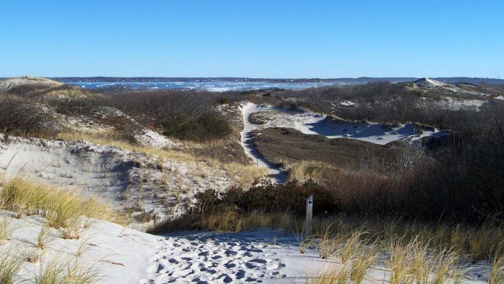
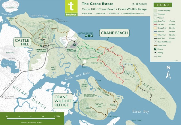
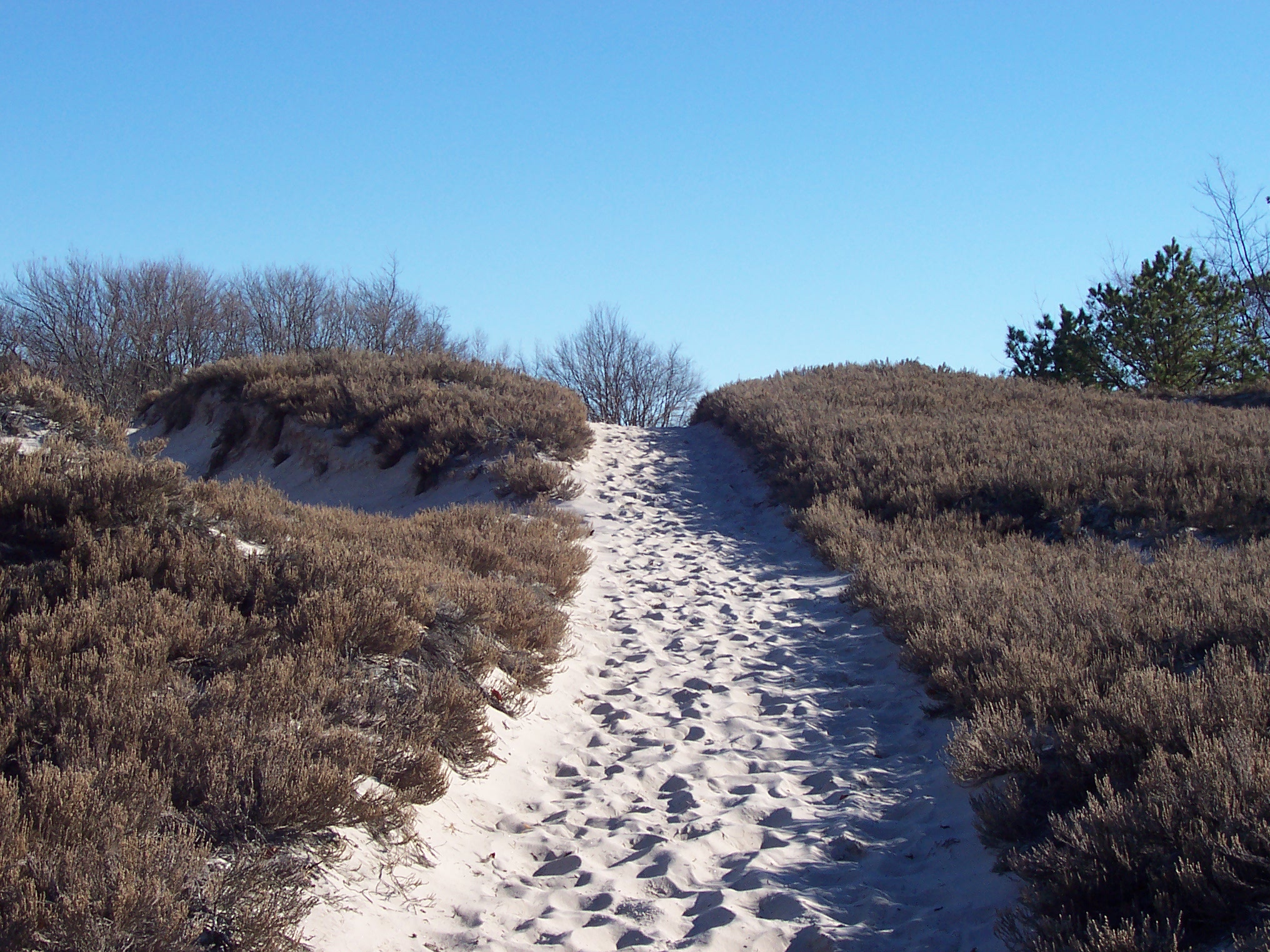
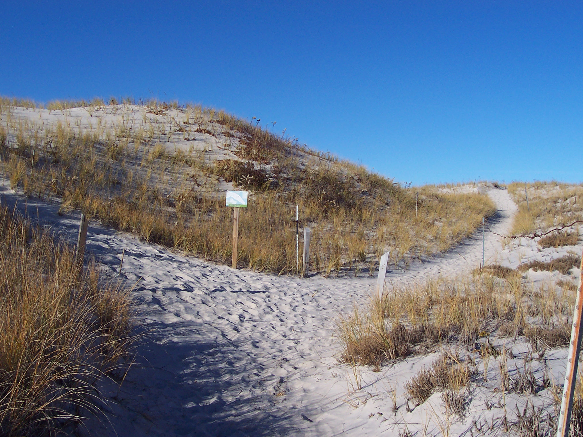
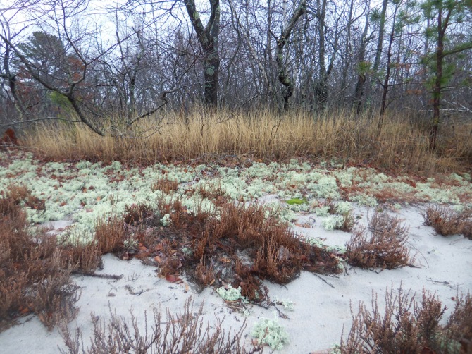
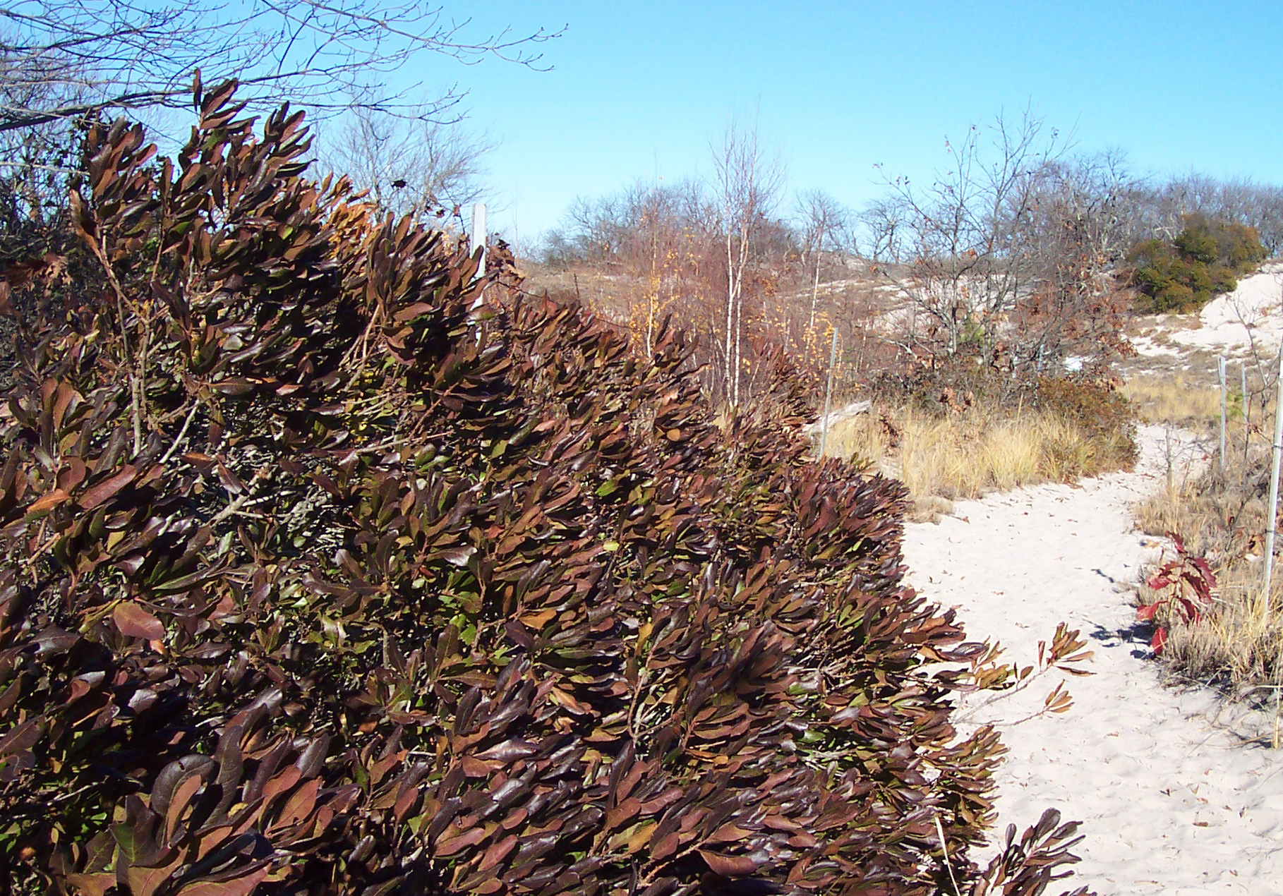
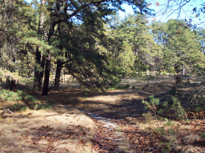
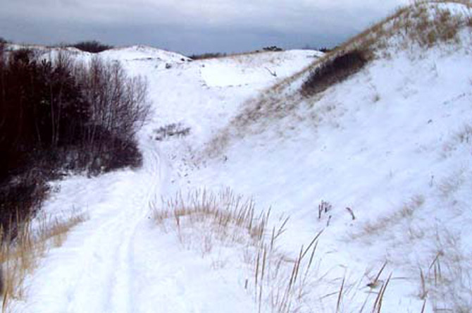
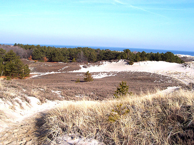
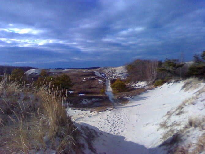
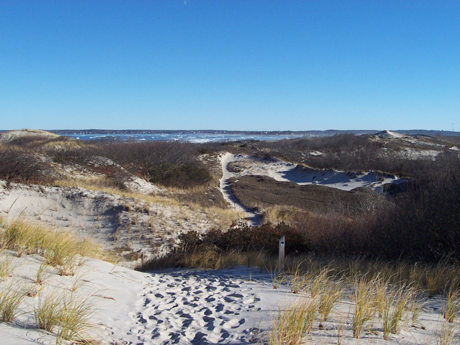
Crane Beach and all of Castle Neck are protected by the Trustees of Reservations. Warm winter days are the perfect time to hike the miles of dune trail, accessible from the Crane Beach parking lot. My loop usually begins at the green trail entrance on the far right side of the Crane Beach parking lot, first making sure to have the wind at my back along the shore. A small bridge takes you through a thicket of bayberry, dwarf yellow birches, and brilliant red winter berries to the first of several trail forks.


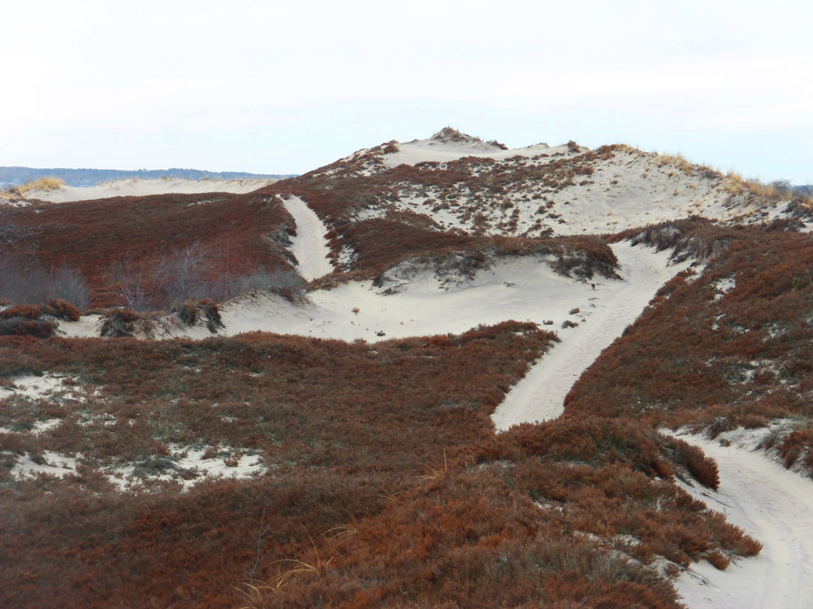
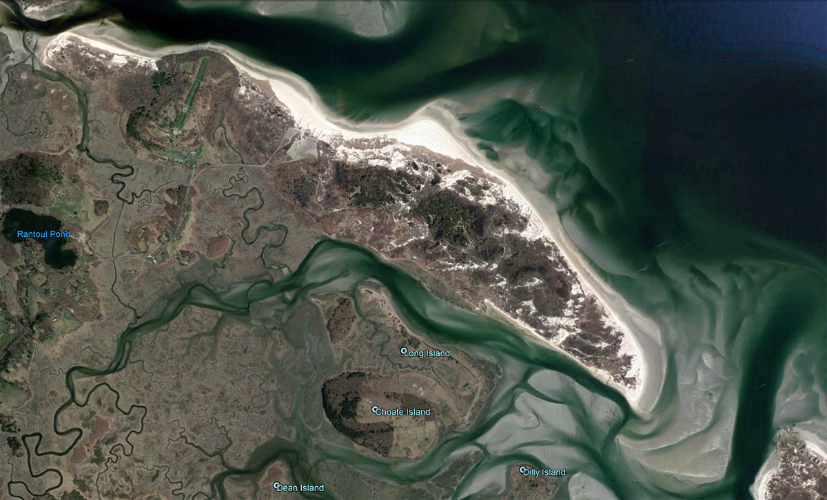
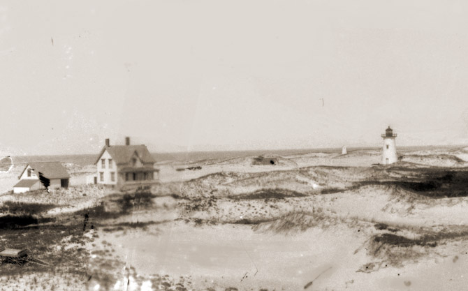
Like other barrier beaches in New England, Castle Neck and Crane Beach are shape-shifters. A lighthouse that once stood near the water’s edge trapped so much sand that it became accessible only from an upper window before it was moved in 1939 to Martha’s Vineyard. Several large dunes at the far end of Castle Neck seen in 1995 satellite images were flattened by winter storms and can no longer be distinguished.


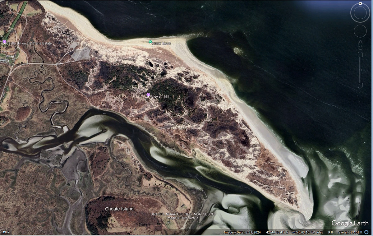
Much of the 1200 acres of dunes at Castle Neck along Crane Beach were forested with pitch pine in 1634 when European settlers arrived. Ipswich selectmen decreed that “The Neck of Land whereupon the great Hill standeth, which is known by the name of the Castle Hill, shall remain unto the common use of the Towne forever” and that no tree may be cut with a diameter less than 12″. The trees were nonetheless not preserved. In 1682, it was ordered that blacksmiths should have the liberty to fell trees for charcoal. Symonds Epes bought a large tract in 1726 and built a substantial farm and orchards at Wigwam Hill, named for a group of destitute Indians who briefly camped there. The land was passed down through two or three generations, and the husband of one of his descendants cut the protecting scrub pines for lumber. This removed a wind barrier, and the thin layer of topsoil blew away. All that remains along that trail is the top of a chimney protruding from a giant sand dune.

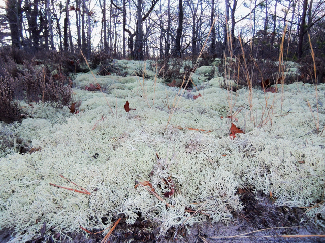
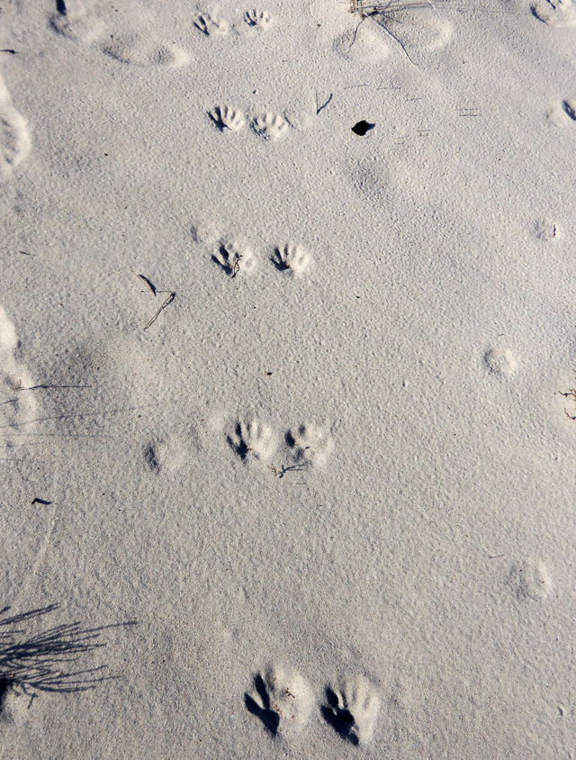
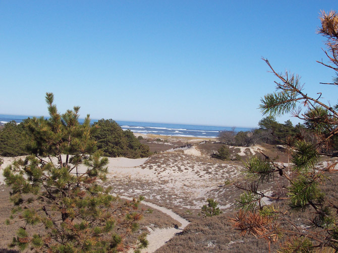
Pitch pine and scrub oak rise from the masses of marsh grass, sage green Hudsonia, and dune lichen lining the trails, and the leathery carcasses of sand-star puffballs lie strewn about the sand. You may have the fortune to view a magnificent large buck atop a sandy ridge before it disappears into the brush or an Ipswich sparrow running in the grass.
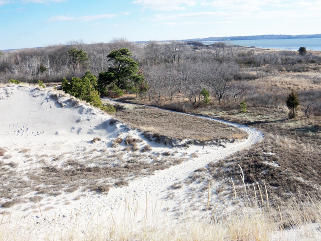
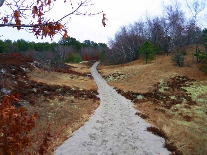
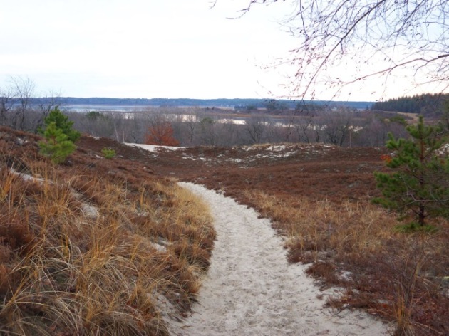
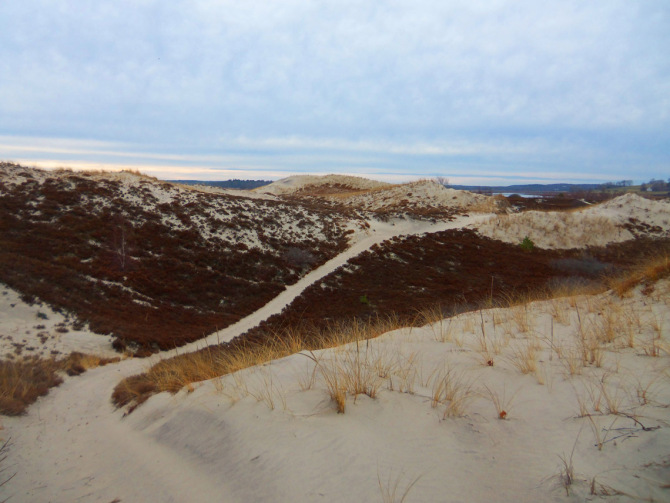
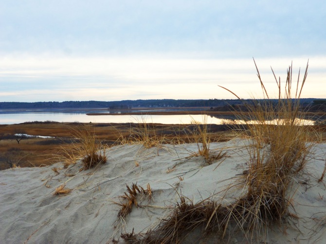
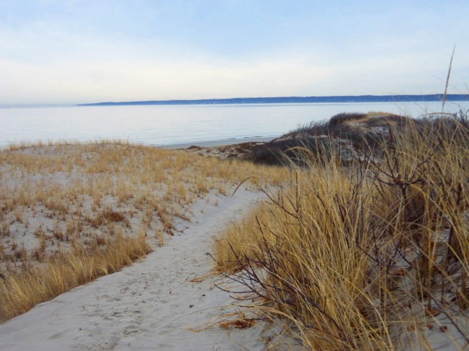
As you reach the mid-point of Castle Neck, the red and blue trails take you from the wooded secondary dunes to the starker primary dunes parallel to the shore. Stop here in the fall to taste the sweet cranberries that form a vast red carpet in the sheltered valleys. The yellow trail ends at Essex Bay, where you have the option of walking back along the wide Castle Neck River or rounding the point to enjoy the crashing waves on Crane Beach. The dunes are very fragile so always stay on marked trails and do not walk on the vegetation.

In 1634, the Ipswich selectmen decreed that “The Neck of Land whereupon the great Hill standeth which is known by the name of the Castle Hill shall remain unto the common use of the Towne forever.” The mild weather today beckoned me to Castle Neck for a walk in the dunes, my “forever” favorite cold-weather hike. I started at the trail entrance on the far right side of the Crane Beach parking lot and followed the green, red, and blue trails to Essex Bay, and then I continued upstream along the Castle Neck River and crossed back over Castle Neck to Crane Beach.


/


/
Life in the Shifting Dunes
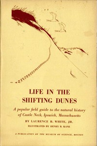
A popular field guide to the natural history of Castle Neck, Ipswich, Massachusetts, with attention to the unusual ecological relationships peculiar to such an area, by Laurence B. White Jr., Museum of Science, Boston. Illustrated by Henry B. Kane BY LAURENCE B. WHITE, JR.
Excerpt:
“There was a time when many of our most beautiful beaches, the Castle Neck area included, were far inland from the edge of the sea. This was about a million and a half years ago, when the sea was at a lower level than it is today. In fact, a great many changes have helped to form the beaches we see and enjoy now. Of them all, the one brought about by the Ice Age was probably the most influential. It was some 30,000 or 40,000 years ago that New England was overwhelmed by the final advance of a great continental ice sheet. It came from the northwest, and as it inched its way toward the ocean, it pushed chunks of rock and great quantities of soil along with it. The rock was continually breaking up as it was shoved forward under the ice.
This last glacier covered New England for thousands of years. When it melted, all the debris it had been moving along like a giant bulldozer was left deposited irregularly over the land, some debris perhaps a hundred miles from its original location. In addition, the water from the melting ice swept finer sands and gravels along, depositing them over land areas and in lakes and bays.
In some places, streamlined hills of debris had been built up under the ice. Later, as the ice melted, they became exposed. They were shaped like the bowl of an inverted spoon, and we call them “drumlins.” Along the coast, as the sea level rose, the drumlins there were surrounded by water and became islands. On the sides exposed to the sea, they were eroded by the waves, and the eroded materials were collected to form spits. Other sands and gravels carried by longshore currents were added, and, by and by, in some cases, these sand spits connected one drumlin to another. It was just such a modification of three separate drumlins that formed Castle Neck. It was on the protected back side of the drumlins that plants first took hold.”
Sand Dunes and Salt Marshes
Charles Wendell Townsend, M.D. was attracted by the natural beauty of Ipswich. In the late 19th century, he built a summer house on Argilla Road overlooking the salt marsh and the open sea. From there, he wrote several books, including Sand Dunes and Salt Marshes. The following excerpts from that book are about flora he identified in the Castle Neck dunes that run parallel to Crane Beach.
SAND DUNES have a fascination all their own. In the multiplicity of their forms and colors, varying with the seasons and years, they are a constant source of pleasure, while in their wealth of plant and animal life, their interest is never-ending. Born in Boston on November 10, 1859, Charles Wendell Townsend, M.D., was attracted by the natural beauty of Ipswich. He built a summer house on a ridge overlooking a wide expanse of salt marsh with an open sea to the east. From here, he wrote a number of books, including Beach Grass, Sand Dunes and Salt Marshes, and the Birds of Essex County. Wendell was a charter member of the Essex County Ornithological Club, a member of the Boston Society of Natural History, and at the time of his death, a director of the Massachusetts Audubon Society.
Sand Dunes And Salt Marshes is available through Amazon.com
Thanks to Kellscraft.com for text and pictures from Wendell’s book, Sand Dunes and Salt Marshes, which you can read with the following links, or by flipping the pages in the embedded book below.
PREFACE
I. SAND DUNES
II. TRACKS AND TRACKING
III. VEGETATION IN THE DUNES
IV. LAND BIRDS OF THE DUNES
V. SWALLOW ROOSTS AND SWALLOW MIGRATION
VI. WATER BIRDS SEEN FROM THE DUNES
VII. THE HARBOR SEAL
VIII. SALT MARSHES
IX. SALT MARSHES — THEIR PAST AND FUTURE
X. BIRDS OF THE SALT MARSHES
XI. THE HORSESHOE CRAB AND OTHER DENIZENS OF SAND AND MUD
XII. BIRD GENEALOGY

By far the most characteristic plant of the dunes, one that is of great economic importance in that it restrains by its binding network of roots the movement of the sands, is the cosmopolitan beach grass, the marram-grass of East Anglia. Everywhere it extends its long, creeping rootstocks, sending up at the ends its spiny-tipped leaf-blades, sharp and hard as a needle, where they emerge from the sand.
As the winter comes on the green gradually fades, but is replaced by a golden straw color, that like a luminous yellow haze spreads over the sands. While the beach grass is beautiful in mass, with its colors varying with the season, the individual clumps and sprays of graceful upright and drooping grass stems, and rigid plumes of flower and fruit are exceedingly picturesque in their brilliant white setting of sand. Around each clump is often drawn a magic circle, a fairy ring, for the drooping grass blade, blown by the wind, writes with its tip in the soft sand.
In photographs of the semi-arid regions of eastern Africa, one sees great spreading trees, and giant candelabra, under which the rhinoceros takes his noonday siesta. These are euphorbias or spurges, and here throughout the dunes, a lowly member of the same family, the seaside spurge, spreads itself in mats from the size of a silver dollar to that of a large saucer, prostrate on the sand. By a central taproot, it draws its nourishment from the damp sand below.

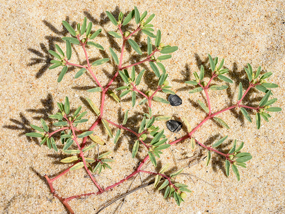
The American sea rocket is a plant of the mustard family, with small purplish flowers, but swollen and dropsical like a sand-loving cactus. The resemblance of these plants to the cacti is not wholly accidental, for, like cacti, they are growing to a certain extent under desert conditions, and it is incumbent on them, therefore, to treasure up as much moisture as possible. In the dunes, the air always contains moisture, and the sand is wet a few inches down, no matter how dry it may be on the surface, yet the strong winds, the intense light, and the great heat radiated from the white sand approximate the conditions of a desert. The sea rocket and saltwort conserve moisture by making reservoirs for water in their stems and leaves, taking on a fleshy habit, in the language of the botanists.
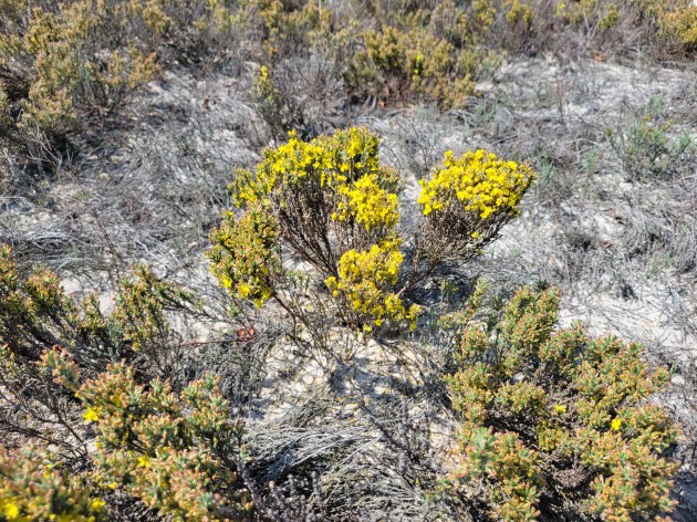
Another plant that binds the sand has the singularly inappropriate name of poverty-grass, for it is not a grass, but a member of the rockrose family, and it expresses anything but poverty if one is to judge by its wealth of golden blossoms, which paint the dune sides yellow in June. Rather, should it be called by its own name, Hudsonia, given in honor of William Hudson, an early English botanist. Matted together like heather and close to the sand, it forms in summer great patches of a beautiful sage green, which in the autumn are tinged with yellow, and in winter become sandy gray, while in the spring all is smothered in the brilliant yellow of the closely crowded blossoms. The Hudsonia is a plant well worth knowing.
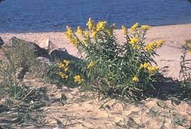
Each species of goldenrod — and there are over fifty in eastern North America — has an interest and beauty of its own, but the salt-loving species, the seaside goldenrod, which is equally at home on the edges of the dunes and on the border of the salt marshes, is certainly one of the finest, with its dark green vigorous leaves and its robust flowering stalk of large golden flowers. Long after the flowers have succumbed to the frosts the stalks stand up like gray plumes waving in the wind.

One would hardly expect to find mushrooms growing in the dry sand, but there are a number of such, both on the bare wastes and among the groves of trees and bushes. The most noticeable one is the sand-star puffball, which during wet weather stretches its leathery-looking star flat on the sand, and holds on its upper surface a puffball not much larger than a hazel nut. In dry weather, the leathery arms of the star curl up dry and brittle around the puffball, as if to protect it from the sun.

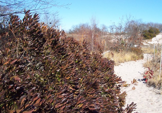
Of the bushes growing in the dunes, the beach plum is the most characteristic, a straggling prostrate shrub that is exposed to the full force of the wind, but expanding luxuriantly in the protected hollows. In the early spring, it is a mass of white blossoms, and in the fall, the small globular purple or crimson fruit can be gathered. There is a wild flavor about it, not unattractive. It abounds at Plum Island, from which, indeed, the island takes its name. You can see them along the boardwalks at Crane Beach.
Everywhere in the dunes grows the bayberry or myrtle with its fragrant leaves and aromatic, wax-covered berries, the favorite food of four different kinds of birds, namely, the flicker, crow, tree swallow, and myrtle warbler. The early settlers found these bayberries useful for making candles, which had a delicate greenish-brown tint and exhaled a faintly aromatic odor. The berries were gathered in large quantities and boiled in kettles, and the wax that rose to the surface of the water was skimmed off when cool.

The Sumach family is an interesting and beautiful one. Three of the tribe occur in the dunes, and of these, the staghorn sumach deserves first place with its thickets of brown, hairy branches in the spring, very suggestive of a stag’s antlers in the velvet. Its wealth of dark green foliage in the summer is tropical and palm-like in appearance, and its flame-colored masses of fruit in the autumn are borne aloft like so many torches on the ends of the branches. Its great compound leaves, before they drop, rival the fruit in color.
The most important tree is the pitch pine, which forms two groves of several acres in extent, both of which have spread considerably in the last twenty years. Mr. C. J. Maynard tells me that forty years ago not only were there no pines, but no large clumps of bushes to be found in the dunes. One of these pine groves, as we have already seen, is being overwhelmed by a sand wave from the north, but is more than making up for this by its extension to the south. The trees are somewhat stunted and rarely reach a height of more than thirty feet, but their thick groves are a welcome refuge in storms for bird and man alike.
The Missing Dunes
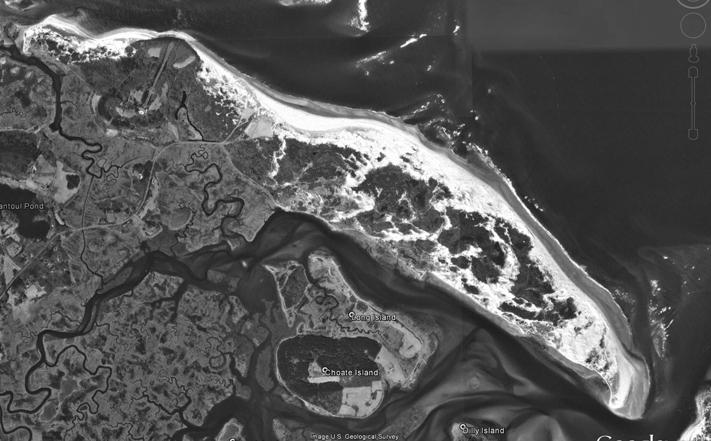
When Google Maps first went online, it showed a couple of large dunes at the tip of Crane Beach, one labeled “The Great Dune.” It was the tallest of the newer dunes, comparable in size to Wigwam Hill, which is actually a sand-covered drumlin in the middle of Castle Neck. The Great Dune, alas, is no more. Using Google Earth, I compared satellite images from 1995 and 2005 with the satellite view today. The tip of Castle Neck, where the Great Dune once stood, is retreating, and the opening to Essex Bay between the tip of Castle Neck and the tip of Wingaersheek Beach has widened by perhaps a quarter-mile.
The newer dunes may have been a temporary phenomenon–they seem to have appeared after the publication of the 1912 nautical map of Ipswich Bay, reaching prominence sometime in the middle of the 20th Century, then began their retreat. The crude map produced in 1786 and shown further down indicates that Castle Neck is, in fact, longer than it was 230 years ago.
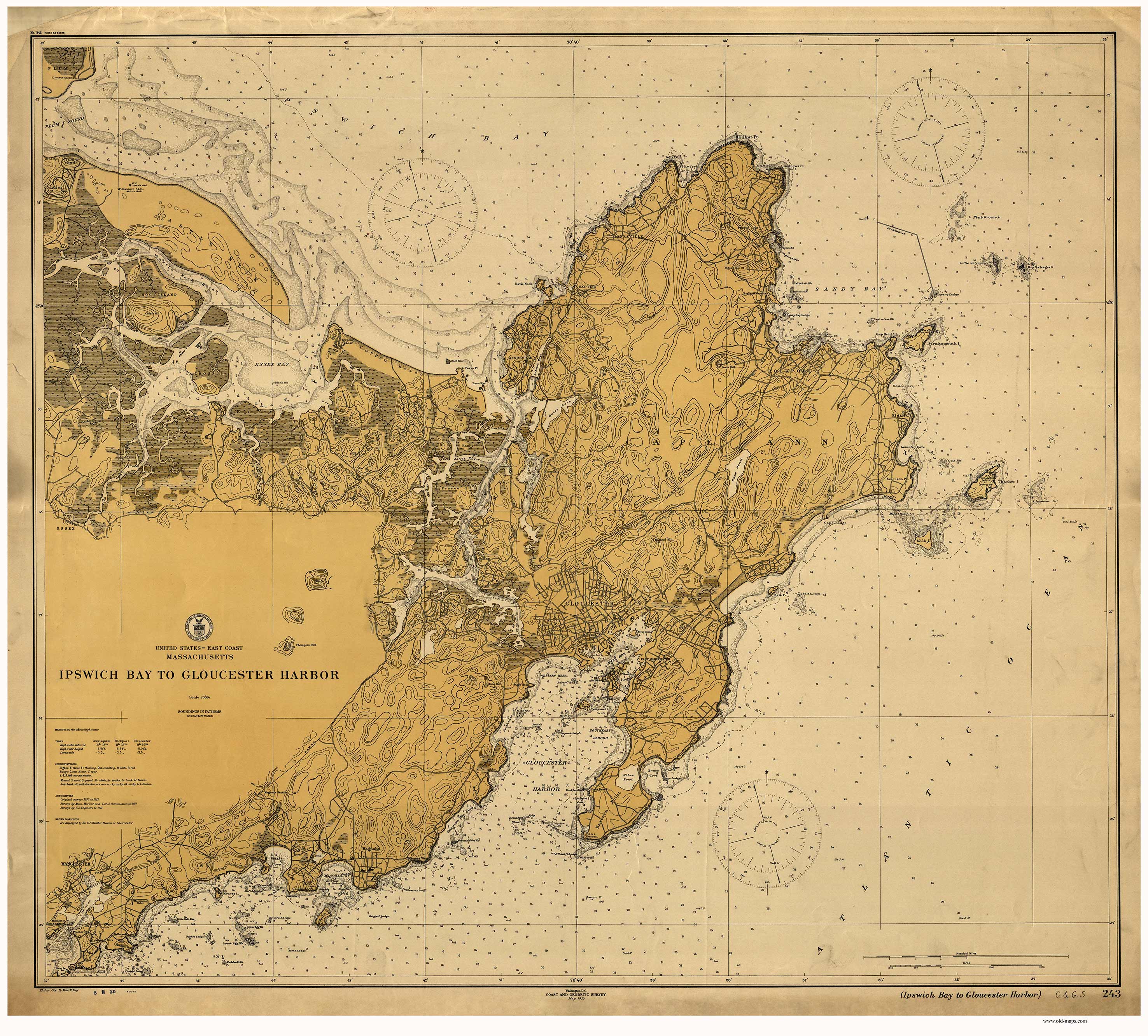

The large new treeless dunes at the tip of Castle Neck were short-lived. In the book, Sand Dunes and Salt Marshes, a study of the Ipswich dunes published by Charles Wendell Townsend in 1925, he includes the map below, drawn in 1786. In the map, Castle Neck is rounded at the end and does not protrude so far into Essex Bay.


Related Posts:
 The Ipswich Visitor Center - 1820 Hall-Haskell House sits at the heart of our town on the Center Green, in one of several national historic districts in town.… Continue reading The Ipswich Visitor Center
  The Crane Estate at Castle Hill (1928) - Castle Neck and Crane Beach have a long history of ownership by several families before being granted by the Cranes to the Trustees of Reservations.… Continue reading The Crane Estate at Castle Hill (1928)
 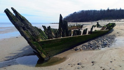 Wreck of the Ada K. Damon - Christmas, 1909 witnessed the heaviest storm in many years. The ship was wrecked during the captain's first trip for a load of sand from the plentiful supply on Plum Island.… Continue reading Wreck of the Ada K. Damon
  The Missing Dunes at Castle Neck - The "Great Dune" at the end of Castle Neck has disappeared, the point is retreating, and the opening to Essex Bay between Castle Neck and Wingaersheek Beach has widened.… Continue reading The Missing Dunes at Castle Neck
  Wreck of the Edward S. Eveleth, October 1922 - In October 1922, the sand schooner Edward S. Eveleth rolled over when a wave rushed over her deck and pushed her onto the edge of Steep Hill Beach. Filled with sand, each tide buried her deeper. Her remains were visible for several years. The skeleton of the hull is just off-shore a short distance from the wreck of the Ada K. Damon.… Continue reading Wreck of the Edward S. Eveleth, October 1922
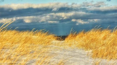
 Destination Ipswich: A Walk in the Dunes - Gordon Harris kicks off the first episode of Ipswich ICAM'S "Destination Ipswich" series with a walk in the sand dunes at Castle Neck.… Continue reading Destination Ipswich: A Walk in the Dunes
 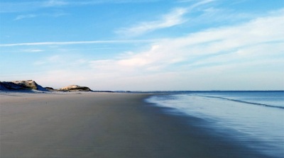 Crane Beach - Crane Beach belongs to the Trustees of Reservations and is part of the historic Crane Estate. The property includes Crane Castle, miles of shoreline, and over 5 miles of marked trails through the dunes at Castle Neck and Steep Hill Beach, open year-round.… Continue reading Crane Beach
  Choate Island and Rufus Choate - Choate Island was originally known as Hog Island, and is the largest island in the Crane Wildlife Refuge and is the site of the Choate family homestead, the Proctor Barn, the White Cottage, and the final resting place of Mr. and Mrs. Cornelius Crane. There are great views from the island summit of the Castle Neck dunes and Plum Island Mount Agamenticus in Maine.… Continue reading Choate Island and Rufus Choate
  Charles Wendell Townsend, Ipswich Naturalist - Charles Wendell Townsend, M.D. was attracted by the natural beauty of Ipswich. He built a summer house overlooking a wide expanse of salt marsh with open sea to the east. From here he wrote a number of books, including Beach Grass, Sand Dunes and Salt Marshes, and the Birds of Essex County. … Continue reading Charles Wendell Townsend, Ipswich Naturalist
  The Fox Creek Canal and Robinson’s Boatyard - The Fox Creek Canal is the oldest man-made tidewater canal in the United States, dug in 1820. In 1938 it was dredged to accommodate ship-building at Robinson's Boatyard, where small minesweepers were constructed for World War II.… Continue reading The Fox Creek Canal and Robinson’s Boatyard
 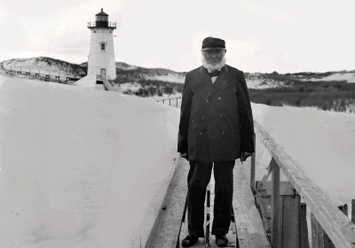 The Ipswich Lighthouse - In 1881, a 45-foot cast iron lighthouse was erected at Crane Beach, replacing an earlier structure. By 1913, the sand had shifted so much that the lighthouse was 1,090 feet from the high water mark. Use of the light was discontinued in 1932 and in 1939 the Coast Guard floated the entire lighthouse to Edgartown on Martha's Vineyard.… Continue reading The Ipswich Lighthouse
  Life at an Estuarine Front - Shorebirds congregate and drift in rafts along the estuarine front where the mixing of fresh and saltwater stirs up small fish, crustaceans, and other aquatic organisms.… Continue reading Life at an Estuarine Front
  The Shipwrecks at Ipswich Bar - The Ipswich Bar has a long history of tragic shipwrecks. Its swift currents and shallow waters are especially dangerous during storms, and many ships have gone aground. The hull of the Ada K. Damon sits on Steep Hill Beach.… Continue reading The Shipwrecks at Ipswich Bar
  The Farm at Wigwam Hill - Symonds Epes bought a large tract in 1726 and built a substantial farm and orchards at Wigwam Hill, named for a group of destitute Indians who briefly camped there. The protecting pitch pines were later cut for lumber, and the farm became a large dune.… Continue reading The Farm at Wigwam Hill
 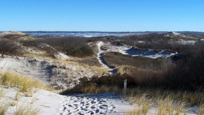 Winter Walks in the Dunes at Castle Neck - Crane Beach and all of Castle Neck are protected by the Trustees of Reservations. Pitch pine and scrub oak rise from the masses of marsh grass, sage green hudsonia and dune lichen lining the trails that wind through the dunes.… Continue reading Winter Walks in the Dunes at Castle Neck
I’m moving to the area next year, and want to express how much I enjoyed this description of Castle Neck and the dunes. I cannot wait to take a hike!
A very pleasant read. Thank you Gordon. I felt there in nature as I read and studied your photos. Dr. Townsends’ botany lesson was engaging as well. You look a bit like him Gordon 🙂
Wonderful collection of images and descriptions which can surprise even those of us who think we know this place so well. Thank you
Very nicely done! One of my favorite places, but your observations and connections to history taught me much and surely will freshen and inform my next walk in the back dunes. (I want to find that chimney!)
* view Rick Isaacs’ nature photos at flickr.com/rickisaacs