

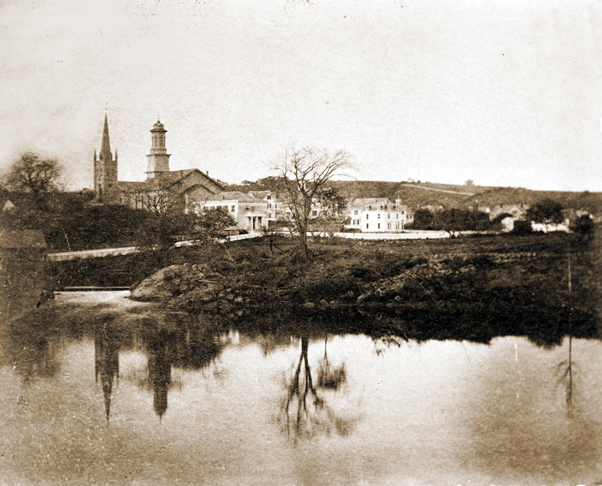
The Industrial History of the Ipswich River was produced for the Ipswich 375th Anniversary by John Stump, a volunteer for the Ipswich Museum, and Alan Pearsall, who produced the Ipswich Mural with funding from EBSCO. Historic photos are by Ipswich photographer George Dexter.
Ipswich River, from the Ipswich town line on Topsfield Road
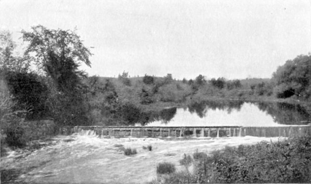

Willowdale Dam
In February of 1824, permission was given to build a dam here to provide water power for a mill, but it was not built until 1829. This dam was said to be about 6’ tall in a 1918 report and is still standing today. Foote Brothers Canoe Rentals was established here in 1955 and is still in operation today with second and third-generation family members operating the business. The first mill built here was a Sawmill in 1829. In 1834 it was converted into a Textile Mill. It produced hosiery as well as woolen goods and was in operation until a fire in January of 1884 destroyed it. The foundation can still be seen today. A long sluiceway was built here and runs parallel with the river, directing the water flow under the mill.

Winthrop Street Bridge
In February of 1824, permission was given to build a bridge here. It was not built until 1844-5 and is still in use today. A dam is known to have been at this location as early as October of 1923 and is used to monitor the water flow of the river. There are no records on the remnants of the dam located about a half mile downstream from here, but it is thought to have been built to slow the river’s flow and create a “pond” to draw water from for irrigation purposes.
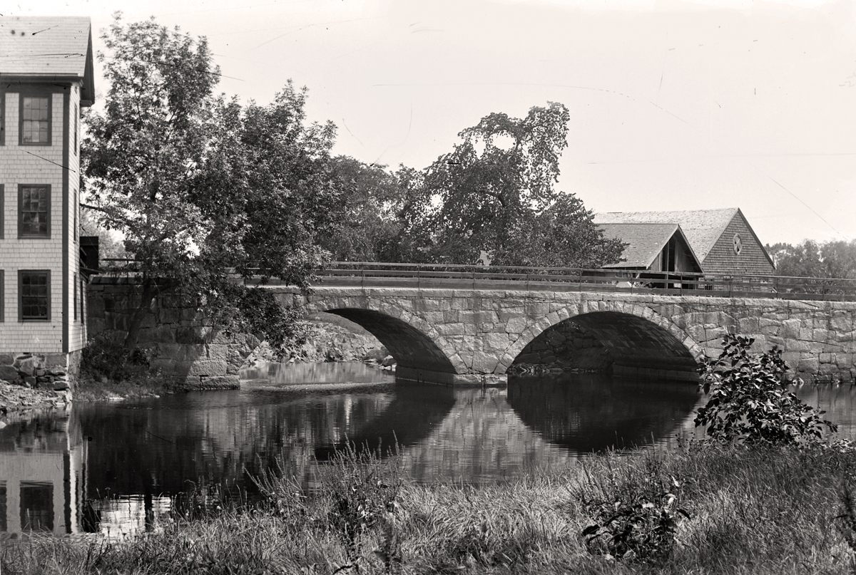
Mill Rd. /Highland St. Bridge
Just upstream from the Mill Road/Highland St. bridge, an earlier bridge was built about 1667, but no longer exists. The current bridge was built between 1829 and 1832, with three stone arches. The bridge was severely damaged and closed after the Mother’s Day Flood of 2006, and re-opened in May of 2009. This site was first in use in 1697 as a fulling mill. In 1794. a carding machine and a picking machine were added. Sometime around 1857, it was converted to an Isinglass Mill. This mill was in use until approximately 1912. In the late 1880s, it was producing 100,000 pounds of isinglass annually. The building was torn down in 1919, but portions of the foundation and sluiceway can still be seen today. On the Hamilton side of the bridge, a grist mill was built at this location in 1697 and continued in operation until 1918. A sawmill was added circa 1750 and was also in operation as of 1918. By 1880, a cider mill had been added and was in operation until 1919, when the property was sold. During the year 1887, the cider mill consumed more than 10,000 bushels of apples, resulting in the production of 35,000 gallons of cider, and in 1918 the mill produced 60,000 gallons. After a fire in 1822, a new structure was built to house the grist and cider mill that is still standing today. From the bridge, you can see the remnants of the dam. The original dam at this location was built in 1697 in conjunction with the building of the fulling and grist mill. It was allowed to be built 3′ above the river’s normal level. It can be assumed that it was torn down when the mills no longer operated at this location.
Upstream from the Ipswich Mills
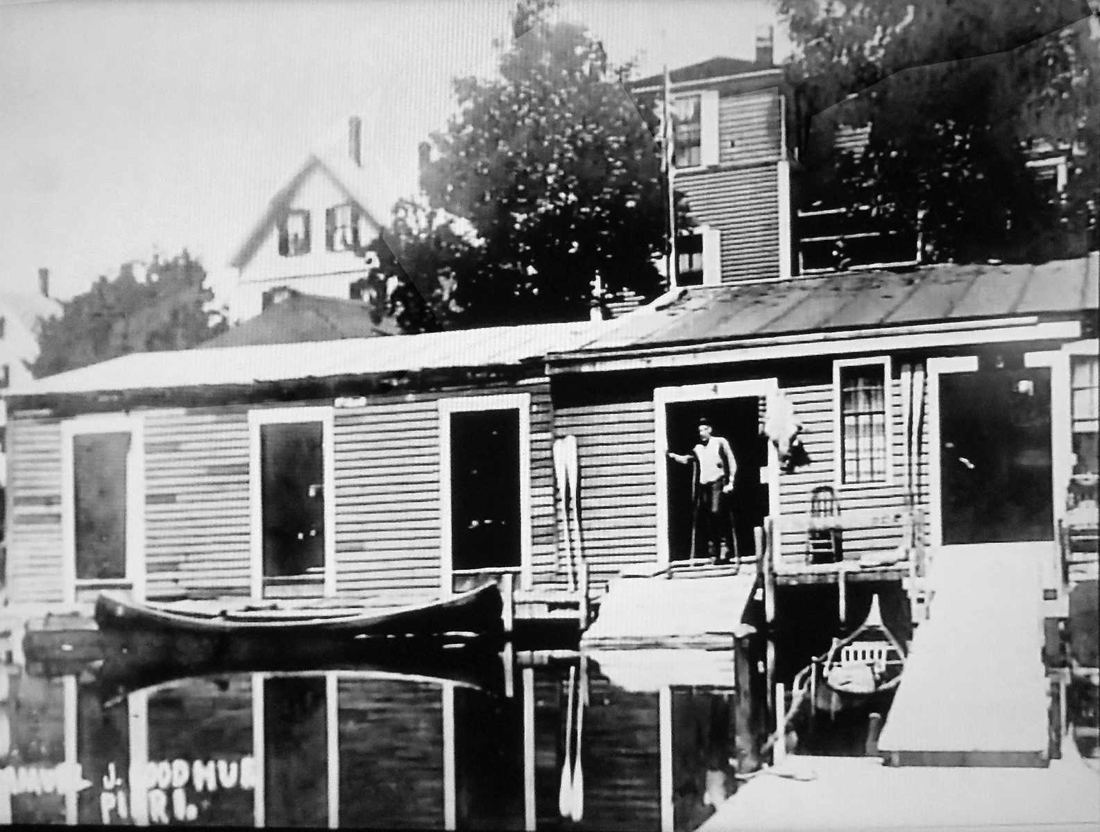
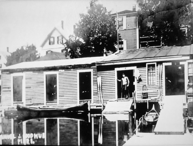
A railroad bridge has been in continuous use about a half mile upstream from the Ipswich Mills, since 1839. The original granite abutments are visible. An ice house was built about 1890 on the river off of Haywood St. and is thought to have burned in the 1940s. Ice was harvested from the river and stored here for use throughout the year. In 1938 the ice being harvested from the river was 14″ thick. If the river did not freeze enough, ice was brought down in boxcars by rail from the north. Down river off of Peatfield St. just above the dam was where Goodhue’s Boathouse was located. It was in business as early as 1891 and rented boats for recreation as well as offering accommodations. The location is a public canoe launch today.
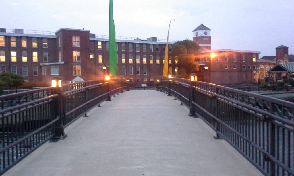
The Mill Dam
This location was home to early industries. A sawmill was in operation here in 1729 and is believed to have operated until 1858. The first dam at this location was probably built in 1635. It was most likely maintained by each subsequent mill owner. A new dam was built in 1827. The height of the dam, as with the others along the river could be adjusted with the use of flashboards. The dam still stands today at the site of EBSCO Publishing. The name “Mill Garden” was given to this location due to the numerous types of mills that were located here throughout the years. There were at different times, grist mills, fulling mills, dye houses, saw mills, and hemp mills. This was the site of the first grist mill built in Ipswich in the year 1635. This site was also the location of the first water-powered cotton mill in Ipswich in 1828. A textile mill operated in different forms here until 1928 and was one of Ipswich’s largest employers. It then became the location of Sylvania and today is the home of EBSCO Publishing.

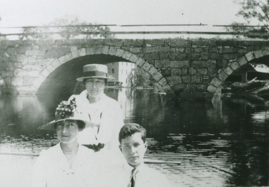
The Choate Bridge
As early as 1635 there is mention of a footbridge for pedestrians here. By 1646, a bridge had been built, large enough to allow animals pulling carriages or work carts to cross. In 1764 the double stone arch Choate Bridge that is still in use today was built. It is believed to be the second oldest stone arch bridge in America and is the oldest double stone arch bridge. In 1794, next to the bridge at the site of the Caldwell Building, a horizontal windmill was built by Dr. John Manning to be used in the production of woolen textiles. It was a complete failure.
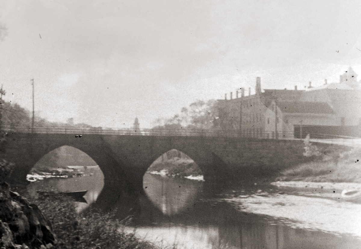
The County St. Bridge
In 1673, a fulling mill was built here, and a grist mill in 1715. It is believed a grist mill was in operation here until at least 1872. As early as the 1720s this location was used as a wharf, and soon thereafter a shipyard was established. The town voted on March 11, 1861, to build this bridge due to the roundabout way people were forced to travel with the many heavy loads heading to and from the wharves along the river. Prior to the dam being built water power for the early mills here was generated largely due to the Falls, There are still remnants of a dam here today. In 1863, a mill was built at this location to produce yarn, and within 5 years it was producing hosiery. The mill complex was eventually used as a box factory and a warehouse before being torn down in about 1920. During the 1870s Ipswich was receiving shiploads of corn, carrying as much as 3,000 to 5,000 bushels at a time. For many years a sawmill was in operation here. The first one is believed to have been in use by 1652, and the last standing sawmill here was in 1902, although not in use at the time.
The Great Cove
A Distillery for the manufacture of rum was located along Turkey Shore as early as 1765. It continued its operation until 1836 when it was sold and converted into a Tannery, which was still in operation in 1872. The riverbank that now hosts the Sidney Shurcliff Riverwalk was used as a campsite by Native Americans to fish during the spring spawning. Two and three-masted sailing ships loaded and unloaded wares in the Great Cove, timing their arrival and departures with the tide.
The Green Street Bridge
A jail complex was built at the site of the current Ipswich Town Hall in 1806. It was also home to an insane asylum and a prison shoe workshop. This bridge was built in 1881-82 with stone piers and a wooden roadway. It was rebuilt in 1894 with stone arches and is still in use today. An Ipswich bridge contractor named Joseph Ross who patented a horizontal folding bridge for railroads in 1849 was the builder. The remnants of a dam that was built in the 1930s as a Works Project Administration (WPA) project can still be seen just above the bridge.
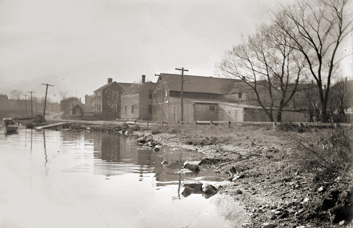
Water Street
A shipyard was in operation here in 1673, and it was also the location of a tannery as early as 1640, thought to have continued until the 1690s. In 1652, this location was being used to manufacture salt from seawater. This was also one of 3 locations along the river where the Choate Family operated a shipyard. A wharf was built in this area in 1756 and was often used to unload molasses from the West Indies for use in the distillery. John S. Glover operated a coal wharf at this location.
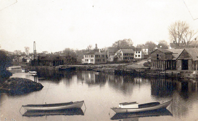
The Town Wharf
As early as 1641, this area was built up with wharves for shipping. Some of the many items shipped were lumber, lime, sand, coal, and granite. Over time there were many individuals involved in the shipping industry here. A continuous wharf wall was built in 1865. In 1663. a brewery and warehouse were built here. The large boulder in the river across from the wharf is known as Ring Bolt Rock. It was used by ships to navigate the turn in the narrow channel. At the end of Agawam Avenue was another shipyard operated by the Choate Family. There was a wharf on the other side of the river in 1692, Early settler Daniel Hovey built a wharf along the river below Tansey Lane.
The Lower River and The Necks
As early as 1635 fish-drying stages were located on a small river island off of Greenwood Farm. The Fox Creek Canal connects the river and Essex Bay and is the oldest man-made tidewater canal in the United States. The mouth of Fox Creek was the site of Robinson’s Shipyard, which employed hundreds of people during World War II. Little Neck was the location of numerous fish drying stages and warehouses as early as the 1640s.
More photos and additional information:
 County Street, Sawmill Point, and Bare Hills - The town voted in 1861 to build County Street and its stone arch bridge, connecting Cross and Mill Streets. A Woolen mill, saw mill, blacksmith shop and veneer mill operated near the bridge.… Continue reading County Street, Sawmill Point, and Bare Hills
  Historic Survey of the Ipswich Mills Dam - Inventory No: IPS.9009: Ipswich Mills Hosiery Manufacturing Company Dam. Survey Form F (structure) submitted to the Massachusetts Historical Commission, Recorded by: Ted Dattilo for the Public Archaeology Laboratory, Inc., May 2024. Received by the Mass. Historical Commission on Nov. 12, 2024 Historical Narrative: The history of the dam and how it relates to the development… Continue reading Historic Survey of the Ipswich Mills Dam
  The Willowdale Mill - In 1829, Dr. Thomas Manning of Ipswich constructed a 6' tall dam and mill on the Ipswich River along Topsfield Rd. Workers were provided housing a the large stone house. In 1884 the mill building burned and much of the stone walls for the mill building collapsed. … Continue reading The Willowdale Mill
 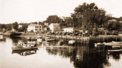 The Old Town Landings and Wharfs - Many a pleasant sail down the river are in the memories of William J. Barton. "These were the names of the places and flats along the Ipswich River before my time, and familiar to me during my time. They were used by the fishermen and clammers. I know. I was one of them. It was the happiest time of my life."
… Continue reading The Old Town Landings and Wharfs
The Old Town Landings and Wharfs - Many a pleasant sail down the river are in the memories of William J. Barton. "These were the names of the places and flats along the Ipswich River before my time, and familiar to me during my time. They were used by the fishermen and clammers. I know. I was one of them. It was the happiest time of my life."
… Continue reading The Old Town Landings and Wharfs  The Last Days of Norwood’s Mill - A landmark we're probably all familiar with was the old mill building on the Hamilton side of the Mill Road bridge. The abandoned sawmill was last used in 1919 and was demolished in late February 2024.… Continue reading The Last Days of Norwood’s Mill
 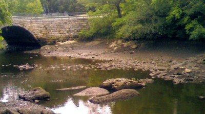 The Green Street Dam - "It was a poor time in which to build a dam. The winter was very severe and at times the temperature was below zero. The center of the dam was soon washed away, and by spring the new structure had almost disappeared."… Continue reading The Green Street Dam
  The Fox Creek Canal and Robinson’s Boatyard - The Fox Creek Canal is the oldest man-made tidewater canal in the United States, dug in 1820. In 1938 it was dredged to accommodate ship-building at Robinson's Boatyard, where small minesweepers were constructed for World War II.… Continue reading The Fox Creek Canal and Robinson’s Boatyard
 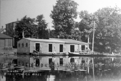 Samuel J. Goodhue’s Pier 1 Canoe Depot - In the late 19th century, Samuel Goodhue operated a canoe rental business on the Ipswich River at the end of Peatfield St in the area known as Pole Alley.… Continue reading Samuel J. Goodhue’s Pier 1 Canoe Depot
 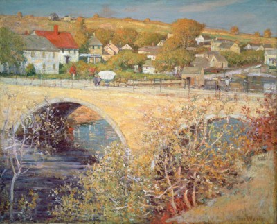 The Green Street Bridge - Twenty years after building the County Street Bridge, construction began for the Green Street Bridge. The original structure was made of wood but was later replaced by an arched bridge of stone on May 14, 1894. This was the fifth bridge built on the Ipswich River in the Town of Ipswich.… Continue reading The Green Street Bridge
 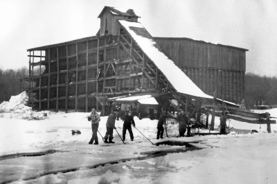 The Ice House - Lathrop Brothers Coal and Ice Company harvested on the Ipswich River between Upper River Road and Haywood Street. Lines were drawn on the ice and horses dragged "groovers" along the line, cutting the ice about 6 to 8 inches deep. The ice was then floated to the ice house, where it was cut into blocks.… Continue reading The Ice House
  Destination Topsfield: Mass Audubon’s Ipswich River Wildlife Sanctuary - Massachusetts Audubon's Ipswich River Wildlife Sanctuary at 87 Perkins Row in Topsfield has miles of trails weave through an amazing mix of forests, meadows, and wetlands, with beautiful views of the Ipswich River from an observatory and two glacial eskers. … Continue reading Destination Topsfield: Mass Audubon’s Ipswich River Wildlife Sanctuary
  The Choate Bridge - The American Society of Civil Engineers cites the Choate Bridge in Ipswich as the oldest documented two-span masonry arch bridge in the U.S., and the oldest extant bridge in Massachusetts. … Continue reading The Choate Bridge
 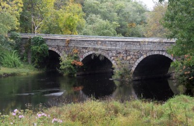 The Mill Road Bridge and the Isinglass Factory - The triple stone arch Warner Bridge that connects Mill Rd. in Ipswich to Highland St. in Hamilton was constructed in 1829, and rebuilt in 1856. The isinglass mill sat on the downstream Ipswich side of the bridge.… Continue reading The Mill Road Bridge and the Isinglass Factory
  Destination Ipswich: the Mill Pond - We're back with Episode Eight of Destination Ipswich with local historian Gordon Harris, and Carla Villa from the Ipswich River Watershed Association, who takes us on a couple of trails at the IRWA headquarters, then joins us for a kayak trip to the Mill Dam and back. Special thanks to Bryan Grasso and Beth Myer from Ipswich ICAM.… Continue reading Destination Ipswich: the Mill Pond
  Massachusetts Provincial Law: “An Act to Prevent the Destruction of Alewives on the Ipswich River” - Concerns about the environmental toll that dams have on the Ipswich River date to before 1773. … Continue reading Massachusetts Provincial Law: “An Act to Prevent the Destruction of Alewives on the Ipswich River”
 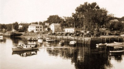 Industrial History of the Ipswich River - The Industrial History of the Ipswich River was produced for the Ipswich 375th Anniversary by John Stump, , and Alan Pearsall.Historic photos are by Ipswich photographer George Dexter. … Continue reading Industrial History of the Ipswich River
 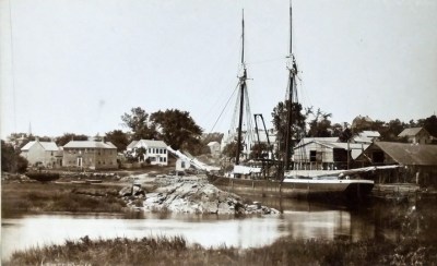 The Town Wharf - The Ipswich Town Landing is one of several locations along the River where wharves were located over the centuries. … Continue reading The Town Wharf
 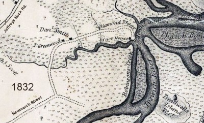 Diamond Stage - In 1673, two fishermen from the Isles of Shoals, Andrew Diamond and Harry Maine, arrived together in Ipswich. Mr. Diamond built a platform for salting and shipping fish, and became quite successful. The location is still known today as Diamond Stage. … Continue reading Diamond Stage
 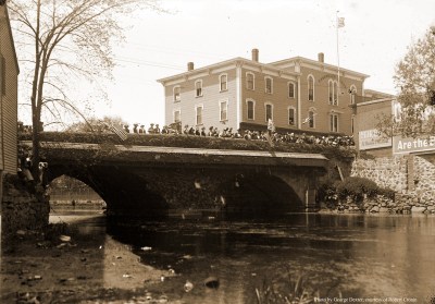 The Bridges of Ipswich - Excerpts from Ipswich in the Massachusetts Bay Colony, by Thomas Franklin Waters “The stone bridges which span the Ipswich river with their graceful arches are picturesque and interesting. The readiness with which the Town proceeded to build the latter two stone bridges is in singular contrast with the belligerent opposition to the earliest ones. The foot… Continue reading The Bridges of Ipswich
 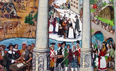 The Ipswich Riverwalk Mural - In 2005 EBSCO Publishing commissioned artist Alan Pearsall to paint a 2,700-square-foot mural on one of the old mill buildings occupied by the company in Ipswich. The mural is the centerpiece of the town's Riverwalk. … Continue reading The Ipswich Riverwalk Mural Along the Ipswich River - Historic photos of the Ipswich River from original glass negatives taken by early Ipswich photographers Arthur Wesley Dow, George Dexter and Edward L. Darling. … Continue reading Along the Ipswich River
 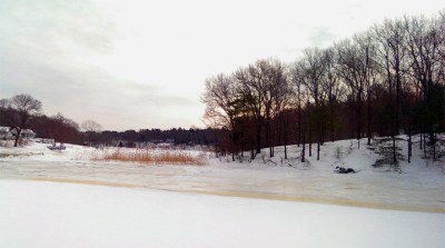 The Boy Who Fell Beneath the Ice - The Rev. Joseph Dana served the Second Congregational Church at the South Green from 1765 until his death in 1827 at age 85. Rev, Dana’s tombstone in the Old South Cemetery reads: “In memory of the Rev Joseph Dana D.D., for sixty-two years, Minister of the South Church. His protracted life was eminently devoted to… Continue reading The Boy Who Fell Beneath the Ice
  Melanson’s fire, August 7, 2009 - The boatyard, constructed in 1954, burned in a spectacular fire, and has since been replaced by a residential building.… Continue reading Melanson’s fire, August 7, 2009
 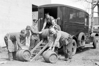 Rum Runners - Ipswich folks have always had a taste for good rum. Its hidden creeks was a paradise for the rum runners and bootleggers during the Prohibition era. Tales of the Coast Guard chasing rum runners were common. It was very seldom that one could be caught. The booze was unloaded at convenient places like Gould's Bridge. To distract the authorities, someone would set a fire in town.… Continue reading Rum Runners
 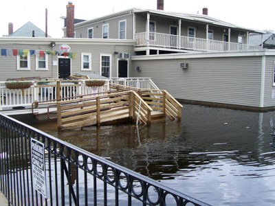 Mothers Day Flood, May 14-16, 2006 - Fourteen inches of rain fell between May 14 and May 16, 2006, creating the historic 2006 Mothers Day Flood. Water flow levels in the Ipswich River were 27% higher than recorded in previous epic floods. … Continue reading Mothers Day Flood, May 14-16, 2006
 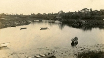 The Ipswich River - The 35-mile Ipswich River flows into the Atlantic Ocean at Ipswich Bay. The Ipswich River Water Association works to protect the river and its watershed. Foote Brothers Canoes on Topsfield Rd provides rentals and shuttle service from April to October.… Continue reading The Ipswich River
 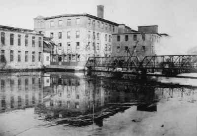 A Photographic History of the Ipswich Mills Dam - Geologically, the Ipswich River is quite young. The Laurentide ice sheet during the most recent ice age receded to the northern border of Massachusetts around 14,000 years ago. As the ice sheet melted, the sea level rose about 100 ft. higher than current levels, putting much of the North Shore area temporarily under water until… Continue reading A Photographic History of the Ipswich Mills Dam
 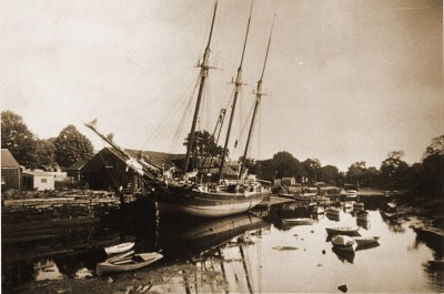 Glover’s Wharf and the Ipswich Coal Industry - John S. Glover opened a wharf on Water St. in 1847, receiving shipments of coal and cement, along with maritime salvage. His wharf was a short distance from the home be built on East St. around 1872 across from the present-day Town Wharf.… Continue reading Glover’s Wharf and the Ipswich Coal Industry
  The Steamship “Carlotta” - The excursion boat Carlotta was built in 1878 at Rogers Point boat yard, and sailed from Town Wharf to the Neck and Plum Island for 35 years. The small hotels at Little Neck, Ipswich Bluff and Grape Island were favorite destinations for tourists and locals.… Continue reading The Steamship “Carlotta”
 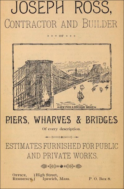 Joseph Ross, 19th Century Ipswich Bridge Builder - Joseph Ross (1822-1903) is best known for designing the first movable span bridge in the country, which he patented in 1849 at the age of 26, and became the most common railroad bridge type in the Boston area. His corporation Joseph Ross & Sons was highly successful.… Continue reading Joseph Ross, 19th Century Ipswich Bridge Builder
[…] and proximity to colonial history make it an intriguing spot for those interested in uncovering colonial […]