
Quick links
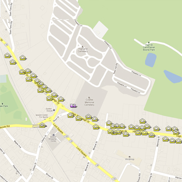
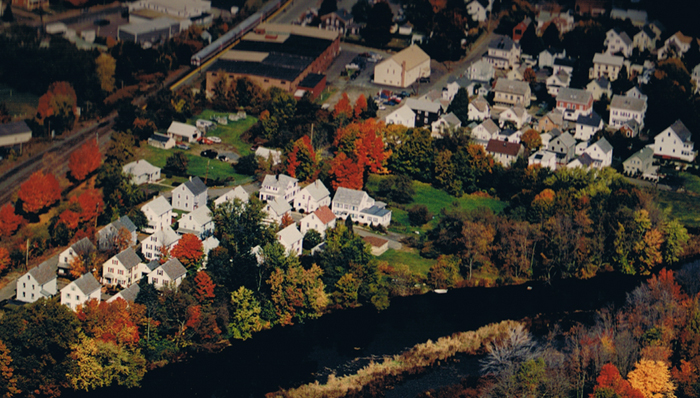
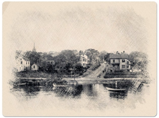
Ipswich, Massachusetts, was founded in 1633 in an area the Native Americans called “Agawam.” The oldest part of town has remained, to an exceptional degree, intact, with more “First Period” houses (1625-1725) still standing than any other community in America. The contiguous historic neighborhoods of Meeting House Green, High Street, the East End, and the South Green are well-preserved streetscapes of 17th to 19th-century private residences. A comparison of today’s village with historic photos shows that much of the village retains its historic buildings, roads, bridges, and settlement pattern. The mill district neighborhoods of “Pole Alley” and Brownville Avenue were added in 1996 for their significance as millworker housing. The National Park Service maintains the Registry of Historic Places listings, which includes 31 historic districts, houses, and structures in Ipswich.
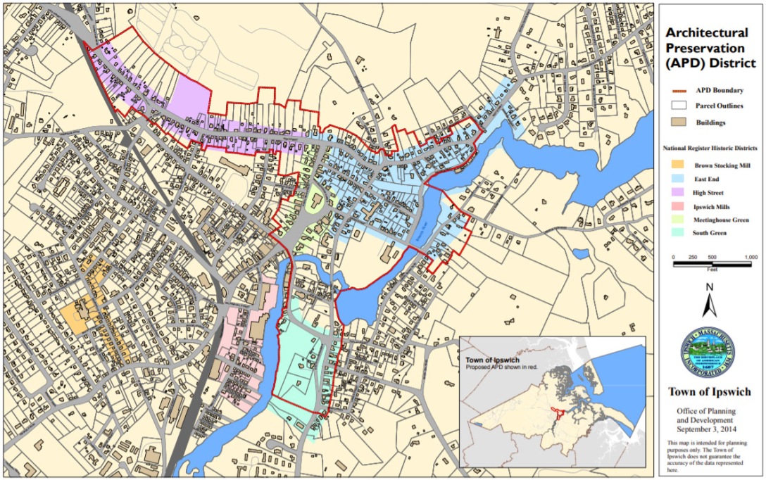
Ipswich Architectural Preservation District
The Fall Town Meeting on Tuesday, October 21, 2014, established an Architectural Preservation District (APD) for the most historic areas of the town.
- Architectural Preservation District Bylaw
- Architectural Preservation District Map
- Ipswich Architectural Preservation District styles and guidelines
The bylaw was adopted at a Town Meeting under the Home Rule Amendment of the Massachusetts Constitution and is administered by an Architectural Preservation District Commission. The Architectural Preservation District proposal was revised through a series of open meetings of the Historical Commission. The APD encompasses an area roughly defined as 220 acres beginning at the South Green, continuing along the river to the Town Wharf, East and High Streets to the High Street Bridge, North Main Street, and Meeting House Green.
The Ipswich Architectural Preservation District (APD) protects the most historic areas of the town, beginning at the South Green, continuing along the river to the Town Wharf, East and High Streets to the High Street Bridge, North Main Street, and Meeting House Green. No building within the Architectural Preservation District constructed before 1900 may be demolished, constructed, or substantially altered without the consent of the APD Commission, which also provides advisory design guidelines.
Meetinghouse Green Historic District
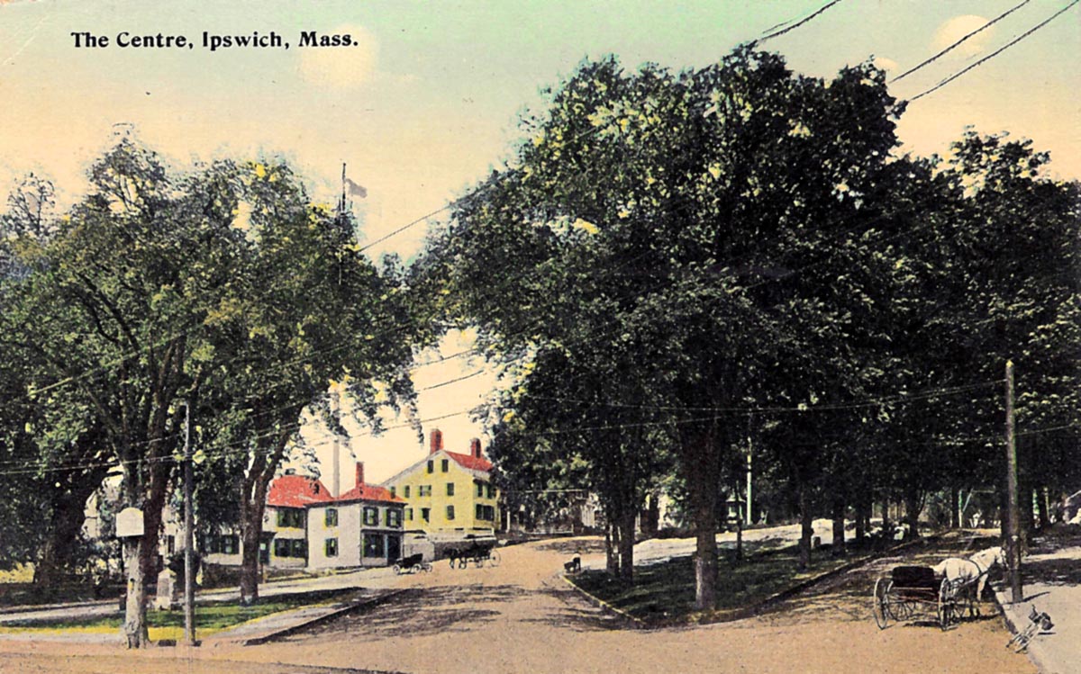
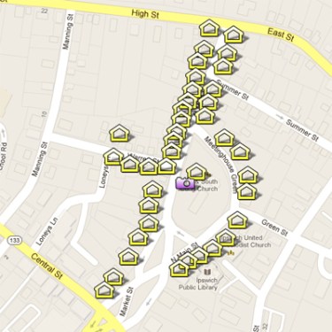
Town Hill was the governmental center for early Ipswich. By order of the General Court, dwellings had to be within one-half mile of the Meeting House at Meeting House Green. A meeting house was built here by 1636, surrounded by a high wall to protect them from the ever-present danger of Indian attacks. Several churches have stood at this same spot. The Meeting House Green District includes thirty houses, three churches, and the town library, which are situated around the steep, rocky Green itself and along Main Street. It encompasses a wide range of architectural styles, with approximately half of the structures dating from the eighteenth century and half from the nineteenth. Continue reading …
East End Historic District
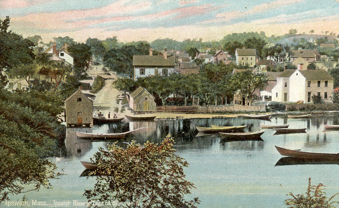

The seafaring portion of the original village of Ipswich offers an architectural history of the town’s development. It was here that the first houses were built in this town, where fishing and lumbering were prominent industries. When settlers arrived in the 1630s ′s, wigwams, huts, and hovels were constructed between Town Hill and the Town Wharf. The Ipswich River was the town’s avenue to the Atlantic. The East End is bounded on the north and west by East Street. That street extends from the High-North Main Streets intersection on the west to Jeffrey’s Neck Road on the north, skirting Town Hill. The River and Turkey Shore Road form the eastern boundary of the district from Town Wharf to the Green Street Bridge. Green Street is the southern edge of the District, enclosing Water, Summer, and Hovey Streets, Agawam Avenue, and a major portion of County Street. Continue reading.
High St. Historic District
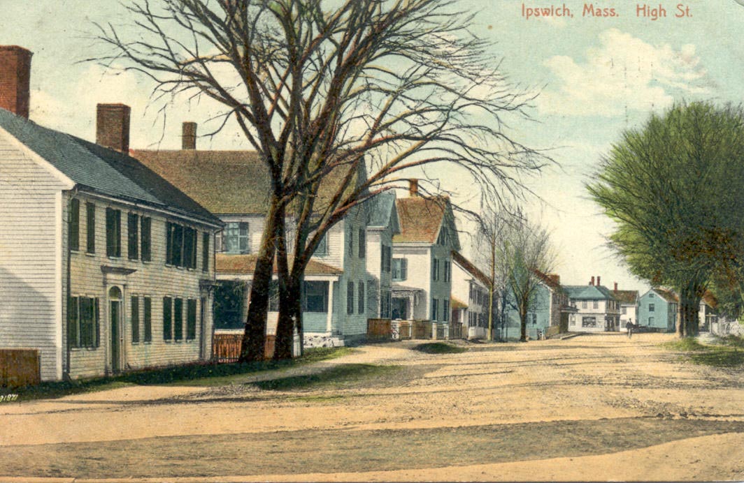
High Street was the main residential and commercial street of the new community. The predominant character of the street is now residential, but several of the 17th, 18th, and 19th-century houses along High Street earlier served as taverns, stores, or craftsmen’s shops. One of the most important was the inn. Ipswich was on the road to Boston, and a constant stream of travelers passed through the town. The High Street National Register Historic District boundaries define the area of earlier settlement and later growth. Two other districts, the East End and Meeting House Green, define the eastern border of High St. Running west, the boundary lines follow back lots of both the north and south sides of the street. Lord’s Square has been omitted from the district as it no longer conforms to the character of the area. The boundary lines continue west to the High St. bridge, which is a distinct boundary, for beyond it were common pastures during the 17th and 18th centuries. Continue reading
South Green Historic District

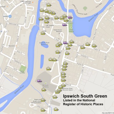
The South Green dates from 1686, when the town voted that the area be held in common, and it has fulfilled various community needs. Cattle were gathered here to be driven to outlying pastures. All adult men reported monthly to the Green for military training. Above all, South Green was the educational center of Ipswich. In fact, it was first known as the School House Green. Though most 17th-century houses originally in the area are now gone, the John Whipple House represents that era very well. Moved from a site across the Ipswich River to its present lot at the north end of the Green in the 1930s, this mid-17th-century house is a National Historic Landmark. The rest of the Green is bordered by Georgian, Federal, Greek Revival, and Victorian houses, as well as a mid-18th-century cemetery. The Nathaniel Wade House c.1727, John Heard House c. 1795, Locke’s Folly 1835-37, and “The Gables,” c. 1846, are among the most notable houses ringing the ancient training field. The Heard House marks the Northwest corner, then the boundary line runs south to Saltonstall Creek, crosses County Rd., then runs north to the Sweeney Tavern, which marks the northeast corner. Continue reading.
Ipswich Mills and Brown Mills Historic Districts
The Ipswich Mills Historic District is a community in Ipswich, MA, west of EBSCO Publishing, bordered by Union St., the MBTA commuter rail tracks, and the Ipswich River. The former woolen and stocking mill buildings, more recently housed Sylvania’s fluorescent lighting plant, were where, in 1942, Sylvania designed and assembled the proximity fuse for WWII bombs. The buildings are now the home of EBSCO Publishing. The Brown Stocking Mill Historic District is across Topsfield Road and includes mills and worker housing dating from 1906 at the Brown Stocking Mill on Brownville Ave., established by Harry Brown. Both districts were added to the National Park Service’s Registry of Historic Places in August 1996. That same year, EBSCO Publishing moved into the old Ipswich Woolen Mills buildings. In 1868, Amos A. Lawrence established the original Ipswich Hosiery Mills in the old stone mill on County Street. By the turn of the 20th century, the company had moved to the Ipswich Mills location and had become the largest stocking mill in the country. Continue reading
Ipswich Streets and Neighborhoods
The 19th and 20th centuries saw the size of the town grow greatly as foreign-born workers arrived to work in the flourishing mills. New neighborhoods quickly arose west of the tracks, and are known as Pole Alley, Brownville, and Mount Pleasant. They are the newest Ipswich neighborhoods in the National Register of Historic Places, joining the Meeting House Green Historic District, the East End Historic District, the High Street Historic District, and the South Green Historic District.
