
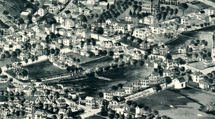
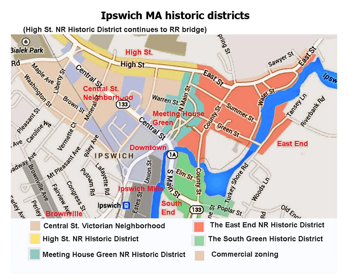
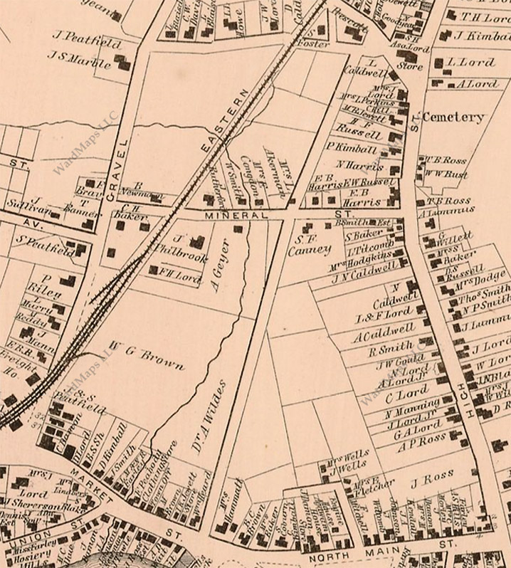
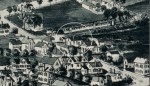
The featured image above is a closeup from the 1893 Birdseye map of Ipswich showing the Central and Washington Streets neighborhood. While four older sections of Ipswch are listed in the National Register of Historic Places and are included in the Ipswich Architectural Preservation District, the adjoining 19th-century neighborhoods populating Central, Manning, Mineral, Liberty, Maple, Brown, and Washington Streets remain vulnerable to development pressures.
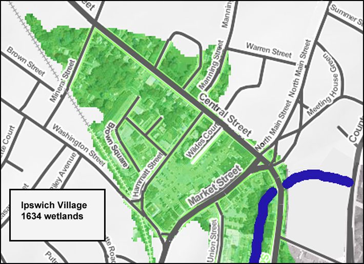
In the first two centuries after Ipswich was settled, much of the land between Washington Street and High Street was a wetland with Farley’s Brook running through it. After the railroad came to Ipswich in 1839, the center of commerce moved from North Main Street to Market Street. During the Industrial Revolution, the population of Ipswich swelled as immigrants came to work in the mills. Worker housing was constructed in Pole Alley, and former farmland was used to create the Mount Pleasant neighborhood.
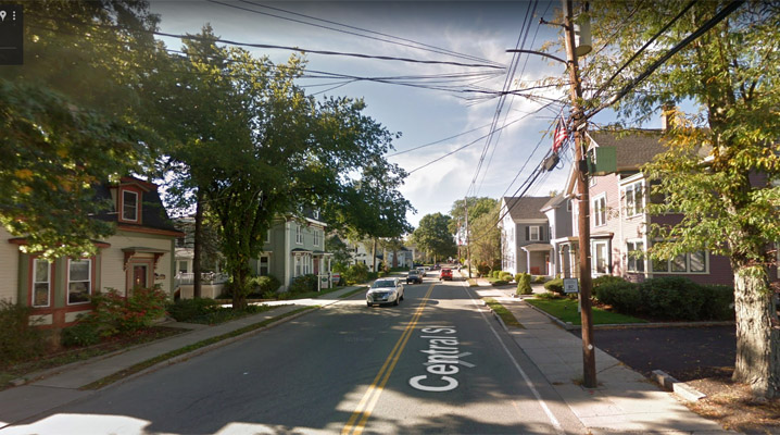
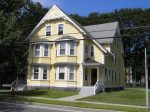
Central Street
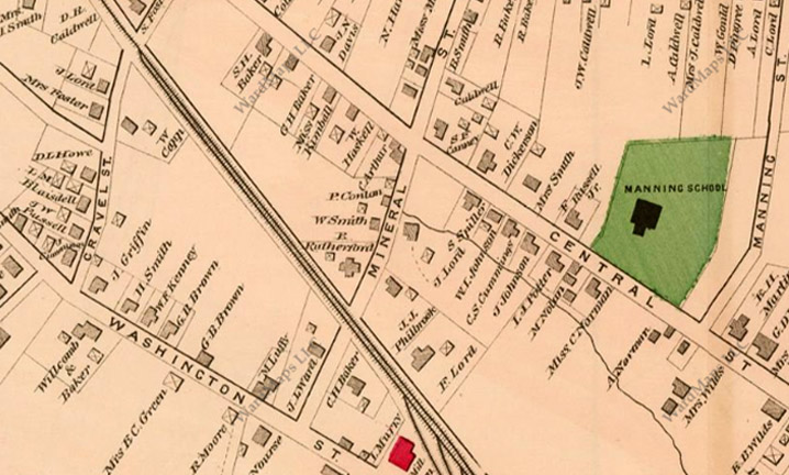
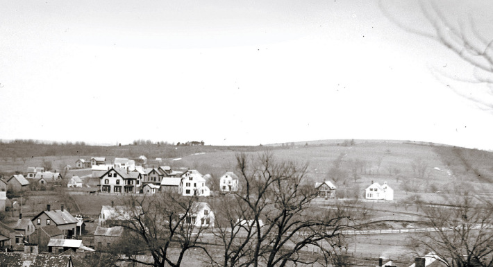
In the 1872 Ipswich map, Central Street had just been constructed. Manning School opened two years later, and stores began to be constructed. Ipswich Town Reports during the second half of the 19th Century show payments for hauling gravel from the now-depleted gravel pits near Washington St. and Topsfield Rd. The Town experienced a building boom, and by 1884, the Victorian neighborhoods that line Central, Hammatt, Manning, Mineral, Brown, Cottage, and Liberty Streets had been created. This distinctive Ipswich neighborhood includes historic houses and streets, but has not received a historic designation.

Central Street

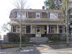
2 Central Street, the Tyler Block (1906) – The Tyler Building was the last commercial block on Central Street to be constructed after the 1894 Central Street fire. It was the home of Tyler’s Department Store and Quint’s Drugs, and houses the Heart and Soul restaurant.

33 Central Street, Memorial Hall (1921) – In 1921 the Memorial Building was built in memory of Ipswich Veterans. The long stairs from Central Street were difficult. The town sold the building to a non-profit corporation in 2003 and the building was renovated into affordable senior housing.

35 Central St., the Caldwell-Copp House (1880) – The Oak Hill apartments building at 35 Central Street was constructed in 1880 by Joel Caldwell. In 1891, Margaret and Lydia Caldwell sold the property to Carlton and Harriett Copp.

38 Central Street, the Measures Building (c. 1900) – Austin Measures built this after the Central Street fire of 1894. Measures’ Candy Shop was a long-lasting institution that began in a small building on North Main Street. The building was taken down in 1904 to construct the Colonial Building, and he reopened in this Central Street location.

44 Central St., the Ellen V. Lang House (c. 1885) – The 1884 Ipswich map shows a house set back from Central St., belonging to “Mrs. Wildes.” In 1888, The Agawam Manual and Directory by M.V. B. Perley, shows the following residences: This house is shown in the 1893 Ipswich Birdseye map. The 1910 Ipswich map shows this house belonging to “Mrs. Lang.”

55 Central Street, Central Fire Station (1907) – Constructed for horse-drawn equipment in 1908, this building has served for over a century as the Ipswich fire station.
79 Central Street, the Foster Russell Jr. House (1883) – John Cogswell sold this lot without a house for $300.00 to Augustus Russell and Foster Russell Jr. in 1883 (book 1110, page 078). This house appears in the 1893 Ipswich Birdseye map; the 1884 and 1910 Ipswich maps show the owner of the house as Foster Russell Jr.

101 Central Street, Newton House (c. 1900) – This house first appears in the 1910 Ipswich map on the same lot with the house in front, labeled, “Mrs. Newton.”
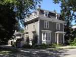
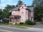
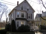
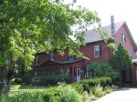
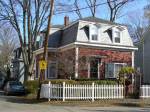
107 Central Street, the Collins House (c. 1880) – This rambling double house is trimmed with characteristic Queen Anne finery. The porches are decorated with turned posts, balusters, and spindle screens. Elaborate rising sun motifs, eave brackets, and staggered shingles complete the design.

108 Central Street, the George W. Baker House (1872) – 108 Central Street is one of three identical houses along this stretch of Central Street. George W. Baker, who served in the Civil War from February, 1962 until August, 1865 occupied the house after its construction.

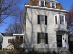
109 Central Street, Daniel and Mary Collins House (1873) – The house at 109 Central St. appears in the 1884 Ipswich map as “Collins,” and is shown in the 1893 Ipswich Birdseye map. Daniel Collins deeded the house to his “loving daughter” Mary Collins in 1887. The “parcel of land” “on the new road” was conveyed by Nathan Jewett to Dan Collins on August 16, 1872.

80 Central Street, the Malachi Nolan House (1877) – Dr. Asabel Wildes sold three small lots to Malachi Nolan who appears to have build this house in 1877. His daughter Mary Marshall sold the combined lots with the building to Charles A Sayward in 1911.

82 Central St., the Isaac J. Potter House (b. 1884) – This house was the home of Isaac J. Potter, editor of the Ipswich Chronicle, who became the paper’s sole proprietor.

83 Central Street, the International House (1866) – In 1866 the International House was built by the Eastern Railroad beside the Ipswich Depot. It was moved in 1882 to make room for a new depot. It continued to be operated as a hotel, and In the 1970s and 80s was known as the House of Hinlin.

87 Central Street (c 1890) – The 1910 Ipswich map shows the owner of the house at 87 Central Street as”Misses Peatsfield.” The house is almost identical in construction to the house at 89 Central Street, which is shown in the 1884 Ipswich map.
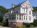
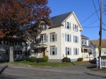
88 Central Street, the W. L. Johnson House (c. 1880) – The W. L. Johnson house is the most ambitious Mansard on Central St., and preserves original decorative detailing. A matching carriage house also survives.

90 Central Street, the Brown-Riley House (1897) – Deeds show the sale of a parcel of land by Abbie Lord to Maria Brown, June 3, 1897. James Brown sold to Adelle Riley, 1906, sale of a parcel of land with a house thereon.

91 Central Street, the Sylvanius and Mary Canney House (c. 1866) – The house at this location first appears in the 1872 Ipswich map under the name “S. F. Canney.” Sylvanius F. Canney purchased the lot in 1866, and sold the house and land to Israel Jewett in 1869.

92 Central St., the Abbie G. Lord House (1871) – The house at 90 Central St., was constructed after Andrew Geyer purchased the lot from Amos Smith in 1869. He sold the finished house to Abbie G. Lord in 1873, who sold to Maria J. Brown in 1897.
97 Central Street, the Olive and Charles McIntire House (1885) – This house was constructed with stick-style Victorian decorative features.
98 Central Street, the William and Abigail Haskell House (b 1884) – This house first appears under the name William Haskell in the 1884 Ipswich map. The house is shown as “A. Damon” on the 1910 map. It is also shown in the 1893 Birdseye map of Ipswich.

110 Central Street, the Samuel Baker House (before 1884) – Three identical houses with mansard roofs appear in the 1893 Ipswich Birdseye map and are still standing. The 1884 Ipswich map shows this house owned by Samuel H. Baker and the one next door owned by George H. Baker.
111 Central Street, the Albert and Annie Garland House (1894) – The house at 111 Central St. first appears in the 1910 Ipswich map, with the owner shown as A. S. Garland. Albert J. Garland, Edward Lord and Edward Baxter received a mortgage for the lot “with a new building thereon” in 1894 (Book 1432, page 305). Henry Garland was the owner of the house in 1934.
Brown Square

2 Brewery Place (Brown Square) Ipswich Ale Brewery (c.1900) – The Burke Shoe Heel factory burned on June 19, 1933, but this wing survived the fire, and is today the Ipswich Ale Brewery. It was the home of Saffron Brothers, the exclusive suppliers of clams to the Howard Johnson chain for 32 years.

10 Brown Square, Tedfords Lumber (1933) – Tedford’s Lumber on Brown Square got its start in 1946 when James Tedford Sr. and Bill Martin, just back from the Navy, took a portable sawmill into the woods to cut timber. The next year they decided to open a lumber yard on Brown Square.

19 Brown Square (1903) – Harold Bowen wrote that this building was constructed from bricks that were saved from where the parking lot is now for the Ipswich Inn opposite N. Main St.
Brown Street

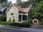
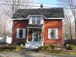
8 Brown Street, Timothy Carey House (1890) – The house is typical of the Liberty/Brown/Mineral/Washington Street “folk victorian” homes built at the end of the 19th Century, often from plans available through architectural magazines. The style in Ipswich was generally L-shaped with a porch and brackets under the gable, and mass-produced prefabricated trim.

10 Brown Street, Essex Hosiery Company Worker Housing (c. 1900) – Several homes on this street were built by the short-lived Essex Hosiery Company to house their employees. The house is typical of the vernacular Victorian “gable with ell” homes built at the end of the 19th Century on Brown and Mineral Streets.

12 Brown St. (c. 1890) – Several homes on this street were built by the short-lived Essex Hosiery Company to house their employees. The house is typical of the vernacular Victorian “gable with ell” homes built at the end of the 19th Century on Brown, Cottage and Mineral Streets.

14 Brown St., Mitchell-Ralph House (c. 1890) – Several homes on this street were built by the short-lived Essex Hosiery Company to house their employees. The house is typical of the vernacular Victorian “gable with ell” homes built at the end of the 19th Century on Brown, Cottage and Mineral Streets.

16 Brown St., the Leno House (1890) – Several homes on this street were built by the short-lived Essex Hosiery Company to house their employees. The house is typical of the vernacular Victorian “gable with ell” homes built at the end of the 19th Century on Brown, Cottage and Mineral Streets.
Hammatt Street

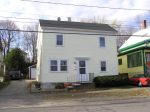
10 Hammatt St., the old South Church Vestry (1857) – This house was originally the Vestry for the South Church, and sat on South Main Street near the South Green. It was moved to its current location and converted into a two-family dwelling.
Liberty Street
Liberty Street – In the late 19th century, Washington Street was extended to Linebrook Road, and Liberty Street became its own street. The houses on Liberty Street date to 1850-1910.

3 Liberty St., the Foster House (c. 1880) – This house is shown in the 1872 and 1884 Ipswich maps as owned by “S. Foster.”

6 Liberty St. (c. 1890) – A house at 6 Liberty St. is shown in the 1893 Birdseye map and the 1910 Ipswich map, the owner is shown as “C. Caldwell.” The modestly Italianate “Gable and Ell” form confirm the architectural period.

7 Liberty St., the John W. and Annie M. Lord House (c. 1867) – The house at 7 Liberty St. first appears in the 1872. and was first owned by John W. Lord and his wife Annie M. Pingree.
9 Liberty St. (c. 1880) – This house first appears in the 1884 Ipswich map, with the owner shown as “Mrs. Foster.” It is also shown in the 1893 Ipswich Birdseye Map, but not in the 1872 map. The owner in the 1910 Ipswich map is T. H. Lord.
10 Liberty St., the Brown House (c. 1900) – The house at 10 Center Street is not in the 1884 Ipswich map, but appears in the 1910 Ipswich map under the name “C. Brown.”

11 Liberty Street, the Levi Howe House (c. 1870) – The descendants of Levi L. Howe, a farmer, owned this Gothic Revival cottage until 1953. Ken Savoie restored its appearance, and was the winner of the 1992 Mary Conley Award for historic preservation.
12 Liberty St., Charles Brown House (c. 1890) – The earliest Identified owner is Charles E. Brown, proprietor who owned the house by 1910. Brown and his son, Walter 6. Brown, operated a brick manufactory and contracting company.
13 Liberty St., the Roberts House (c.1900) – The 1910 Ipswich map shows the owner of the house at 13 Liberty St. as D. A. Roberts.
14 Liberty Street, the George B. Brown House (1898) – The elegant Victorian house at 14 Liberty Street in Ipswich was built between 1896-98 by George B. Brown, who owned a grain mill on Washington Street.
15 Liberty St. (c 1870) – The earliest identified owner is C.W. Davis who owned the house by 1872. By 1884 the house had been sold to John W. Russell, a freight agent, who continued to own the house into the 1920s.

16 Liberty St., the Martha Curtis House (1885) – The 1910 map shows the owner as “L. Brown.”

17 Liberty St., the Blaisdell House (c.1870) – The 1872 Ipswich map shows the owner of this house as “L. Blaisdell.”

18 Liberty St. (1885) – The houses at #16 and # 18 Liberty Street were built between 1884 and 1887 by John A. Brown, a brick manufacturer and lumber dealer, probably in association with C.E. Brown & Son.
Inner Linebrook Road

5 Linebrook Rd., the Richard Lane House (1851) – Richard Rogers Lane built the house in 1851, He died in 1858, and his only child, Etta, inherited the house. which is mentioned in the 1898 deed when she sold it to Charles W. Woodbury.

7 Linebrook Road (1914) – The actual date of construction for the house at 7 Linebrook Rd. is unverified. There is a tradition that 5 Linebrook was originally at this location and was moved.

8 Linebrook Rd., the C. Chester Caldwell House – In September 1867, Joseph and Joanna Ross sold Daniel R. Caldwell this lot.
Manning Street

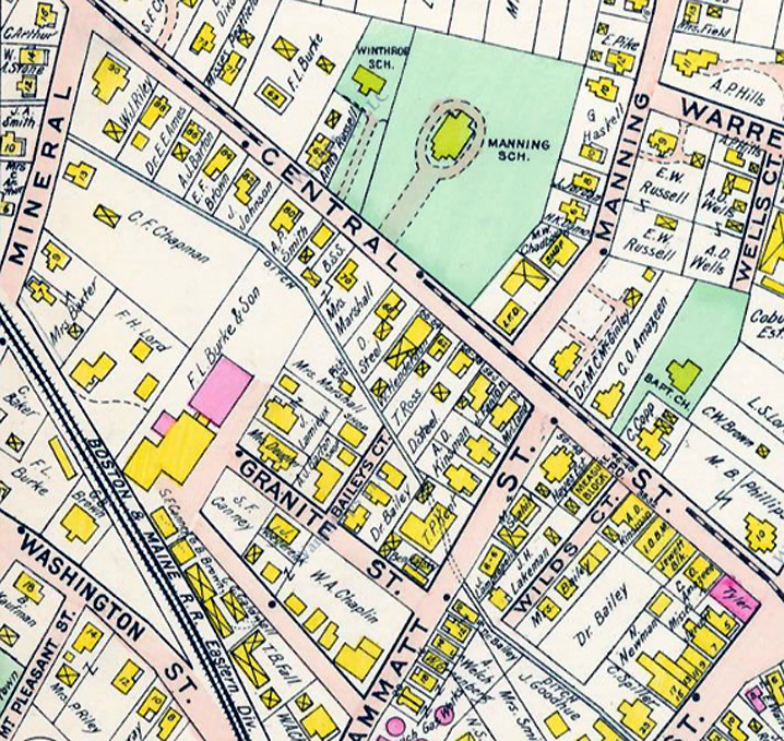
Manning Street, a Victorian Neighborhood – Central Street was laid out in 1872, and Manning Street in 1882. Manning Street first appears in the 1884 Ipswich map, newly created, with no houses yet. The 1910 Ipswich map shows all of the houses now on the street, and Warren Street has been extended from North Main to Manning Street.

1 Manning Street, the E.H. Martin House (1880) – The E. H. Martin house originally faced Central Street. It was moved back one lot and turned to face Manning St.
3 Manning St. (after 1910) – 3 Manning Street. An empty lot is shown on the 1910 Ipswich map, owned by E. W. Russell.

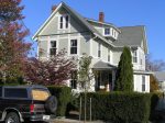
6 Manning Street, the H. K. Damon House (1890) – This 1890 Victorian house features a third floor porch, slate shingles, 10-foot ceilings, two stain glass windows, oak floors, original moldings and pocket doors.

7 Manning St., the Edward W. Russell House (c. 1890) – The house at 7 Manning St. appears first in the 1893 Ipswich Birdseye map. The 1910 Ipswich map shows the owner as E W. Russell, who worked as a dyer at the Ipswich Mills.

8 Manning Street, the Jordan House, (c. 1890) – This house first appears in the 1893 Ipswich Birdseye map.

9 Manning St., the Albert P. Hills House (c. 1890) – Like many of the houses on Manning Street, it first appears in the 1893 Ipswich Birdseye map. Hills owned a grocery on North Main Street. E. W.Russell was the owner in the 1910 Ipswich map.
10 Manning Street, the G. Haskell House (c. 1890) – 10 Manning Street, the G. Haskell house (circa 1890) Like most of the houses on Manning Street, this house first appears in the 1893 Birdseye map of Ipswich. In the 1910 Ipswich map the owner is G. Haskell.

12 Manning Street, the Edward T. Pike House (1885) – The mortgage for this house was taken out in 1885. Almost all of the houses on Manning Street appear in the 1893 Ipswich map.

13 Manning St., the Fields House, (c. 1900) – 13 Manning St., is owned by “Mrs. Fields” in the 1910 map. The town assessors database gives the date of construction as 1870. However, the 1884 Ipswich map shows no houses yet constructed on the street, which had not even been added in the 1872 map.

14 Manning Street (c. 1915) – The house at 14 Manning Street does not appear in the 1910 Ipswich map, but based on the architectural characteristics in common with other houses on the street is presumed to have been constructed shortly thereafter.

15 Manning Street (c 1920) – The Ipswich assessors database provides a date of 1920 for this house.

16 Manning St. (c. 1900) – 16 Manning St., circa 1900. G. A. Lord owned this house, another house next door and one on High St.

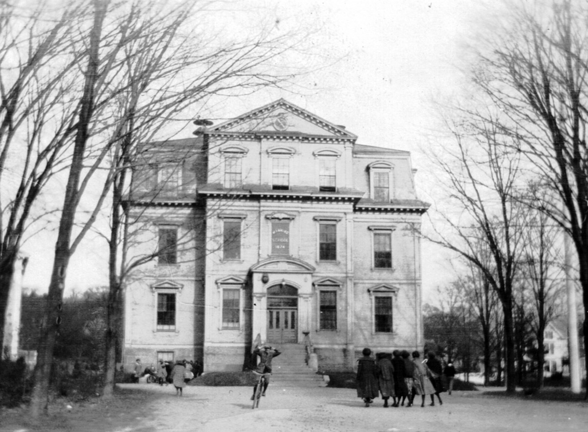
17 Manning Street, the Candlewood School (1856) (moved to this location) – Records indicate that the 1856 schoolhouse on Candlewood Road was moved to this location and enlarged in 1905 to relieve overcrowding in the original Winthrop School.

20 Manning Street (1902) – This house was owned by G. A. Lord in the 1910 Ipswich map. A different structure is shown in the 1893 Ipswich Birdseye Map.

21 Manning Street – The date of construction for this house is uncertain. The Ipswich assessors database shows the date of construction as 1990. The 1893 Ipswich Birdseye Map and 1910 map show a utilitarian structure at this location, which may have been converted.

23 Manning Street (1934) – The Ipswich Assessors database shows the date of construction as 1934.
24 Manning Street, the A. P. Hills House (c. 1900) – This house first appears in the 1910 map of Ipswich.

26 Manning Street, the Sullivan House (1927) – The 17th-century Caleb Lord house on the corner of High and Manning Streets was removed in 1927 and was replaced by the home of Bernard Sullivan. This is a modified form of the “American foursquare” house of the 1920s and 30s.
Maple Avenue
Maple Avenue, originally Maple Street, first appears in the 1884 Ipswich map, without houses. The hillside behind was still primarily farmland. By 1910, the Ipswich map shows the street completely filled.

3 Maple Avenue, the Harland and Blanche Burke House (1916) – Harland Burke was a superintendent at F.L. Burke & Son, heel manufacturers whose factory was at Brown Square.
4 Maple Avenue, the Arthur H. and Madeline H. Tozer House (1915) – Arthur Tozer was a music teacher for the public schools and apparently worked out of his home. Prior to construction of this house, land on which it stands was part of a larger parcel belonging to G. Tozer.
5 Maple Avenue, the Baxter-Campbell House (1890) – This small house features chamfered posts, brackets, and spindle friezes. The houses at 3 and 5 Newmarch Street in Ipswich are identical to 5 Maple Ave., all constructed between 1870 and 1890.

8 Maple Avenue, the George Tozer House (c. 1890) – Maple Street first appears in the 1884 Ipswich map, without houses. George Tozer constructed this large house when the Washington Street neighborhood section behind it was still farmland.

16 Maple Avenue, the William H. Bodwell House (1890) – In 1891 this house appears on maps under the ownership of William H. Bodwell, a carpenter.
Mineral Street

3 Mineral Street, the Charles H. Baker House (c. 1870) – The house at 3 Mineral Street was constructed between publications of the 1856 and 1872 Ipswich maps. The earliest owner to be identified is Charles H. Baker who owned the house by 1884. Baker is listed is town directories as a “flagman”, possibly for the local branch of the Boston & Maine Railroad.

10 Mineral Street, the Webster Smith House (c.1862) – The 1872 Ipswich map and the 1884 map show a house at this location owned by “W. Smith.” In the 1910 map, the owner is J. A. Smith.

14 Mineral Street (c. 1915) – The house at 14 Mineral Street does not appear on the 1910 Ipswich map but was probably constructed or moved to this location soon after.

16 Mineral Street, Daniel Ringe House c. 1742/ Wise Saddle Shop (1801) – Jabez Farley sold this lot to Joseph and John Wise in 1801, who probably built this small dwelling shortly thereafter. As late as 1832, this was the only house on Mineral Street.

17 Mineral St., the Baxter-Adamowicz House, (c. 1885) – This house is part of what was a double lot, constructed in the early 1880s by J. J Philbrook, who sold it soon thereafter to Edward H. Baxter. The Adamowitz family owned it from 1926 into the 21st century.

19 Mineral Street, the Philbrook House (1856) – In 1856, Mary Lord Baker, widow of Stephen W. Baker transferred 1 1/2 acres including this lot to Mary Philbrook. The Philbrook family constructed a house on the property, which appears in the 1872 Ipswich map.

20 Mineral Street, the Lucy Ackerman House (c. 1870) – This house began as a story and a half Mansard cottage, with the Mineral Street wing added later. The small front section is shown in the 1872 map with the name “Mrs. L. Ackerman.”

22 Mineral Street, the Warner-Harris House (c. 1696, alt. 1835) – The earliest sections of this house were built by Daniel Warner in 1696 on Market Street. In 1835, Ephraim Harris, builder, was commissioned by Capt. Robert Kimball to build a new house on the lot. Harris removed a portion of the Warner house to his own land at the corner of Central and Mineral Streets, and enlarged it.

23 Mineral Street, the Lydia and Joseph Lord House (1871) – Andrew Geyer purchased the lot in 1871 and in 1873 sold the lot with a house on it to Lydia and Josiah Lord.
26 Mineral Street (c. 1870) – In the 1872 map, this house and the house at 22 Mineral Street are owned by builder Ephraim Harris, but only the latter house appears in the 1856 map. By 1910 both houses were owned by Mrs. A. Spiller.

28 Mineral Street, the Moore House (c. 1880) – The house at 28 Mineral St. is shown in the 1884 Ipswich map and the 1893 Ipswich Birdseye Map. The owner’s name is shown as “Miss Moore.”

31 Mineral Street (c. 1870) – This house first appears in the 1872 Ipswich map. The first owner is shown as “Caldwell.” Gable and wing houses with Italianate Victorian woodwork are found throughout Ipswich dating to the period from 1860-1880.
33 Mineral Street, the Caroline Norman House, 1884 (moved from Central St.) – The house at 33 Mineral Street was moved from the location of Cumberland Farms on Central street in Ipswich.

35 Mineral Street, the Smith House (c. 1835) – The Ipswich Assessors map shows the date of construction as 1823, but it first appears in the 1856 Ipswich map, and continues into the 20th century as the Smith house.

39 Mineral Street (c. 1920) – The building at this location in the 1910 Ipswich map was a two-story barn or storage building belonging to the neighboring Smith family. The Ipswich assessors site estimates a construction date of 1920.
Washington Street
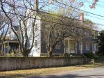
10 Washington St., the Mary Holmes and Captain John Lord House (b. 1770) – The house was constructed before 1770 at 45 N. Main St., and was moved to this location in 1860 by Michael Ready. The second floor was probably added at that time.

12 Washington Street, the Patrick Riley House (1880) – This house was built between 1872 and 1884 for Patrick and Ellen Riley. Riley was a farmer and he and his wife owned this house and the one at #16. By 1924 this house was occupied by Maurice and Mary Blaquiere.

16 Washington Street, the Patrick Riley House (c. 1865) – Patrick Riley is listed in town directories as a farmer. By 1924 this house was occupied by Isaac W. Mitchell, a carpenter.

18 Washington Street, Sanford Peatfield House (1860) – This house was built for Sanford and Mary Peatfield around 1860. Sanford and James Peatfield built a brick mill on Washington Street and continued making woolen underwear until about 1877. The factory became the Hayes Hotel, and burned in the 20th Century.

31 Washington St., the Laffy-Chapman-Morrill House (c. 1880) – This house was built between 1872 and 1884. By 1884 it was owned by Michael Laffy; Laffy is listed in town directories as a laborer. By 1910 the house was owned by Walter Chapman, a farmer who lived on Pineswamp Road and presumably rented this house. In 1916 the house was occupied by Euclid A. and Charolette B. Morrill. In 1924 it was occupied by Insurance agent William F. Connor and his wife Mary.

32 Washington Street, the Frederick Bray – Daniel Nourse House (c 1870) – The first owner of this house, built around 1865 was Frederick Bray, a Civil War veteran. By 1884 it was owned by Daniel P. and Sarah Nourse. Nourse died by 1888 and the house was sold. By 1916 it was occupied by Dennis and Nora Monahan. Dennis is listed in town directories as a mason.
35 Washington Street, the Charles and Margaret Bell House (c. 1890) – This house, and two identical houses behind it on Cottage St. were built for Charles E. and John A. Brown, who were also involved in speculative development on Brown and Liberty Streets.
37 Washington Street, the Brown-Grossman-Doucette House (1884) – This house was built by 1884 by George V. Brown, one of several houses he built on a large parcel. Brown operated a large hay & grain business nearby at Brown Square and lived on Liberty Street. In 1916 this house was occupied by Charles (& Mary) Grossman and Denis (& Maggie) Doucette.
41 Washington Street, the George Brown House (1883) – John A. Brown sold this lot to George B. Brown in 1883 and he built a house shortly thereafter. Brown’s house is one of the few Stick Style Victorian homes in Ipswich. Brown built a grist mill, also located on Washington St., in 1881. He started with a single team and by 1888 employed 6 men. Brown was the first in the area to install a roller mill, which removed all foreign iron substances from the grain before it entered the mill.
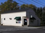
42 Washington Street, DJ’s Variety Store (1938) – This small grocery store was built between 1936 and 1940, and was operated by Christ G. Geanakos as a grocery store. Geanakos lived at 1 Burley Avenue.

44 Washington St., the Howard Hills House (1905) – The house at 44 Washington Street was built between 1902 and 1907, and was constructed for Howard S. Hills who was the manager of Russell’s Ideal Lunch at Depot Square.
46 Washington Street, the James S. Marble-James Peatfield House (1859) – This two-family house was came into the possession of Sanford and James Peatfield in 1846 or 1859. After James Peatfield came to America in 1827, he built one of the first lace machines in this country, and invented a warp machine, after which he began manufacturing woolen underwear. He and his brother, Sanford Peatfield, built a brick mill on Depot Square.

53 Washington Street, the George W. Smith – Pickard House, (1880) – The earliest owner to be identified is George W. Smith who owned the house by 1884, and is listed in town directories as a flagman for the railroad. By 1910 the property was owned by Henry A. Pickard.

56 Washington Street, the Ephraim Goodhue House (1875) – The earliest owner of the house was Ephraim Goodhue, listed in town directories as a blacksmith and grocer with a shop on Pleasant Street. By 1902 the house had been converted to two-family use.
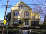
59 Washington Street, the Charles W. Bamford House (c. 1887) – This house was built between 1884 and 1888 for Charles W. Bamford, who was at various times in his career the Town Clerk, Treasurer, and Justice of the Peace. The elaborate cornices and multiple colors of paint are a mix of Italianate and Queen Anne Victorian.

62 Washington St., the Robert Stone House (1869) –

78 Washington Street, the Daniel Haskell House (1835) – The Federal trim and substantial chimneys identify this house as perhaps the earliest of the story-and-one-third 19th century cottages on Linebrook. It is uncertain which Daniel Haskell Sr. or Jr. was the owner. Records show that both died of dementia.
